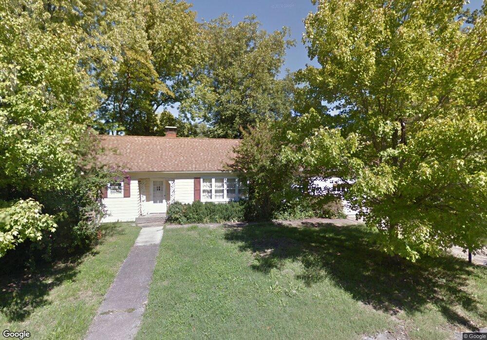
1100 W College St Carbondale, IL 62901
Estimated Value: $142,000 - $158,807
4
Beds
--
Bath
1,763
Sq Ft
$86/Sq Ft
Est. Value
About This Home
This home is located at 1100 W College St, Carbondale, IL 62901 and is currently estimated at $151,952, approximately $86 per square foot. 1100 W College St is a home located in Jackson County with nearby schools including Parrish Elementary School, Lewis School, and Thomas Elementary School.
Ownership History
Date
Name
Owned For
Owner Type
Purchase Details
Closed on
May 9, 2013
Sold by
Favreau Carl L and Cook Sandra S
Bought by
Russell Lauren and Russell Jill A
Current Estimated Value
Purchase Details
Closed on
Apr 25, 2013
Sold by
Favreau Carl L and Cook Sandra S
Bought by
Russell Lauren and Russell Jill A
Purchase Details
Closed on
Aug 14, 2012
Sold by
Favreau Carl L and Cook Sandra S
Bought by
Dillard Neil L and Dillard Mary Ellen
Create a Home Valuation Report for This Property
The Home Valuation Report is an in-depth analysis detailing your home's value as well as a comparison with similar homes in the area
Home Values in the Area
Average Home Value in this Area
Purchase History
| Date | Buyer | Sale Price | Title Company |
|---|---|---|---|
| Russell Lauren | -- | None Available | |
| Russell Lauren | $62,500 | None Available | |
| Dillard Neil L | $1,500 | None Available |
Source: Public Records
Tax History Compared to Growth
Tax History
| Year | Tax Paid | Tax Assessment Tax Assessment Total Assessment is a certain percentage of the fair market value that is determined by local assessors to be the total taxable value of land and additions on the property. | Land | Improvement |
|---|---|---|---|---|
| 2024 | $4,662 | $46,909 | $4,748 | $42,161 |
| 2023 | $4,313 | $42,490 | $4,301 | $38,189 |
| 2022 | $4,126 | $39,227 | $3,971 | $35,256 |
| 2021 | $4,026 | $37,320 | $3,778 | $33,542 |
| 2020 | $3,902 | $37,981 | $3,845 | $34,136 |
| 2019 | $3,748 | $38,137 | $3,861 | $34,276 |
| 2018 | $3,655 | $39,797 | $4,029 | $35,768 |
| 2017 | $3,702 | $40,527 | $4,029 | $36,498 |
| 2016 | $3,614 | $40,527 | $4,029 | $36,498 |
| 2015 | -- | $41,178 | $4,029 | $37,149 |
| 2014 | -- | $41,178 | $4,029 | $37,149 |
| 2012 | -- | $42,018 | $4,111 | $37,907 |
Source: Public Records
Map
Nearby Homes
- 1206 W Schwartz St
- 400 S Oakland Ave
- 408 S James St
- 516 S Forest Ave
- 1110 W Walkup Ave
- 1114 W Walkup Ave
- 902 W Mill St Unit 904,906,908
- 718 S Forest Ave
- 813 W Walnut St
- 400 S Forest Ave
- 806 W Walnut St
- 1130 W Walkup Ave
- 800 W Walnut St
- 404 S Orchard Dr
- 906 S Elizabeth St
- 701 & 703 W College St
- 702 S Dixon Ave
- 903 S Carter St
- 604 S Rawlings St
- 702 W Walnut St
- 502 S Oakland Ave
- 1103 W College St
- 500 S Oakland Ave
- 501 S Oakland Ave
- 1105 W College St
- 1200 W College St
- 503 S Oakland Ave
- 601 S Oakland Ave
- 1004 W Schwartz St
- 1202 W College St
- 1205 W Schwartz St
- 603 S Curtis Place
- 1201 W College St
- 1209 W Schwartz St
- 1003 W Schwartz St
- 603 S Oakland Ave
- 1002 W Schwartz St
- 1007 W Cherry St
- 406 S Oakland Ave