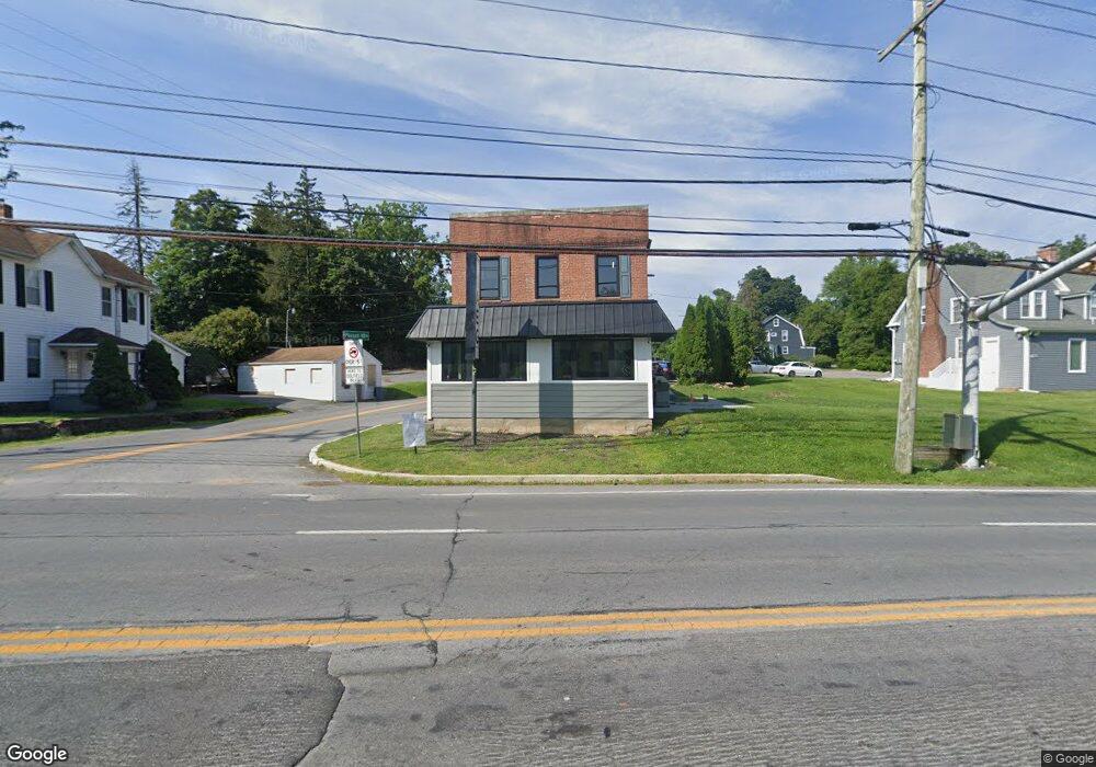
11000 Reisterstown Rd Owings Mills, MD 21117
Estimated Value: $385,241
--
Bed
--
Bath
1,590
Sq Ft
$242/Sq Ft
Est. Value
About This Home
This home is located at 11000 Reisterstown Rd, Owings Mills, MD 21117 and is currently estimated at $385,241, approximately $242 per square foot. 11000 Reisterstown Rd is a home located in Baltimore County with nearby schools including Owings Mills Elementary School, Deer Park Middle Magnet School, and Owings Mills High School.
Ownership History
Date
Name
Owned For
Owner Type
Purchase Details
Closed on
Dec 12, 2019
Sold by
Smith Charles L and Smith Virginia B
Bought by
11000 Reisterstown Llc
Current Estimated Value
Home Financials for this Owner
Home Financials are based on the most recent Mortgage that was taken out on this home.
Original Mortgage
$204,000
Interest Rate
3.7%
Mortgage Type
Future Advance Clause Open End Mortgage
Purchase Details
Closed on
Feb 17, 1982
Sold by
Lewis Henry H
Bought by
Smith Charles L and Smith Virginia B
Create a Home Valuation Report for This Property
The Home Valuation Report is an in-depth analysis detailing your home's value as well as a comparison with similar homes in the area
Home Values in the Area
Average Home Value in this Area
Purchase History
| Date | Buyer | Sale Price | Title Company |
|---|---|---|---|
| 11000 Reisterstown Llc | $255,000 | Forward Title Services Llc | |
| Smith Charles L | $50,000 | -- |
Source: Public Records
Mortgage History
| Date | Status | Borrower | Loan Amount |
|---|---|---|---|
| Open | 11000 Reisterstown Llc | $204,000 |
Source: Public Records
Tax History Compared to Growth
Tax History
| Year | Tax Paid | Tax Assessment Tax Assessment Total Assessment is a certain percentage of the fair market value that is determined by local assessors to be the total taxable value of land and additions on the property. | Land | Improvement |
|---|---|---|---|---|
| 2025 | $3,362 | $263,000 | $106,600 | $156,400 |
| 2024 | $3,362 | $255,600 | $0 | $0 |
| 2023 | $1,637 | $248,200 | $0 | $0 |
| 2022 | $3,145 | $240,800 | $106,600 | $134,200 |
| 2021 | $1,427 | $217,567 | $0 | $0 |
| 2020 | $2,635 | $194,333 | $0 | $0 |
| 2019 | $2,074 | $171,100 | $106,600 | $64,500 |
| 2018 | $2,296 | $171,100 | $106,600 | $64,500 |
| 2017 | $2,271 | $171,100 | $0 | $0 |
| 2016 | $2,152 | $171,100 | $0 | $0 |
| 2015 | $2,152 | $170,400 | $0 | $0 |
| 2014 | $2,152 | $169,700 | $0 | $0 |
Source: Public Records
Map
Nearby Homes
- 11015 Reisterstown Rd
- 11017 Reisterstown Rd
- 11019 Reisterstown Rd
- 11021 Reisterstown Rd
- 17 Pleasant Hill Rd
- 21 Pleasant Hill Rd
- 32 Pleasant Hill Rd
- 307 Wyndham Cir Unit G
- 11123 Wilder Way
- 210 Earhart Ct
- 156 S Ritters Ln
- 60 S Ritters Ln
- 57 Chins Ct
- 6 Bee Jay Ct
- 16 Garrison Ridge Ct
- 921 Academy Ave
- 923 Academy Ave
- 139 Grist Stone Way
- 105 Allgate Ct
- 26 Wyegate Ct
- 10912 Reisterstown Rd Unit D
- 10912 Reisterstown Rd Unit C
- 10912 Reisterstown Rd
- 10912 Reisterstown Rd Unit B
- 11006 Reisterstown Rd
- 10910 Reisterstown Rd Unit A
- 10910 Reisterstown Rd
- 7 Gwynnswood Rd
- 5 Gwynnswood Rd
- 9 Gwynnswood Rd
- 11 Gwynnswood Rd
- 3 Gwynnswood Rd
- 13 Gwynnswood Rd
- 15 Gwynnswood Rd
- 1 Gwynnswood Rd
- 19 Gwynnswood Rd
- 10911 Reisterstown Rd
- 5 Pleasant Hill Rd
- 6 Pleasant Hill Rd
- 21 Gwynnswood Rd