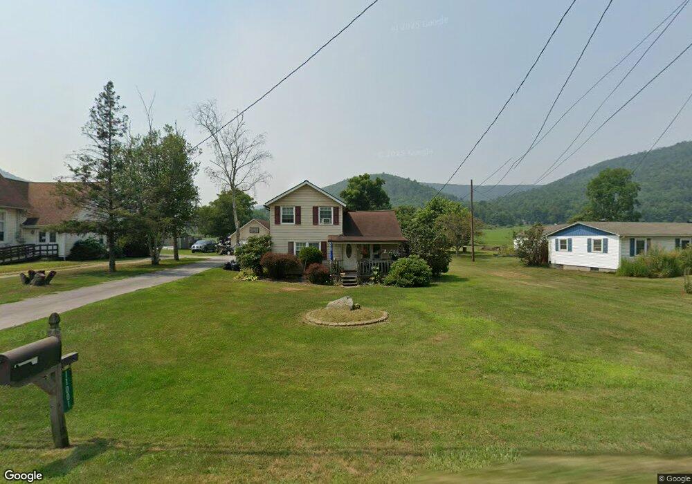
11001 Route 287 Wellsboro, PA 16901
Estimated Value: $155,767 - $293,000
2
Beds
1
Bath
1,909
Sq Ft
$110/Sq Ft
Est. Value
About This Home
This home is located at 11001 Route 287, Wellsboro, PA 16901 and is currently estimated at $210,442, approximately $110 per square foot. 11001 Route 287 is a home located in Tioga County with nearby schools including Charlotte Lappla Elementary School, Don Gill Elementary School, and Rock L. Butler Middle School.
Ownership History
Date
Name
Owned For
Owner Type
Purchase Details
Closed on
Jan 14, 2019
Sold by
Koernig William E
Bought by
Borden Richard M and Tameris Cory A
Current Estimated Value
Home Financials for this Owner
Home Financials are based on the most recent Mortgage that was taken out on this home.
Original Mortgage
$124,601
Outstanding Balance
$109,550
Interest Rate
4.6%
Mortgage Type
FHA
Estimated Equity
$100,892
Purchase Details
Closed on
Dec 14, 2010
Sold by
Koernig Sheryl Lynne and Koernig William E
Bought by
Koernig William E
Create a Home Valuation Report for This Property
The Home Valuation Report is an in-depth analysis detailing your home's value as well as a comparison with similar homes in the area
Home Values in the Area
Average Home Value in this Area
Purchase History
| Date | Buyer | Sale Price | Title Company |
|---|---|---|---|
| Borden Richard M | $126,900 | None Available | |
| Koernig William E | -- | None Available |
Source: Public Records
Mortgage History
| Date | Status | Borrower | Loan Amount |
|---|---|---|---|
| Open | Borden Richard M | $124,601 |
Source: Public Records
Tax History Compared to Growth
Tax History
| Year | Tax Paid | Tax Assessment Tax Assessment Total Assessment is a certain percentage of the fair market value that is determined by local assessors to be the total taxable value of land and additions on the property. | Land | Improvement |
|---|---|---|---|---|
| 2025 | $1,942 | $128,930 | $21,380 | $107,550 |
| 2024 | $3,011 | $128,930 | $21,380 | $107,550 |
| 2023 | $1,869 | $67,040 | $15,000 | $52,040 |
| 2022 | $1,870 | $67,040 | $15,000 | $52,040 |
| 2021 | $1,846 | $67,040 | $15,000 | $52,040 |
| 2020 | $1,848 | $67,040 | $15,000 | $52,040 |
| 2019 | $1,824 | $67,040 | $15,000 | $52,040 |
| 2018 | $1,815 | $67,040 | $15,000 | $52,040 |
| 2017 | -- | $67,040 | $15,000 | $52,040 |
| 2016 | $1,789 | $67,040 | $15,000 | $52,040 |
| 2015 | -- | $67,040 | $15,000 | $52,040 |
| 2014 | -- | $67,040 | $15,000 | $52,040 |
Source: Public Records
Map
Nearby Homes
- 0 Maier Ln Unit 11284664
- 0 Maier Ln Unit LotWP001 20459919
- 37 Moonwalk Ln
- 449 Cummings Creek Rd
- 1750 State Route 249
- 1810 Route 249
- 000 State Route 249
- 2492 Hills Creek Lake Rd
- 0 Buck Horn Court Rd
- Lot #4 Hunters Trail Rd
- 46 Whitetail Cir
- Lot 2 Hunters Ridge Rd
- 77 Hunters Trail Rd
- 275 Tioga St
- 265 Tioga St
- 00 Us Highway 6
- PARCEL 056D Us Highway 6
- 0 Nichols St Unit 31723064
- 104 Nichols St
- 00 Buena Vista St Lot 1&2
- 11015 Route 287
- 11021 Route 287
- 10987 Pennsylvania 287
- 11004 Route 287
- 11014 Route 287
- 10957 Route 287
- 11032 Route 287
- 11063 Route 287
- 10987 Route 287
- 16 Norris Brook Rd
- 8 Norris Brook Rd
- 10929 Route 287
- 36 Norris Brook Rd
- 11064 Route 287
- 25 Cemetery Rd
- 10912 Route 287
- 10912 Route 287
- 39 Cemetery Rd
- 11078 Route 287
- 47 Cemetery Rd