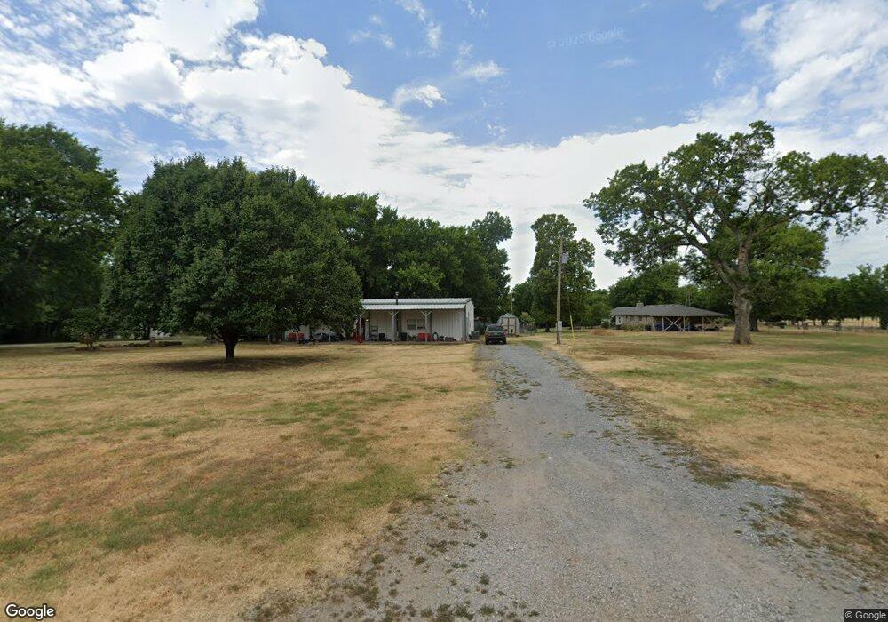
11002 S 4185 Rd Claremore, OK 74017
Estimated Value: $177,291 - $344,000
3
Beds
2
Baths
2,400
Sq Ft
$97/Sq Ft
Est. Value
About This Home
This home is located at 11002 S 4185 Rd, Claremore, OK 74017 and is currently estimated at $233,823, approximately $97 per square foot. 11002 S 4185 Rd is a home located in Rogers County with nearby schools including Foyil Elementary School and Hope Harbor Academy.
Ownership History
Date
Name
Owned For
Owner Type
Purchase Details
Closed on
Dec 29, 2017
Sold by
Barbee Lucky and Barbee Paula
Bought by
Barbee Lucky and Barbee Paula
Current Estimated Value
Purchase Details
Closed on
Dec 21, 2017
Sold by
The Bank Of New York Mellon
Bought by
Barbee Lucky
Purchase Details
Closed on
Oct 19, 2016
Sold by
Figg Timothy D and Figg Timothy D
Bought by
The Bank Of New York Mellon and Cit Mortgage Loan Trust
Purchase Details
Closed on
Feb 16, 1995
Sold by
Figg Barbara
Create a Home Valuation Report for This Property
The Home Valuation Report is an in-depth analysis detailing your home's value as well as a comparison with similar homes in the area
Home Values in the Area
Average Home Value in this Area
Purchase History
| Date | Buyer | Sale Price | Title Company |
|---|---|---|---|
| Barbee Lucky | -- | First Title & Abstract Servi | |
| Barbee Lucky | $60,000 | Accommodation | |
| The Bank Of New York Mellon | $99,077 | None Available | |
| -- | $19,000 | -- |
Source: Public Records
Tax History Compared to Growth
Tax History
| Year | Tax Paid | Tax Assessment Tax Assessment Total Assessment is a certain percentage of the fair market value that is determined by local assessors to be the total taxable value of land and additions on the property. | Land | Improvement |
|---|---|---|---|---|
| 2025 | $936 | $10,081 | $981 | $9,100 |
| 2024 | $929 | $9,787 | $952 | $8,835 |
| 2023 | $929 | $9,502 | $880 | $8,622 |
| 2022 | $879 | $9,270 | $880 | $8,390 |
| 2021 | $830 | $9,000 | $880 | $8,120 |
| 2020 | $860 | $8,969 | $880 | $8,089 |
| 2019 | $781 | $7,354 | $880 | $6,474 |
| 2018 | $789 | $7,570 | $880 | $6,690 |
| 2017 | $904 | $8,652 | $943 | $7,709 |
| 2016 | $800 | $9,196 | $1,869 | $7,327 |
| 2015 | $838 | $8,929 | $1,857 | $7,072 |
| 2014 | $827 | $8,668 | $1,844 | $6,824 |
Source: Public Records
Map
Nearby Homes
- 11686 S 4185 Rd
- 14716 E 400 Rd
- 11822 S Rawhide Rd
- 11992 S Cherrywood Dr
- 10670 S 4200 Rd
- 16762 E 380 Rd
- 15522 E 370 Rd
- 0 E 370 Rd Unit 2548027
- 17310 E 400 Rd
- 16254 E 410 Rd
- 12795 S 4200 Rd
- 0 NE Edgewater Rd Unit 2530563
- 7 S 4170 Rd Unit OK 74017
- 12667 S Oak Ave
- 17712 E 370 Rd
- 10981 S Highway 66
- 0 Coyote Hills Rd Unit 2532610
- 14319 S Brendan Blvd
- 9005 S 4150 Rd Unit C
- 5 E 370
- 15361 E Winchester Dr
- 19364 S Quail Ave
- 18427 S Quail Ave
- 18397 S Quail Ave
- 13874 S Quail Ave
- 18404 S Quail Ave
- 18374 S Quail Ave
- 19334 S Quail Ave
- 19436 S Quail Ave
- 19407 S Quail Ave
- 0 S 4185 Rd Unit 1712824
- 0 S 4185 Rd Unit 2116275
- 0 S 4185 Rd Unit 2119360
- 15174 E 390 Rd
- 15201 E Winchester Dr
- 15369 E Winchester Dr
- 11031 S 4185 Rd
- 15230 E Winchester Dr
- 15253 E Colt Dr
- 15193 E Colt Dr