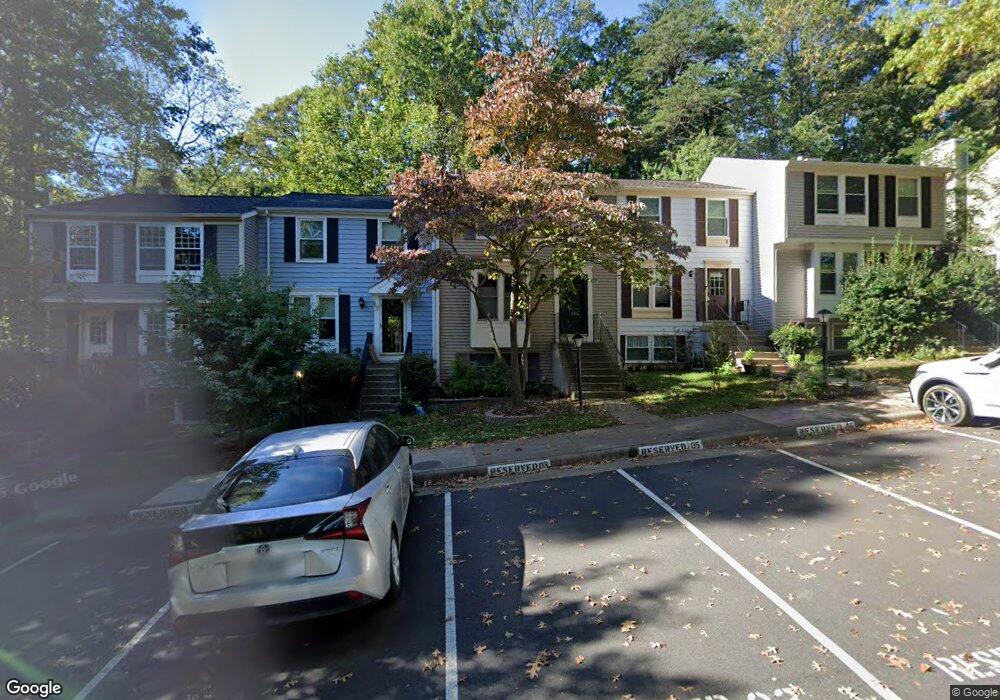
11005 Barton Hill Ct Reston, VA 20191
Estimated Value: $561,399 - $577,000
3
Beds
3
Baths
1,128
Sq Ft
$503/Sq Ft
Est. Value
About This Home
This home is located at 11005 Barton Hill Ct, Reston, VA 20191 and is currently estimated at $567,100, approximately $502 per square foot. 11005 Barton Hill Ct is a home located in Fairfax County with nearby schools including Sunrise Valley Elementary, Langston Hughes Middle School, and South Lakes High School.
Ownership History
Date
Name
Owned For
Owner Type
Purchase Details
Closed on
Feb 7, 2024
Sold by
Anderson David L
Bought by
Anderson David L and Anderson Casey M
Current Estimated Value
Purchase Details
Closed on
Mar 28, 1994
Sold by
James C
Bought by
Anderson David L
Home Financials for this Owner
Home Financials are based on the most recent Mortgage that was taken out on this home.
Original Mortgage
$124,400
Interest Rate
7.15%
Create a Home Valuation Report for This Property
The Home Valuation Report is an in-depth analysis detailing your home's value as well as a comparison with similar homes in the area
Home Values in the Area
Average Home Value in this Area
Purchase History
| Date | Buyer | Sale Price | Title Company |
|---|---|---|---|
| Anderson David L | -- | None Listed On Document | |
| Anderson David L | $138,248 | -- |
Source: Public Records
Mortgage History
| Date | Status | Borrower | Loan Amount |
|---|---|---|---|
| Previous Owner | Anderson David L | $124,400 |
Source: Public Records
Tax History Compared to Growth
Tax History
| Year | Tax Paid | Tax Assessment Tax Assessment Total Assessment is a certain percentage of the fair market value that is determined by local assessors to be the total taxable value of land and additions on the property. | Land | Improvement |
|---|---|---|---|---|
| 2025 | $6,142 | $517,370 | $195,000 | $322,370 |
| 2024 | $6,142 | $509,460 | $190,000 | $319,460 |
| 2023 | $5,558 | $472,830 | $165,000 | $307,830 |
| 2022 | $5,613 | $471,480 | $165,000 | $306,480 |
| 2021 | $5,136 | $420,790 | $125,000 | $295,790 |
| 2020 | $5,032 | $408,930 | $120,000 | $288,930 |
| 2019 | $4,408 | $358,230 | $110,000 | $248,230 |
| 2018 | $3,971 | $345,330 | $100,000 | $245,330 |
| 2017 | $4,172 | $345,330 | $100,000 | $245,330 |
| 2016 | $4,163 | $345,330 | $100,000 | $245,330 |
| 2015 | $4,242 | $364,720 | $100,000 | $264,720 |
| 2014 | $4,010 | $345,510 | $95,000 | $250,510 |
Source: Public Records
Map
Nearby Homes
- 1933B Villaridge Dr Unit 1933B
- 1951 Sagewood Ln Unit 226
- 1951 Sagewood Ln Unit 315
- 10921 Harpers Square Ct
- 11110 Lakespray Way
- 2031 Beacon Place
- 1975 Lakeport Way
- 1933 Lakeport Way
- 10809 Dayflower Ct
- 2027 Headlands Cir
- 1806 Cranberry Ln
- 2022 Headlands Cir
- 11009 Thrush Ridge Rd
- 10900 Sunset Hills Rd
- 11269 Silentwood Ln
- 11184 Silentwood Ln
- 11332 Headlands Ct
- 11303 Harborside Cluster
- 11200 Reston Station Blvd Unit 208
- 1862 Michael Faraday Dr
- 11007 Barton Hill Ct
- 11003 Barton Hill Ct
- 11009 Barton Hill Ct
- 11001 Barton Hill Ct
- 11011 Barton Hill Ct
- 11013 Barton Hill Ct
- 11015 Barton Hill Ct
- 11017 Barton Hill Ct
- 10987 Greenbush Ct
- 11019 Barton Hill Ct
- 10985 Greenbush Ct
- 1926A Villaridge Dr Unit 1926A
- 1928A Villaridge Dr Unit A
- 1926A Villaridge Dr Unit 1926-A
- 1928B Villaridge Dr
- 1926B Villaridge Dr Unit B
- 1928B Villaridge Dr Unit B
- 1932A Villaridge Dr Unit 1932A
- 1932-A Villaridge Dr
- 1930-A Villaridge Dr