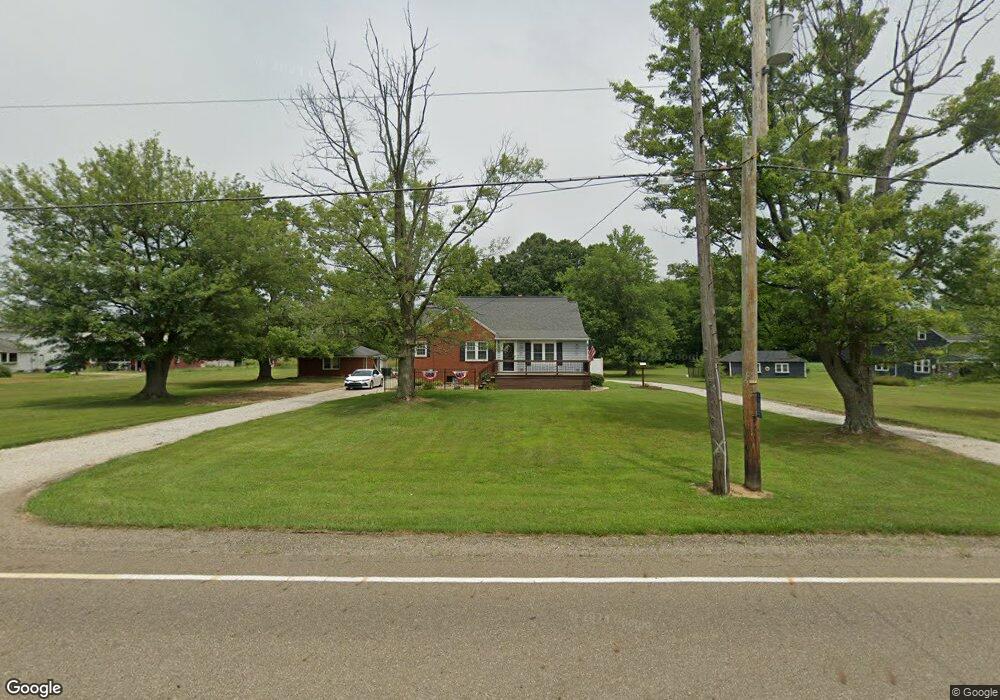
11005 Beeson St NE Alliance, OH 44601
Estimated Value: $242,000 - $291,441
3
Beds
2
Baths
1,976
Sq Ft
$135/Sq Ft
Est. Value
About This Home
This home is located at 11005 Beeson St NE, Alliance, OH 44601 and is currently estimated at $265,860, approximately $134 per square foot. 11005 Beeson St NE is a home located in Stark County with nearby schools including Marlington High School and Regina Coeli/St Joseph School.
Ownership History
Date
Name
Owned For
Owner Type
Purchase Details
Closed on
Apr 27, 2000
Sold by
Oyster Kathleen P and Oyster Kathleen S
Bought by
Gallina William C and Gallina Jennifer E
Current Estimated Value
Home Financials for this Owner
Home Financials are based on the most recent Mortgage that was taken out on this home.
Original Mortgage
$80,910
Outstanding Balance
$28,153
Interest Rate
8.24%
Estimated Equity
$237,707
Purchase Details
Closed on
Mar 25, 1994
Purchase Details
Closed on
Jul 30, 1993
Create a Home Valuation Report for This Property
The Home Valuation Report is an in-depth analysis detailing your home's value as well as a comparison with similar homes in the area
Home Values in the Area
Average Home Value in this Area
Purchase History
| Date | Buyer | Sale Price | Title Company |
|---|---|---|---|
| Gallina William C | $89,900 | Bond & Associates Title Agen | |
| -- | -- | -- | |
| -- | -- | -- |
Source: Public Records
Mortgage History
| Date | Status | Borrower | Loan Amount |
|---|---|---|---|
| Open | Gallina William C | $80,910 |
Source: Public Records
Tax History Compared to Growth
Tax History
| Year | Tax Paid | Tax Assessment Tax Assessment Total Assessment is a certain percentage of the fair market value that is determined by local assessors to be the total taxable value of land and additions on the property. | Land | Improvement |
|---|---|---|---|---|
| 2025 | -- | $75,990 | $19,920 | $56,070 |
| 2024 | -- | $75,990 | $19,920 | $56,070 |
| 2023 | $2,229 | $60,490 | $16,000 | $44,490 |
| 2022 | $2,237 | $60,490 | $16,000 | $44,490 |
| 2021 | $2,244 | $60,490 | $16,000 | $44,490 |
| 2020 | $2,034 | $50,230 | $13,440 | $36,790 |
| 2019 | $2,019 | $44,780 | $13,450 | $31,330 |
| 2018 | $1,720 | $44,780 | $13,450 | $31,330 |
| 2017 | $1,442 | $34,740 | $11,700 | $23,040 |
| 2016 | $1,443 | $34,740 | $11,700 | $23,040 |
| 2015 | $1,445 | $34,740 | $11,700 | $23,040 |
| 2014 | $1,362 | $30,290 | $10,190 | $20,100 |
| 2013 | $666 | $30,290 | $10,190 | $20,100 |
Source: Public Records
Map
Nearby Homes
- 0 Reeder Ave NE
- 10666 Wilma Ave NE
- 12355 Edison St NE
- 13334 Cindy St NE
- 11960 Freshley Ave NE
- 0 Meadow St NE
- 12415 Snode St NE
- 2377 Ansley St Unit 2377
- 13109 Edison St NE
- 1430 Westwood Ave
- 11480 Aebi Ave NE
- 2081 Marwood Cir
- 0 W Main St Unit 5090123
- 2851 Patriots Path Unit 3D
- 2435 Queensbury Rd
- 0 Valewood Cir Unit 5006281
- 0 Easton St NE
- 000 Klinger Ave
- 432 Johnson Ave
- 1201 Overlook Dr
- 11035 Beeson St NE
- 10959 Beeson St NE
- 11079 Beeson St NE
- 10935 Beeson St NE
- 10930 Beeson St NE
- 10566 Clapsaddle Ave NE
- 10845 Beeson St NE
- 10844 Beeson St NE
- 10636 Clapsaddle Ave NE
- 10814 Beeson St NE
- 11243 Beeson St NE
- 0 Beeson St NE Unit 3721104
- 0 Beeson St NE Unit 3789951
- 10690 Clapsaddle Ave NE
- 10752 Beeson St NE
- 11307 Beeson St NE
- 10730 Clapsaddle Ave NE
- 10785 Clapsaddle Ave NE
- 10785 Clapsaddle Ave NE
- 10770 Clapsaddle Ave NE