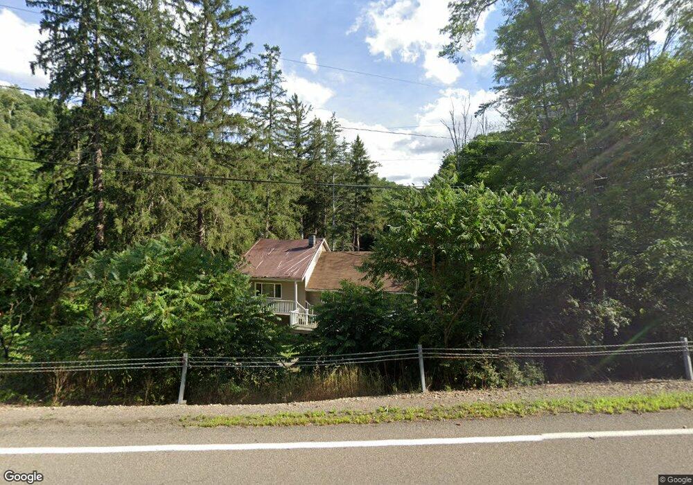
11008 W Caton Rd Unit B Corning, NY 14830
Estimated Value: $140,176 - $173,000
3
Beds
1
Bath
1,848
Sq Ft
$82/Sq Ft
Est. Value
About This Home
This home is located at 11008 W Caton Rd Unit B, Corning, NY 14830 and is currently estimated at $152,044, approximately $82 per square foot. 11008 W Caton Rd Unit B is a home located in Steuben County with nearby schools including Frederick Carder Elementary School, Corning-Painted Post Middle School, and Corning-Painted Post High School.
Ownership History
Date
Name
Owned For
Owner Type
Purchase Details
Closed on
Apr 2, 2015
Sold by
Bulkley Scott L
Bought by
Bulkley Billiejean M
Current Estimated Value
Purchase Details
Closed on
May 24, 2011
Sold by
Campbell Joshua
Bought by
Bulkley Scott L
Home Financials for this Owner
Home Financials are based on the most recent Mortgage that was taken out on this home.
Original Mortgage
$89,700
Outstanding Balance
$62,509
Interest Rate
4.94%
Mortgage Type
Purchase Money Mortgage
Estimated Equity
$89,535
Purchase Details
Closed on
Mar 14, 2006
Sold by
Wilson Michelle
Bought by
Federal National Mortgage Association
Create a Home Valuation Report for This Property
The Home Valuation Report is an in-depth analysis detailing your home's value as well as a comparison with similar homes in the area
Home Values in the Area
Average Home Value in this Area
Purchase History
| Date | Buyer | Sale Price | Title Company |
|---|---|---|---|
| Bulkley Billiejean M | -- | Vincent J. Welch | |
| Bulkley Scott L | $90,000 | Vincent Welch | |
| Federal National Mortgage Association | $37,689 | Steven Baum, Pc |
Source: Public Records
Mortgage History
| Date | Status | Borrower | Loan Amount |
|---|---|---|---|
| Open | Bulkley Scott L | $89,700 |
Source: Public Records
Tax History Compared to Growth
Tax History
| Year | Tax Paid | Tax Assessment Tax Assessment Total Assessment is a certain percentage of the fair market value that is determined by local assessors to be the total taxable value of land and additions on the property. | Land | Improvement |
|---|---|---|---|---|
| 2024 | $4,152 | $99,300 | $11,000 | $88,300 |
| 2023 | $4,113 | $99,300 | $11,000 | $88,300 |
| 2022 | $3,922 | $99,300 | $11,000 | $88,300 |
| 2021 | $3,960 | $99,300 | $11,000 | $88,300 |
| 2020 | $2,115 | $99,300 | $11,000 | $88,300 |
| 2019 | $15 | $99,300 | $11,000 | $88,300 |
| 2018 | $2,901 | $99,300 | $11,000 | $88,300 |
| 2017 | $2,914 | $99,300 | $11,000 | $88,300 |
| 2016 | $2,843 | $99,300 | $11,000 | $88,300 |
| 2015 | -- | $90,400 | $14,000 | $76,400 |
| 2014 | -- | $90,400 | $14,000 | $76,400 |
Source: Public Records
Map
Nearby Homes
- 0 Caton Rd Unit R1640864
- 0 Caton Rd Unit R1637646
- 2085 Caton Rd
- 0 Davis Rd
- 1653 Caton Rd
- 1594 Thurber Rd
- 1536 Thurber Rd
- 1860 Whiskey Creek Rd
- 11014 Wolcott Rd
- 10843 Caton Crescent
- 2602-2606 Bailey Creek Rd
- 2497 Caton Rd
- 10614 Skyline Dr
- 1238 Caton Rd
- 2789 Bailey Creek Rd
- 1964 Spencer Hill Rd
- 31 Caton Rd
- 19 S Maple St
- 10493 Skyline Dr
- 11 Caton Rd
- 11010 W Caton Rd
- 2422 Caton Rd
- 00 Caton Rd
- 0 Caton Rd
- 11015 W Caton Rd
- 10998 W Caton Rd
- 00 River Rd
- 10986 W Caton Rd
- 10995 W Caton Rd
- 10974 W Caton Rd Unit A
- 1871 Riff Rd
- 10981 W Caton Rd
- 1987 Caton Rd
- 1822 Caton Rd
- 2005 Caton Rd
- 1980 Riff Rd
- 1820 Caton Rd
- 2015 Riff Rd
- 1251 Caton Rd
- 10894 W Caton Rd Unit A