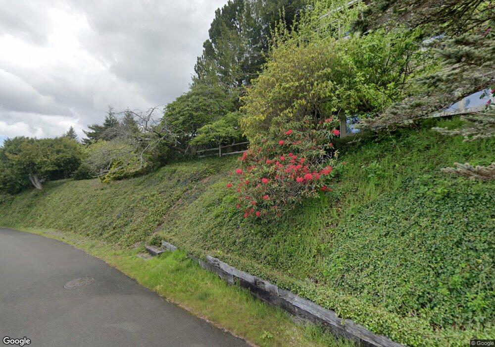
1101 Council Crest Dr Aberdeen, WA 98520
Estimated Value: $489,000 - $656,000
3
Beds
3
Baths
3,488
Sq Ft
$162/Sq Ft
Est. Value
About This Home
This home is located at 1101 Council Crest Dr, Aberdeen, WA 98520 and is currently estimated at $566,012, approximately $162 per square foot. 1101 Council Crest Dr is a home located in Grays Harbor County with nearby schools including McDermoth Elementary School, Miller Junior High School, and J.M. Weatherwax High School.
Ownership History
Date
Name
Owned For
Owner Type
Purchase Details
Closed on
Aug 13, 2010
Sold by
The Ralph & Nellie Lew Revocable Trust
Bought by
Whorton Nathan and Whorton Patricia
Current Estimated Value
Home Financials for this Owner
Home Financials are based on the most recent Mortgage that was taken out on this home.
Original Mortgage
$200,000
Outstanding Balance
$132,085
Interest Rate
4.52%
Mortgage Type
New Conventional
Estimated Equity
$433,927
Purchase Details
Closed on
Jan 5, 2009
Sold by
Lew Ralph and Lew Nellie
Bought by
The Ralph Lew & Nellie Lew Revocable Tru
Create a Home Valuation Report for This Property
The Home Valuation Report is an in-depth analysis detailing your home's value as well as a comparison with similar homes in the area
Home Values in the Area
Average Home Value in this Area
Purchase History
| Date | Buyer | Sale Price | Title Company |
|---|---|---|---|
| Whorton Nathan | $270,000 | Grays Harbor Title | |
| The Ralph Lew & Nellie Lew Revocable Tru | -- | None Available |
Source: Public Records
Mortgage History
| Date | Status | Borrower | Loan Amount |
|---|---|---|---|
| Open | Whorton Nathan | $200,000 |
Source: Public Records
Tax History Compared to Growth
Tax History
| Year | Tax Paid | Tax Assessment Tax Assessment Total Assessment is a certain percentage of the fair market value that is determined by local assessors to be the total taxable value of land and additions on the property. | Land | Improvement |
|---|---|---|---|---|
| 2025 | $4,843 | $505,523 | $58,300 | $447,223 |
| 2023 | $4,122 | $487,241 | $58,300 | $428,941 |
| 2022 | $3,997 | $342,924 | $54,000 | $288,924 |
| 2021 | $3,977 | $342,924 | $54,000 | $288,924 |
| 2020 | $3,851 | $309,833 | $50,000 | $259,833 |
| 2019 | $3,251 | $297,460 | $50,000 | $247,460 |
| 2018 | $3,779 | $264,229 | $50,000 | $214,229 |
| 2017 | $3,427 | $238,104 | $50,000 | $188,104 |
| 2016 | $3,175 | $224,170 | $50,000 | $174,170 |
| 2014 | -- | $219,675 | $50,000 | $169,675 |
| 2013 | -- | $227,345 | $50,000 | $177,345 |
Source: Public Records
Map
Nearby Homes
- 1139 Grays Pointe Ln
- 1823 Sam Benn Ln
- 1819 Sam Benn Ln
- 812 Duffy St
- 1900 W 5th St
- 2218 W 5th St
- 1412 Grays Pointe Ln
- 908 N Jeffries St
- 611 Conger St
- 712 N Scammel St
- 1201 Chilton Rd
- 613 N Jeffries St
- 0 Duffy St
- 2404 Sumner Ave
- 2310 Simpson Ave
- 1904 Aberdeen Ave
- 526 W 6th St
- 1401 Cherry St
- 2002 Pacific Ave
- 1517 Chilton Rd
- 2020 Council Crest Dr
- 2001 Council Crest Dr
- 1002 Council Crest Dr
- 2007 Council Crest Dr
- 1925 Council Crest Dr
- 1111 Grays Pointe Ln
- 1134 Grays Pointe Ln
- 1138 Grays Pointe Ln
- 2010 Isabel Way
- 1113 Grays Pointe Ln
- 2017 W 8th St
- 1142 Grays Pointe Ln
- 963 Rice St
- 2020 Isabel Way
- 1115 Grays Pointe Ln
- 1144 Grays Pointe Ln
- 1117 Grays Pointe Ln
- 960 Rice St
- 1135 Grays Pointe Ln
- 1911 Council Crest Dr
