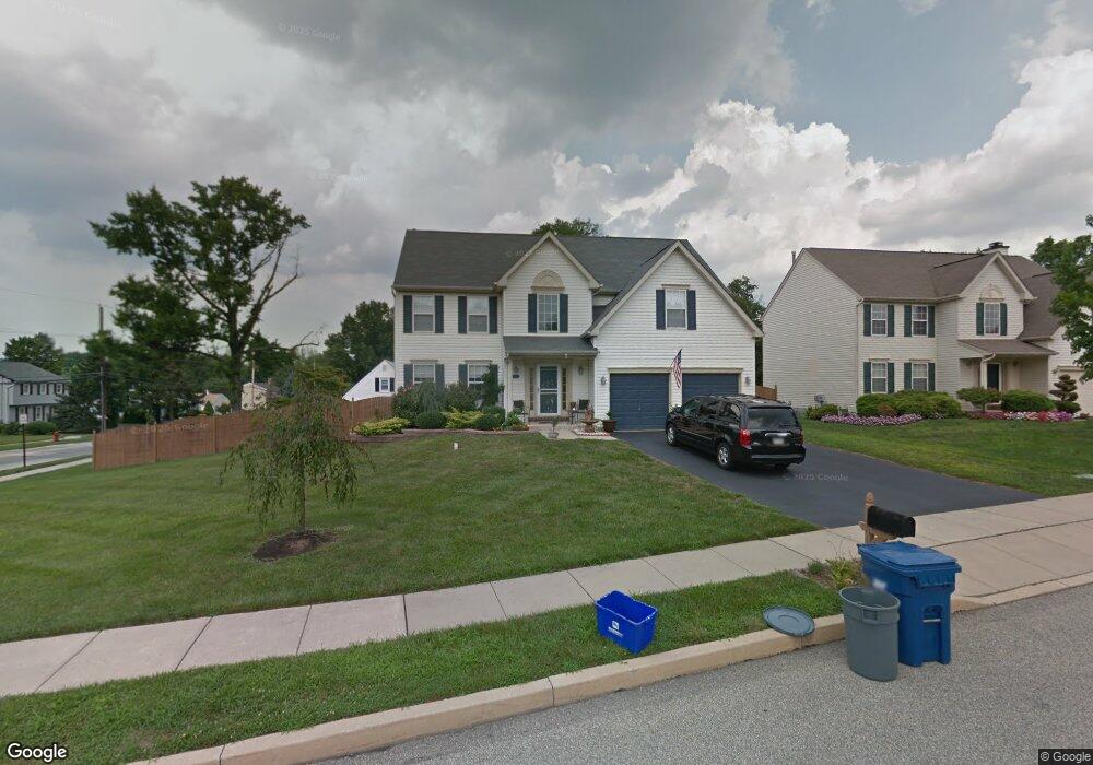
1101 E Chestnut Ave Norristown, PA 19403
West Norriton Township NeighborhoodEstimated Value: $570,209 - $635,000
4
Beds
3
Baths
2,371
Sq Ft
$250/Sq Ft
Est. Value
About This Home
This home is located at 1101 E Chestnut Ave, Norristown, PA 19403 and is currently estimated at $592,052, approximately $249 per square foot. 1101 E Chestnut Ave is a home located in Montgomery County with nearby schools including Charles Blockson Middle School, Paul V Fly Elementary School, and East Norriton Middle School.
Ownership History
Date
Name
Owned For
Owner Type
Purchase Details
Closed on
Nov 26, 2007
Sold by
Callahan Reagan and Callahan Shawn M
Bought by
Petka Diane and Petka Frank
Current Estimated Value
Home Financials for this Owner
Home Financials are based on the most recent Mortgage that was taken out on this home.
Original Mortgage
$270,000
Outstanding Balance
$170,899
Interest Rate
6.3%
Estimated Equity
$421,153
Purchase Details
Closed on
Mar 3, 2003
Sold by
Callahan Shawn M
Bought by
Callahan Shawn M
Purchase Details
Closed on
Apr 29, 1999
Sold by
Chestnut Manor Land Development Inc
Bought by
Callahan Shawn M and Gunshore Reagan
Create a Home Valuation Report for This Property
The Home Valuation Report is an in-depth analysis detailing your home's value as well as a comparison with similar homes in the area
Home Values in the Area
Average Home Value in this Area
Purchase History
| Date | Buyer | Sale Price | Title Company |
|---|---|---|---|
| Petka Diane | $370,000 | None Available | |
| Callahan Shawn M | -- | -- | |
| Callahan Reagan | -- | -- | |
| Callahan Shawn M | $203,875 | -- |
Source: Public Records
Mortgage History
| Date | Status | Borrower | Loan Amount |
|---|---|---|---|
| Open | Petka Diane | $270,000 |
Source: Public Records
Tax History Compared to Growth
Tax History
| Year | Tax Paid | Tax Assessment Tax Assessment Total Assessment is a certain percentage of the fair market value that is determined by local assessors to be the total taxable value of land and additions on the property. | Land | Improvement |
|---|---|---|---|---|
| 2025 | $9,693 | $198,390 | $51,900 | $146,490 |
| 2024 | $9,693 | $198,390 | $51,900 | $146,490 |
| 2023 | $9,584 | $198,390 | $51,900 | $146,490 |
| 2022 | $9,521 | $198,390 | $51,900 | $146,490 |
| 2021 | $9,463 | $198,390 | $51,900 | $146,490 |
| 2020 | $9,181 | $198,390 | $51,900 | $146,490 |
| 2019 | $8,976 | $198,390 | $51,900 | $146,490 |
| 2018 | $7,078 | $198,390 | $51,900 | $146,490 |
| 2017 | $8,474 | $198,390 | $51,900 | $146,490 |
| 2016 | $8,396 | $198,390 | $51,900 | $146,490 |
| 2015 | $7,968 | $198,390 | $51,900 | $146,490 |
| 2014 | $7,779 | $198,390 | $51,900 | $146,490 |
Source: Public Records
Map
Nearby Homes
- 2020 Davis Dr
- 2055 W Marshall St
- 136 Markley Farm Cir
- 37 Burnside Ave
- 32 Miami Rd
- 2020 Sterigere St
- 68 Jefferson Ave
- 709 Middleton Place
- 00 Arden Dr Unit METHACTON SCHOOL
- 1104 Arden Dr Unit METHACTON SCHOOL
- 1107 Middleton Place
- 1749 W Marshall St
- 166 Hoover Ave
- 137 Avondale Rd
- 1613 Countryside Ln
- 155 Avondale Rd
- 108 N Prospect Ave
- 2158 Alexander Dr
- 2008 Hemlock Rd
- 1635 W Marshall W Marshall St
- 100 Burnside Ave
- 1103 E Chestnut Ave
- 104 Burnside Ave
- 1102 E Chestnut Ave
- 1105 E Chestnut Ave
- 1104 E Chestnut Ave
- 225 Liberty Ave
- 101 Burnside Ave
- 108 Burnside Ave
- 103 Burnside Ave
- 221 Liberty Ave
- 1107 E Chestnut Ave
- 73 Burnside Ave
- 101 Acorn Way
- 229 Liberty Ave
- 105 Burnside Ave
- 112 Burnside Ave
- 1108 E Chestnut Ave
- 217 Liberty Ave
- 1109 E Chestnut Ave