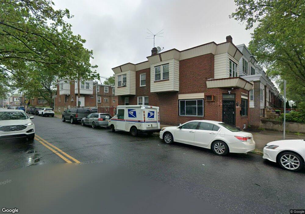
1101 E Sanger St Philadelphia, PA 19124
Frankford NeighborhoodEstimated Value: $219,050 - $261,000
3
Beds
1
Bath
1,633
Sq Ft
$148/Sq Ft
Est. Value
About This Home
This home is located at 1101 E Sanger St, Philadelphia, PA 19124 and is currently estimated at $241,013, approximately $147 per square foot. 1101 E Sanger St is a home located in Philadelphia County with nearby schools including Frankford High School, The Philadelphia Charter School for the Arts & Sciences, and Northwood Academy Charter School.
Ownership History
Date
Name
Owned For
Owner Type
Purchase Details
Closed on
Dec 23, 2000
Sold by
Wong Harry and Wong Lin Yan
Bought by
Gaffney Linda
Current Estimated Value
Home Financials for this Owner
Home Financials are based on the most recent Mortgage that was taken out on this home.
Original Mortgage
$61,759
Outstanding Balance
$22,367
Interest Rate
7.64%
Mortgage Type
FHA
Estimated Equity
$218,646
Create a Home Valuation Report for This Property
The Home Valuation Report is an in-depth analysis detailing your home's value as well as a comparison with similar homes in the area
Home Values in the Area
Average Home Value in this Area
Purchase History
| Date | Buyer | Sale Price | Title Company |
|---|---|---|---|
| Gaffney Linda | $61,900 | Lawyers Title Insurance Co |
Source: Public Records
Mortgage History
| Date | Status | Borrower | Loan Amount |
|---|---|---|---|
| Open | Gaffney Linda | $61,759 |
Source: Public Records
Tax History Compared to Growth
Tax History
| Year | Tax Paid | Tax Assessment Tax Assessment Total Assessment is a certain percentage of the fair market value that is determined by local assessors to be the total taxable value of land and additions on the property. | Land | Improvement |
|---|---|---|---|---|
| 2026 | $2,065 | $178,100 | $35,620 | $142,480 |
| 2025 | $2,065 | $178,100 | $35,620 | $142,480 |
| 2024 | $2,065 | $178,100 | $35,620 | $142,480 |
| 2023 | $2,065 | $147,500 | $29,500 | $118,000 |
| 2022 | $1,435 | $102,500 | $29,500 | $73,000 |
| 2021 | $1,540 | $0 | $0 | $0 |
| 2020 | $1,540 | $0 | $0 | $0 |
| 2019 | $1,478 | $0 | $0 | $0 |
| 2018 | $1,039 | $0 | $0 | $0 |
| 2017 | $1,459 | $0 | $0 | $0 |
| 2016 | $1,039 | $0 | $0 | $0 |
| 2015 | $994 | $0 | $0 | $0 |
| 2014 | -- | $104,200 | $20,216 | $83,984 |
| 2012 | -- | $15,488 | $2,184 | $13,304 |
Source: Public Records
Map
Nearby Homes
- 1431 Rosalie St
- 1209 E Sanger St
- 1137 Bridge St
- 5902 E Roosevelt Blvd
- 5347 Sylvester St
- 1244 E Sanger St
- 1048 Bridge St
- 7753 E Roosevelt Blvd
- 1530 Van Kirk St
- 7600 E Roosevelt Blvd Unit 206
- 7600 E Roosevelt Blvd Unit 212
- 7600 E Roosevelt Blvd Unit 909
- 7600 E Roosevelt Blvd Unit 705
- 7600 E Roosevelt Blvd Unit 701
- 7600 E Roosevelt Blvd Unit 806
- 7600 E Roosevelt Blvd Unit 904
- 7600 E Roosevelt Blvd Unit 604
- 7040 E Roosevelt Blvd
- 7536 E Roosevelt Blvd
- 6840 E Roosevelt Blvd
- 1103 E Sanger St
- 1105 E Sanger St
- 1107 E Sanger St
- 1109 E Sanger St
- 1111 E Sanger St
- 1100 Anchor St
- 1102 Anchor St
- 1113 E Sanger St
- 1104 Anchor St
- 1115 E Sanger St
- 1106 Anchor St
- 1108 Anchor St
- 5404 Large St
- 5408 Large St
- 1117 E Sanger St
- 5400 Large St Unit 1ST FL
- 5400 Large St
- 5361 Large St
- 5406 Large St
- 5410 Large St