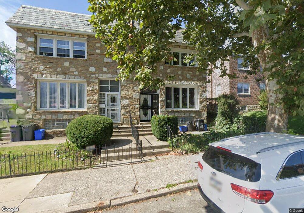
1101 E Slocum St Unit B Philadelphia, PA 19150
West Oak Lane NeighborhoodEstimated Value: $280,000 - $325,000
4
Beds
2
Baths
2,120
Sq Ft
$143/Sq Ft
Est. Value
About This Home
This home is located at 1101 E Slocum St Unit B, Philadelphia, PA 19150 and is currently estimated at $302,500, approximately $142 per square foot. 1101 E Slocum St Unit B is a home located in Philadelphia County with nearby schools including Franklin S Edmonds School, Martin Luther King High School, and West Oak Lane Charter School.
Ownership History
Date
Name
Owned For
Owner Type
Purchase Details
Closed on
Dec 18, 2015
Sold by
U S Bank N A
Bought by
Rhodes Leslie
Current Estimated Value
Purchase Details
Closed on
Jul 17, 2015
Sold by
White Andrea Dale
Bought by
U S Bank N A and Mortgage Loan Trust
Purchase Details
Closed on
May 3, 2006
Sold by
Mellon Bank Na
Bought by
White Andrea Dale
Purchase Details
Closed on
Oct 20, 2005
Sold by
Mellon Bank Na
Bought by
Wright Andrea Dale
Purchase Details
Closed on
Apr 5, 2003
Sold by
Mellon Bank Na
Bought by
Mellon Bank Na and Will Of Audrey D Wright
Create a Home Valuation Report for This Property
The Home Valuation Report is an in-depth analysis detailing your home's value as well as a comparison with similar homes in the area
Home Values in the Area
Average Home Value in this Area
Purchase History
| Date | Buyer | Sale Price | Title Company |
|---|---|---|---|
| Rhodes Leslie | $115,500 | None Available | |
| U S Bank N A | $70,000 | None Available | |
| White Andrea Dale | -- | None Available | |
| Wright Andrea Dale | -- | None Available | |
| Mellon Bank Na | -- | -- |
Source: Public Records
Tax History Compared to Growth
Tax History
| Year | Tax Paid | Tax Assessment Tax Assessment Total Assessment is a certain percentage of the fair market value that is determined by local assessors to be the total taxable value of land and additions on the property. | Land | Improvement |
|---|---|---|---|---|
| 2025 | $2,884 | $316,000 | $63,200 | $252,800 |
| 2024 | $2,884 | $316,000 | $63,200 | $252,800 |
| 2023 | $2,884 | $206,000 | $41,200 | $164,800 |
| 2022 | $2,758 | $206,000 | $41,200 | $164,800 |
| 2021 | $2,758 | $0 | $0 | $0 |
| 2020 | $2,758 | $0 | $0 | $0 |
| 2019 | $2,721 | $0 | $0 | $0 |
| 2018 | $2,403 | $0 | $0 | $0 |
| 2017 | $2,427 | $0 | $0 | $0 |
| 2016 | $2,427 | $0 | $0 | $0 |
| 2015 | $2,324 | $0 | $0 | $0 |
| 2014 | -- | $173,400 | $27,169 | $146,231 |
| 2012 | -- | $23,936 | $2,012 | $21,924 |
Source: Public Records
Map
Nearby Homes
- 1148 E Slocum St
- 1051 Vernon Rd
- 1151 E Dorset St
- 1167 E Dorset St
- 1122 E Phil Ellena St
- 1007 Dorset St
- 1005 Dorset St
- 1159 E Hortter St
- 8038 Lowber Ave
- 1107 E Sharpnack St
- 7802 Woolston Ave
- 7935 Gilbert St
- 933 E Slocum St
- 1152 E Sharpnack St
- 8004 Gilbert St
- 937 E Gorgas Ln
- 1300 E Gorgas Ln
- 1038 E Mount Pleasant Ave
- 6768 Stenton Ave
- 7703 Gilbert St
- 1101 E Slocum St Unit C
- 1101 E Slocum St Unit A
- 1101 E Slocum St Unit C-3
- 1101 E Slocum St Unit C-1
- 1101 E Slocum St Unit C-4
- 1101 E Slocum St
- 1103 E Slocum St
- 1105 E Slocum St
- 1107 E Slocum St
- 1109 E Slocum St
- 1111 E Slocum St
- 1116 E Vernon Rd
- 1118 E Vernon Rd
- 1115 E Slocum St
- 1112 E Vernon Rd
- 1120 E Vernon Rd
- 7931 Lowber Ave
- 7933 Lowber Ave
- 1122 E Vernon Rd
- 1117 E Slocum St