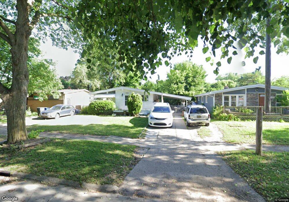
1101 Macdonald Ave Flint, MI 48507
Circle Drive NeighborhoodEstimated Value: $70,000 - $100,000
3
Beds
1
Bath
941
Sq Ft
$90/Sq Ft
Est. Value
About This Home
This home is located at 1101 Macdonald Ave, Flint, MI 48507 and is currently estimated at $84,565, approximately $89 per square foot. 1101 Macdonald Ave is a home located in Genesee County with nearby schools including Freeman Elementary School, Flint Southwestern Classical Academy, and Burton Glen Charter Academy.
Ownership History
Date
Name
Owned For
Owner Type
Purchase Details
Closed on
Mar 27, 2018
Sold by
Kutchey Michele A
Bought by
Kutchey Michele and Heddy Michael W
Current Estimated Value
Purchase Details
Closed on
Mar 29, 2016
Sold by
Little Blair C and Little Leslie L
Bought by
Kutchey Michelle A
Purchase Details
Closed on
Feb 13, 2014
Sold by
Little Blair C and Little Leslie L
Bought by
Kutchey Michele A
Purchase Details
Closed on
Aug 10, 2005
Sold by
Little Blair C and Little Leslie L
Bought by
The Little Revocable Living Trust
Purchase Details
Closed on
Jan 7, 2004
Sold by
Oneill Shane E and Oneill Shalynne K
Bought by
Little Blair C and Little Leslie L
Create a Home Valuation Report for This Property
The Home Valuation Report is an in-depth analysis detailing your home's value as well as a comparison with similar homes in the area
Home Values in the Area
Average Home Value in this Area
Purchase History
| Date | Buyer | Sale Price | Title Company |
|---|---|---|---|
| Kutchey Michele | -- | Cislo Title Co | |
| Kutchey Michelle A | $17,600 | None Available | |
| Kutchey Michele A | -- | None Available | |
| The Little Revocable Living Trust | -- | -- | |
| Little Blair C | $57,000 | Guaranty Title Company |
Source: Public Records
Tax History Compared to Growth
Tax History
| Year | Tax Paid | Tax Assessment Tax Assessment Total Assessment is a certain percentage of the fair market value that is determined by local assessors to be the total taxable value of land and additions on the property. | Land | Improvement |
|---|---|---|---|---|
| 2025 | $827 | $36,000 | $0 | $0 |
| 2024 | $755 | $31,100 | $0 | $0 |
| 2023 | $745 | $26,200 | $0 | $0 |
| 2022 | $0 | $20,100 | $0 | $0 |
| 2021 | $770 | $19,000 | $0 | $0 |
| 2020 | $700 | $18,600 | $0 | $0 |
| 2019 | $686 | $12,400 | $0 | $0 |
| 2018 | $673 | $9,900 | $0 | $0 |
| 2017 | $656 | $0 | $0 | $0 |
| 2016 | $652 | $0 | $0 | $0 |
| 2015 | -- | $0 | $0 | $0 |
| 2014 | -- | $0 | $0 | $0 |
| 2012 | -- | $15,700 | $0 | $0 |
Source: Public Records
Map
Nearby Homes
- 4424 Cheyenne Ave
- 810 Macdonald Ave
- 4310 Cheyenne Ave
- 3343 Cheyenne Ave
- 621 Burroughs Ave
- 630 Buckingham Ave
- 3614 Comanche Ave
- 4127 Custer Ave
- 0000 E Bristol Rd
- 3505 Comanche Ave
- 4205 Red Arrow Rd
- 454 E Atherton Rd
- 3512 Barcey Ct
- 326 Burroughs Ave
- 2207 E Boatfield Ave
- 3115 Circle Dr
- 2231 E Bergin Ave
- 2220 E Bergin Ave
- 2130 E Whittemore Ave
- 2910 Shawnee Ave
- 1021 Macdonald Ave
- 1105 Macdonald Ave
- 1017 Macdonald Ave
- 1109 Macdonald Ave
- 1022 McKeighan Ave
- 1013 Macdonald Ave
- 1113 Macdonald Ave
- 1102 Macdonald Ave
- 1022 Macdonald Ave Unit Bldg-Unit
- 1022 Macdonald Ave
- 1026 McKeighan Ave
- 1106 Macdonald Ave
- 1018 Macdonald Ave
- 1018 McKeighan Ave
- 1009 Macdonald Ave
- 1014 McKeighan Ave
- 1110 Macdonald Ave
- 1117 Macdonald Ave
- 1014 Macdonald Ave
- 4510 Cheyenne Ave