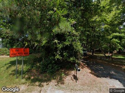
1101 N Main St Wake Forest, NC 27587
Estimated Value: $361,000 - $430,000
3
Beds
2
Baths
1,699
Sq Ft
$233/Sq Ft
Est. Value
About This Home
This home is located at 1101 N Main St, Wake Forest, NC 27587 and is currently estimated at $395,385, approximately $232 per square foot. 1101 N Main St is a home located in Wake County with nearby schools including Richland Creek Elementary School, Wake Forest-Rolesville Middle School, and Wake Forest High School.
Ownership History
Date
Name
Owned For
Owner Type
Purchase Details
Closed on
Dec 17, 1997
Sold by
Perkins John D
Bought by
Odell Paul H
Current Estimated Value
Purchase Details
Closed on
Mar 21, 1990
Bought by
Ammon Jeremiah F and Ammon Nancy L
Create a Home Valuation Report for This Property
The Home Valuation Report is an in-depth analysis detailing your home's value as well as a comparison with similar homes in the area
Home Values in the Area
Average Home Value in this Area
Purchase History
| Date | Buyer | Sale Price | Title Company |
|---|---|---|---|
| Odell Paul H | -- | -- | |
| Ammon Jeremiah F | $85,000 | -- |
Source: Public Records
Mortgage History
| Date | Status | Borrower | Loan Amount |
|---|---|---|---|
| Open | Security Self Storage Inc | $4,350,000 | |
| Closed | Ammon Jeremiah F | $131,398 | |
| Closed | Ammon Jeremiah F | $132,580 | |
| Closed | Ammon Jeremiah F | $149,623 | |
| Closed | Ammon Jeremiah F | $93,000 |
Source: Public Records
Tax History Compared to Growth
Tax History
| Year | Tax Paid | Tax Assessment Tax Assessment Total Assessment is a certain percentage of the fair market value that is determined by local assessors to be the total taxable value of land and additions on the property. | Land | Improvement |
|---|---|---|---|---|
| 2024 | $2,472 | $394,892 | $116,600 | $278,292 |
| 2023 | $1,700 | $215,458 | $74,600 | $140,858 |
| 2022 | $1,576 | $215,458 | $74,600 | $140,858 |
| 2021 | $1,534 | $215,458 | $74,600 | $140,858 |
| 2020 | $1,509 | $215,458 | $74,600 | $140,858 |
| 2019 | $1,549 | $187,194 | $66,000 | $121,194 |
| 2018 | $1,425 | $187,194 | $66,000 | $121,194 |
| 2017 | $1,351 | $187,194 | $66,000 | $121,194 |
| 2016 | $1,324 | $187,194 | $66,000 | $121,194 |
| 2015 | $1,365 | $193,593 | $77,500 | $116,093 |
| 2014 | $1,294 | $193,593 | $77,500 | $116,093 |
Source: Public Records
Map
Nearby Homes
- 321 Conrad Ln
- 1304 Barnford Mill Rd
- 945 Alma Railway Dr Unit 559
- 206 Lilliput Ln
- 955 Alma Railway Dr Unit 563
- 937 Alma Railway Dr Unit 555
- 904 Amersham Ln
- 1012 Coram Fields Rd
- 210 Lilliput Ln
- 0 Ralph Dr
- 951 Alma Railway Dr Unit 561
- 953 Alma Railway Dr
- 959 Alma Railway Dr
- 517 Wheddon Cross Way
- 1201 Dagmar Ln
- 414 Bakewell Ct
- 203 Brick St
- 129 E Chestnut Ave
- 0 Brick St
- 922 N White St
- 1101 N Main St
- 1333 Barnford Mill Rd
- 1329 Barnford Mill Rd
- 1325 Barnford Mill Rd
- 1133 N Main St
- 1321 Barnford Mill Rd
- 1061 N Main St
- 101 Edgeford Park Ln
- 1059 N Main St
- 1317 Barnford Mill Rd
- 1057 N Main St
- 1029 Caladium Dr
- 1025 Caladium Dr
- 1313 Barnford Mill Rd Unit LT6
- 1313 Barnford Mill Rd
- 1051 N Main St
- 100 Edgeford Park Ln
- 325 Conrad Ln
- 331 Conrad Ln
- 1309 Barnford Mill Rd
