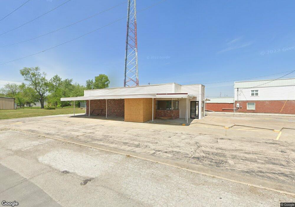
1101 N Morley St Moberly, MO 65270
--
Bed
1
Bath
1,150
Sq Ft
0.7
Acres
About This Home
This home is located at 1101 N Morley St, Moberly, MO 65270. 1101 N Morley St is a home located in Randolph County with nearby schools including Moberly Senior High School, St. Pius X. Catholic School, and Maranatha Seventh-day Adventist School.
Ownership History
Date
Name
Owned For
Owner Type
Purchase Details
Closed on
Jan 26, 2023
Sold by
Lcl Properties Llc
Bought by
Moberly Donut Palace Llc
Home Financials for this Owner
Home Financials are based on the most recent Mortgage that was taken out on this home.
Original Mortgage
$152,800
Outstanding Balance
$147,988
Interest Rate
6.31%
Mortgage Type
New Conventional
Purchase Details
Closed on
Sep 10, 2010
Sold by
Turk Lori J
Bought by
Lcl Properties Llc
Create a Home Valuation Report for This Property
The Home Valuation Report is an in-depth analysis detailing your home's value as well as a comparison with similar homes in the area
Home Values in the Area
Average Home Value in this Area
Purchase History
| Date | Buyer | Sale Price | Title Company |
|---|---|---|---|
| Moberly Donut Palace Llc | -- | -- | |
| Lcl Properties Llc | -- | -- |
Source: Public Records
Mortgage History
| Date | Status | Borrower | Loan Amount |
|---|---|---|---|
| Open | Moberly Donut Palace Llc | $152,800 |
Source: Public Records
Tax History Compared to Growth
Tax History
| Year | Tax Paid | Tax Assessment Tax Assessment Total Assessment is a certain percentage of the fair market value that is determined by local assessors to be the total taxable value of land and additions on the property. | Land | Improvement |
|---|---|---|---|---|
| 2025 | $3,311 | $40,780 | $20,800 | $19,980 |
| 2024 | $3,311 | $44,670 | $20,799 | $23,871 |
| 2023 | $2,104 | $27,970 | $25,602 | $2,368 |
| 2022 | $2,051 | $27,970 | $25,602 | $2,368 |
| 2021 | $2,049 | $27,970 | $25,602 | $2,368 |
| 2020 | $2,049 | $27,970 | $25,602 | $2,368 |
| 2019 | $2,045 | $27,970 | $25,602 | $2,368 |
| 2018 | $2,045 | $28,060 | $25,598 | $2,462 |
| 2017 | $2,041 | $28,060 | $0 | $0 |
| 2016 | $2,030 | $28,060 | $0 | $0 |
| 2014 | -- | $28,060 | $0 | $0 |
| 2013 | -- | $28,060 | $0 | $0 |
| 2012 | -- | $25,600 | $0 | $0 |
Source: Public Records
Map
Nearby Homes
- 1102 N Morley St
- 523 Morehead St
- 664 & 668 N Ault St
- 609 Franklin Ave
- 625 Franklin Ave
- 812 N Moulton St
- 720 Saint Charles St
- 511 Union Ave
- 602 Vincil St
- 1101 Stonebridge Ln
- Lot 11 Stonebridge Lane (Plat 2)
- Lot 10 Stonebridge Lane (Plat 2)
- LOT 5 Robertson Road & Highway 24
- LOT 4 Robertson Road & Highway 24
- LOT 1 Robertson Road & Highway 24
- LOT 3 Robertson Road & Highway 24
- LOT 2 Robertson Road & Highway 24
- 531 Farror St
- Lot 5 Highway 24
- Lot 4 Highway 24
- 1125 N Morley St
- 1024 N Ault St
- 1031 N Ault St
- 1100 N Morley St
- 1029 N Ault St
- 1016 N Ault St
- 310 Chandler St
- 1014 N Ault St
- 1024 N Morley St
- 1104 N Morley St
- 314 Chandler St
- 311 Morehead St
- 1106 N Morley St
- 1010 N Ault St
- 315 Chandler St
- 1013 N Ault St
- 312 Morehead St
- 318 Chandler St
- 317 Morehead St
- 317 Chandler St