Estimated Value: $173,000 - $191,000
3
Beds
1
Bath
1,032
Sq Ft
$176/Sq Ft
Est. Value
About This Home
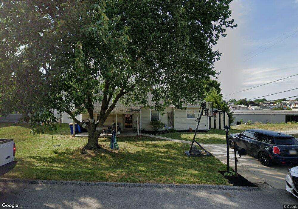
This home is located at 1101 Olson St, York, PA 17404 and is currently estimated at $182,116, approximately $176 per square foot. 1101 Olson St is a home located in York County with nearby schools including West York Area High School, Lincoln Charter School, and York Country Day School.
Ownership History
Date
Name
Owned For
Owner Type
Purchase Details
Closed on
Jun 25, 2007
Sold by
Rhomberg Thomas C and Rhomberg Linda M
Bought by
Rhomberg Thomas C and Rhomberg Linda M
Current Estimated Value
Purchase Details
Closed on
Jan 29, 2007
Sold by
Hoover James R and Hoover Linda A
Bought by
Rhomberg Thomas C and Wolf Linda M
Home Financials for this Owner
Home Financials are based on the most recent Mortgage that was taken out on this home.
Original Mortgage
$65,000
Outstanding Balance
$38,932
Interest Rate
6.16%
Mortgage Type
Purchase Money Mortgage
Estimated Equity
$143,184
Create a Home Valuation Report for This Property
The Home Valuation Report is an in-depth analysis detailing your home's value as well as a comparison with similar homes in the area
Home Values in the Area
Average Home Value in this Area
Purchase History
| Date | Buyer | Sale Price | Title Company |
|---|---|---|---|
| Rhomberg Thomas C | -- | None Available | |
| Rhomberg Thomas C | $119,900 | None Available |
Source: Public Records
Mortgage History
| Date | Status | Borrower | Loan Amount |
|---|---|---|---|
| Open | Rhomberg Thomas C | $65,000 |
Source: Public Records
Tax History Compared to Growth
Tax History
| Year | Tax Paid | Tax Assessment Tax Assessment Total Assessment is a certain percentage of the fair market value that is determined by local assessors to be the total taxable value of land and additions on the property. | Land | Improvement |
|---|---|---|---|---|
| 2025 | $2,508 | $74,380 | $27,390 | $46,990 |
| 2024 | $2,445 | $74,380 | $27,390 | $46,990 |
| 2023 | $2,445 | $74,380 | $27,390 | $46,990 |
| 2022 | $2,445 | $74,380 | $27,390 | $46,990 |
| 2021 | $2,371 | $74,380 | $27,390 | $46,990 |
| 2020 | $2,371 | $74,380 | $27,390 | $46,990 |
| 2019 | $2,326 | $74,380 | $27,390 | $46,990 |
| 2018 | $2,308 | $74,380 | $27,390 | $46,990 |
| 2017 | $2,237 | $74,380 | $27,390 | $46,990 |
| 2016 | $0 | $74,380 | $27,390 | $46,990 |
| 2015 | -- | $74,380 | $27,390 | $46,990 |
| 2014 | -- | $74,380 | $27,390 | $46,990 |
Source: Public Records
Map
Nearby Homes
- 1108 W College Ave
- 1023 W Locust St
- 932 W College Ave
- 1111 W Princess St
- 908 W College Ave
- 1206 W Poplar St
- 908 W Princess St
- 1221 W Poplar St
- 828 W Princess St
- 1250 W King St
- 811 W Poplar St
- 1341 Salem Rd
- 46 S Royal St
- 624 Jack Nicholas Cir
- 636 Jack Nicholas Cir
- 204 S Highland Ave
- 19 Carlisle Ave
- 231 S West St
- 1358 Ben Hogan Way
- 822 Jack Nicklaus Cir
- 1103 Olson St
- 1100 Olson St
- 1105 Olson St
- 1112 W College Ave
- 1102 Olson St
- 1107 Olson St
- 1116 W College Ave
- 1104 Olson St
- 1120 W College Ave
- 1109 Olson St
- 317 Overbrook Dr
- 1103 W College Ave
- 1126 W College Ave
- 1043 W College Ave
- 1107 W College Ave
- 1041 W College Ave
- 300 S Richland Ave
- 1039 W College Ave
- 1121 W College Ave
- 1037 W College Ave