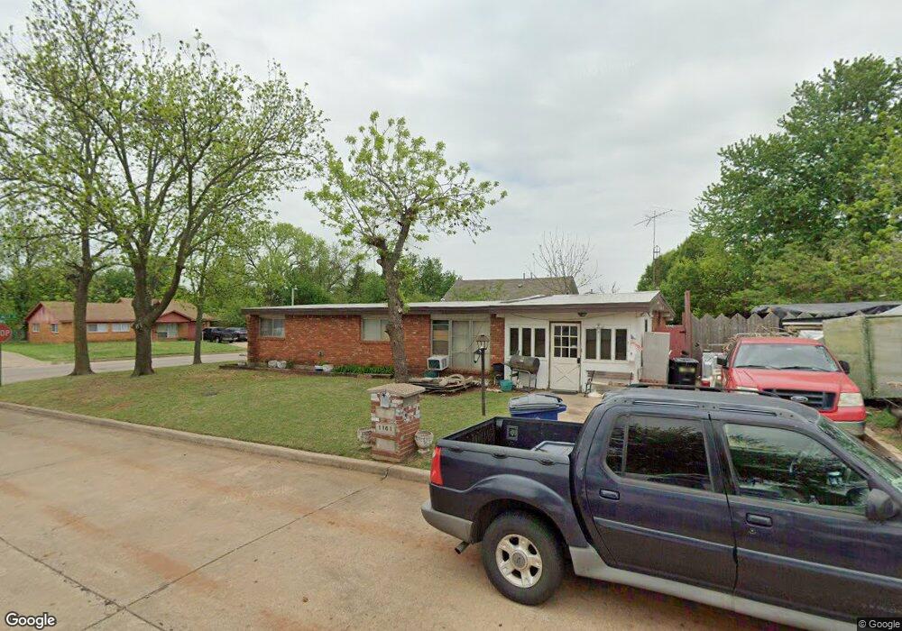
1101 Rockspring Cir Duncan, OK 73533
Estimated Value: $55,000 - $89,000
3
Beds
2
Baths
1,828
Sq Ft
$43/Sq Ft
Est. Value
About This Home
This home is located at 1101 Rockspring Cir, Duncan, OK 73533 and is currently estimated at $77,970, approximately $42 per square foot. 1101 Rockspring Cir is a home located in Stephens County with nearby schools including Emerson Elementary School, Duncan Middle School, and Duncan High School.
Ownership History
Date
Name
Owned For
Owner Type
Purchase Details
Closed on
Jul 1, 2013
Sold by
Us Bank Na
Bought by
Lindsey Tina Marie
Current Estimated Value
Purchase Details
Closed on
Mar 6, 2013
Sold by
Newberry Lula Ann
Bought by
Us Ban Na and Citigroup Mortgage Loan Trust 2006-Wfhe1
Purchase Details
Closed on
Feb 27, 2009
Sold by
Bonner Shirley and Pat Shirley
Bought by
Newberry Lula A
Purchase Details
Closed on
Dec 11, 2008
Sold by
Newberry Lula A
Bought by
Bonner Shirley and Bonner Pat
Purchase Details
Closed on
Oct 20, 2005
Sold by
Wilson Charles Eugene
Bought by
Newberry Lula Ann
Home Financials for this Owner
Home Financials are based on the most recent Mortgage that was taken out on this home.
Original Mortgage
$47,500
Interest Rate
9.25%
Mortgage Type
Adjustable Rate Mortgage/ARM
Create a Home Valuation Report for This Property
The Home Valuation Report is an in-depth analysis detailing your home's value as well as a comparison with similar homes in the area
Home Values in the Area
Average Home Value in this Area
Purchase History
| Date | Buyer | Sale Price | Title Company |
|---|---|---|---|
| Lindsey Tina Marie | $28,000 | Oklahoma Reo Closing & Title | |
| Us Ban Na | -- | None Available | |
| Newberry Lula A | -- | Standard Title Insurance Com | |
| Bonner Shirley | -- | None Available | |
| Newberry Lula Ann | $47,500 | Stewart Escrow & Title |
Source: Public Records
Mortgage History
| Date | Status | Borrower | Loan Amount |
|---|---|---|---|
| Previous Owner | Newberry Lula Ann | $47,500 |
Source: Public Records
Tax History Compared to Growth
Tax History
| Year | Tax Paid | Tax Assessment Tax Assessment Total Assessment is a certain percentage of the fair market value that is determined by local assessors to be the total taxable value of land and additions on the property. | Land | Improvement |
|---|---|---|---|---|
| 2025 | $356 | $5,223 | $385 | $4,838 |
| 2024 | $347 | $5,070 | $385 | $4,685 |
| 2023 | $347 | $4,755 | $385 | $4,370 |
| 2022 | $296 | $4,616 | $385 | $4,231 |
| 2021 | $296 | $4,482 | $385 | $4,097 |
| 2020 | $278 | $4,225 | $385 | $3,840 |
| 2019 | $268 | $4,102 | $385 | $3,717 |
| 2018 | $266 | $4,102 | $385 | $3,717 |
| 2017 | $246 | $3,982 | $385 | $3,597 |
| 2016 | $234 | $3,754 | $385 | $3,369 |
| 2015 | $582 | $3,754 | $385 | $3,369 |
| 2014 | $582 | $3,754 | $385 | $3,369 |
Source: Public Records
Map
Nearby Homes
- 1101 Rockspring Cir
- 121 Forest Hills Dr
- 117 Forest Hills Dr
- 1105 Rockspring Cir
- 1102 Rockspring Cir
- 1105 Rockspring Cir
- 1109 Rockspring Cir
- 200 200 Forest Hills Dr
- 115 Forest Hills Dr
- 124 Forest Hills Dr
- 128 Forest Hills Dr
- 205 Forest Hills Dr
- 120 Forest Hills Dr
- 1113 Rockspring Cir
- 113 Forest Hills Dr
- 116 Forest Hills Dr
- 1104 Rockspring Cir
- 120 Lakewood Blvd
- 124 Lakewood Blvd
- 204 Forest Hills Dr