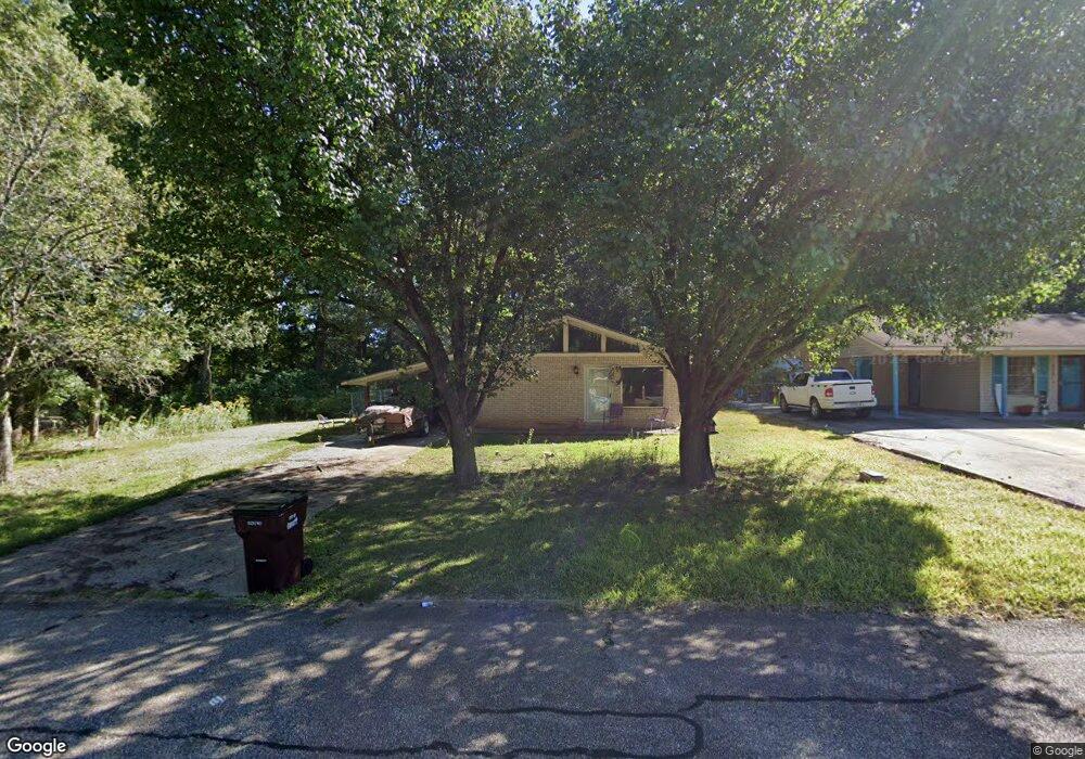
1101 S Adams St Crossett, AR 71635
Estimated Value: $44,162 - $119,000
--
Bed
1
Bath
1,080
Sq Ft
$67/Sq Ft
Est. Value
About This Home
This home is located at 1101 S Adams St, Crossett, AR 71635 and is currently estimated at $72,541, approximately $67 per square foot. 1101 S Adams St is a home located in Ashley County with nearby schools including Crossett Elementary School, Crossett Middle School, and Crossett High School.
Ownership History
Date
Name
Owned For
Owner Type
Purchase Details
Closed on
Mar 4, 2021
Sold by
Rowe Michael
Bought by
Rowe Edward D and Rowe Michael
Current Estimated Value
Purchase Details
Closed on
May 25, 1984
Bought by
Rowe Edward D and Rowe Vickie L
Purchase Details
Closed on
Jan 24, 1984
Bought by
Garrett Eddie Joe
Purchase Details
Closed on
Jul 10, 1979
Bought by
Garrett Ruby Myrtle
Purchase Details
Closed on
Aug 4, 1976
Bought by
Burks James Randall and Carol Lafran
Purchase Details
Closed on
Jun 29, 1976
Bought by
Smith Bobby Joe
Purchase Details
Closed on
Apr 17, 1967
Bought by
Georgia Pacific Investment Company
Purchase Details
Closed on
Oct 3, 1966
Bought by
Boucher Jesse L
Purchase Details
Closed on
Oct 29, 1965
Bought by
Oakhurst Homes Inc
Purchase Details
Closed on
Oct 21, 1965
Bought by
Boucher Jesse L
Create a Home Valuation Report for This Property
The Home Valuation Report is an in-depth analysis detailing your home's value as well as a comparison with similar homes in the area
Home Values in the Area
Average Home Value in this Area
Purchase History
| Date | Buyer | Sale Price | Title Company |
|---|---|---|---|
| Rowe Edward D | -- | None Available | |
| Rowe Edward D | $37,000 | -- | |
| Garrett Eddie Joe | -- | -- | |
| Garrett Ruby Myrtle | -- | -- | |
| Burks James Randall | -- | -- | |
| Smith Bobby Joe | -- | -- | |
| Georgia Pacific Investment Company | -- | -- | |
| Boucher Jesse L | -- | -- | |
| Oakhurst Homes Inc | -- | -- | |
| Boucher Jesse L | -- | -- |
Source: Public Records
Tax History Compared to Growth
Tax History
| Year | Tax Paid | Tax Assessment Tax Assessment Total Assessment is a certain percentage of the fair market value that is determined by local assessors to be the total taxable value of land and additions on the property. | Land | Improvement |
|---|---|---|---|---|
| 2025 | $442 | $8,170 | $1,260 | $6,910 |
| 2024 | $442 | $8,170 | $1,260 | $6,910 |
| 2023 | $409 | $8,170 | $1,260 | $6,910 |
| 2022 | $371 | $6,870 | $1,260 | $5,610 |
| 2021 | $0 | $6,870 | $1,260 | $5,610 |
| 2020 | $66 | $6,870 | $1,260 | $5,610 |
| 2019 | $66 | $6,870 | $1,260 | $5,610 |
| 2018 | $21 | $6,870 | $1,260 | $5,610 |
| 2017 | $66 | $7,690 | $1,260 | $6,430 |
| 2016 | $35 | $7,690 | $1,260 | $6,430 |
| 2015 | $35 | $7,690 | $1,260 | $6,430 |
| 2014 | $35 | $7,690 | $1,260 | $6,430 |
Source: Public Records
Map
Nearby Homes
- Lot 003 Tennessee St
- 1402 Parkway Dr
- 609 W 12th Ave
- 501 N Tennessee St
- 809 S Kentucky St
- 308 N Mississippi St
- 506 N Carolina St
- 1601 Howard Rd
- 203 Doctor Martin Luther King Jr Dr
- 509 Pine St
- 1209 Oak St
- 503 Pine St
- 1305 Beech St
- 000 Elm St
- 1314 Elm St
- 1207 Elm St
- 905 Cedar St
- 1009 Cedar St
- 402 Elm St
- 1513 Cedar St
- 1103 S Adams St
- 1700 S Virginia St
- 1105 S Adams St
- 1702 S Virginia St
- 1701 S Virginia St
- 1107 S Adams St
- 1704 S Virginia St
- 1703 S Virginia St
- 1109 S Adams St
- 1706 S Virginia St
- 1705 S Virginia St
- 1111 S Adams St
- 1707 S Virginia St
- 1708 S Virginia St
- 1700 S Missouri St
- 1702 S Missouri St
- 1113 S Adams St
- 1709 S Virginia St
- 1704 S Missouri St
- 1710 S Virginia St