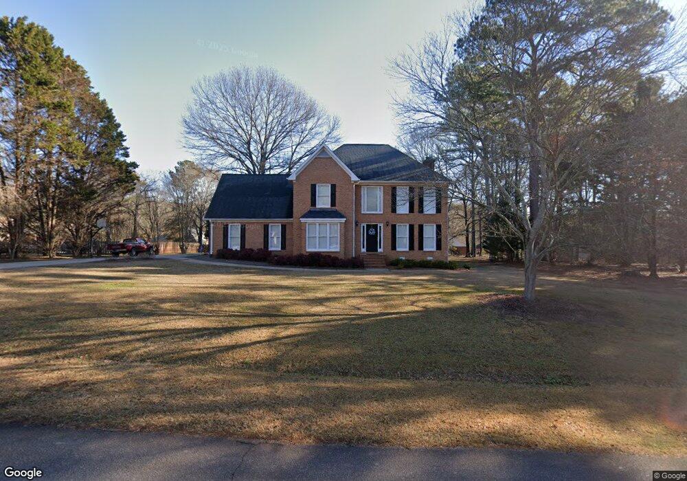
1101 Station Dr Unit 1 Watkinsville, GA 30677
Estimated Value: $501,535 - $564,000
4
Beds
3
Baths
2,671
Sq Ft
$199/Sq Ft
Est. Value
About This Home
This home is located at 1101 Station Dr Unit 1, Watkinsville, GA 30677 and is currently estimated at $532,384, approximately $199 per square foot. 1101 Station Dr Unit 1 is a home located in Oconee County with nearby schools including Oconee County Elementary School, Oconee County Primary School, and Oconee County Middle School.
Ownership History
Date
Name
Owned For
Owner Type
Purchase Details
Closed on
Aug 30, 2005
Sold by
Oppong Nicholas
Bought by
Wilson Benjamin B and Wilson Sarah M
Current Estimated Value
Home Financials for this Owner
Home Financials are based on the most recent Mortgage that was taken out on this home.
Original Mortgage
$180,000
Outstanding Balance
$95,816
Interest Rate
5.77%
Mortgage Type
New Conventional
Estimated Equity
$436,568
Purchase Details
Closed on
Jul 14, 1995
Bought by
Oppong Nicholas and Oppong G
Purchase Details
Closed on
Nov 17, 1994
Bought by
Armstrong Todd B
Create a Home Valuation Report for This Property
The Home Valuation Report is an in-depth analysis detailing your home's value as well as a comparison with similar homes in the area
Home Values in the Area
Average Home Value in this Area
Purchase History
| Date | Buyer | Sale Price | Title Company |
|---|---|---|---|
| Wilson Benjamin B | $225,000 | -- | |
| Oppong Nicholas | $171,500 | -- | |
| Armstrong Todd B | $168,000 | -- |
Source: Public Records
Mortgage History
| Date | Status | Borrower | Loan Amount |
|---|---|---|---|
| Open | Wilson Benjamin B | $180,000 |
Source: Public Records
Tax History Compared to Growth
Tax History
| Year | Tax Paid | Tax Assessment Tax Assessment Total Assessment is a certain percentage of the fair market value that is determined by local assessors to be the total taxable value of land and additions on the property. | Land | Improvement |
|---|---|---|---|---|
| 2024 | $2,799 | $152,068 | $30,000 | $122,068 |
| 2023 | $2,830 | $138,728 | $26,000 | $112,728 |
| 2022 | $2,629 | $123,319 | $26,000 | $97,319 |
| 2021 | $2,571 | $111,899 | $26,000 | $85,899 |
| 2020 | $2,537 | $110,294 | $26,000 | $84,294 |
| 2019 | $2,422 | $105,337 | $26,000 | $79,337 |
| 2018 | $2,369 | $100,880 | $24,000 | $76,880 |
| 2017 | $2,252 | $95,945 | $24,000 | $71,945 |
| 2016 | $2,069 | $88,243 | $24,000 | $64,243 |
| 2015 | $1,987 | $84,644 | $24,000 | $60,644 |
| 2014 | $1,969 | $82,040 | $24,000 | $58,040 |
| 2013 | -- | $83,347 | $28,000 | $55,347 |
Source: Public Records
Map
Nearby Homes
- 1030 Rossiter Ct
- 1040 Rossiter Ct
- 2041 Simonton Bridge Rd
- 2061 Simonton Bridge Rd
- 2190 Simonton Bridge Rd
- 2240 Simonton Bridge Rd
- 1682 River Bank Ln
- 1061 Riverside Dr
- 1250 Calls Creek Cir
- 1145 Watson Ln Unit E3
- 1311 Watson Ln Unit E8
- 1171 Watson Ln Unit E4
- 1195 Watson Ln Unit E5
- 1170 Watson Ln Unit F5
- Laurel Plan at Wire Park - Trillium
- E Building Townhome Plan at Wire Park - The Towns
- Cubicasa Plan at Wire Park - The Towns
- 1121 Watson Ln Unit E2
- 1101 Station Dr
- 1100 Station Dr
- 1010 Victoria Crossing
- 0 Long Branch Run
- 1011 Long Branch Run
- 1141 Station Dr
- 1021 Trestle Run
- 1080 Station Dr
- 1050 Long Branch Run
- 1040 Victoria Crossing
- 1020 Long Branch Run
- 1140 Station Dr
- 1010 Trestle Run
- 1011 Victoria Crossing
- 1021 Long Branch Run
- 1041 Victoria Crossing
- 1060 Victoria Crossing
- 1160 Station Dr
- 1050 Station Dr
- 1020 Trestle Run