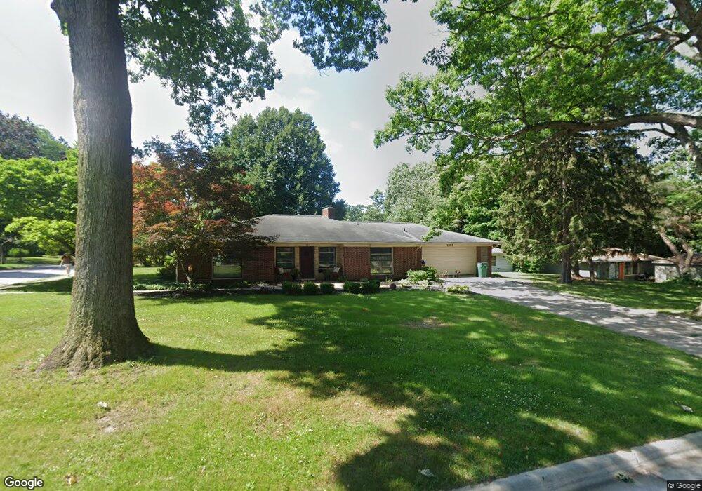
1101 W Oliver St Owosso, MI 48867
Estimated Value: $216,558 - $256,000
--
Bed
--
Bath
--
Sq Ft
22.54
Acres
About This Home
This home is located at 1101 W Oliver St, Owosso, MI 48867 and is currently estimated at $237,140. 1101 W Oliver St is a home located in Shiawassee County with nearby schools including Owosso High School, Salem Lutheran School, and St. Paul School.
Ownership History
Date
Name
Owned For
Owner Type
Purchase Details
Closed on
Jan 12, 2023
Sold by
Kemp Toby J
Bought by
Kemp Toby J and Kemp Shoko
Current Estimated Value
Home Financials for this Owner
Home Financials are based on the most recent Mortgage that was taken out on this home.
Original Mortgage
$135,000
Outstanding Balance
$130,616
Interest Rate
6.33%
Mortgage Type
New Conventional
Estimated Equity
$106,524
Purchase Details
Closed on
Dec 2, 2011
Sold by
Collamer Kirk A
Bought by
Kemp Toby J
Home Financials for this Owner
Home Financials are based on the most recent Mortgage that was taken out on this home.
Original Mortgage
$75,000
Interest Rate
4.11%
Mortgage Type
Purchase Money Mortgage
Create a Home Valuation Report for This Property
The Home Valuation Report is an in-depth analysis detailing your home's value as well as a comparison with similar homes in the area
Home Values in the Area
Average Home Value in this Area
Purchase History
| Date | Buyer | Sale Price | Title Company |
|---|---|---|---|
| Kemp Toby J | -- | -- | |
| Kemp Toby J | $100,000 | -- |
Source: Public Records
Mortgage History
| Date | Status | Borrower | Loan Amount |
|---|---|---|---|
| Open | Kemp Toby J | $135,000 | |
| Previous Owner | Kemp Toby J | $75,000 |
Source: Public Records
Tax History Compared to Growth
Tax History
| Year | Tax Paid | Tax Assessment Tax Assessment Total Assessment is a certain percentage of the fair market value that is determined by local assessors to be the total taxable value of land and additions on the property. | Land | Improvement |
|---|---|---|---|---|
| 2025 | $3,986 | $106,100 | $0 | $0 |
| 2024 | $3,986 | $94,600 | $0 | $0 |
| 2023 | $1,770 | $85,100 | $0 | $0 |
| 2022 | $3,839 | $77,500 | $0 | $0 |
| 2021 | $3,663 | $72,500 | $0 | $0 |
| 2020 | $3,731 | $67,200 | $0 | $0 |
| 2019 | $3,665 | $61,000 | $0 | $0 |
| 2018 | -- | $60,000 | $0 | $0 |
| 2017 | -- | $59,200 | $0 | $0 |
| 2016 | -- | $59,200 | $0 | $0 |
| 2015 | -- | $57,100 | $0 | $0 |
| 2014 | -- | $54,100 | $0 | $0 |
Source: Public Records
Map
Nearby Homes
- Vacant W Oliver St
- 1330 W King St
- 707 W King St
- 1339 Olmstead St
- 206 N Howell St
- 528 River St
- 522 River St
- 117 Elliot St
- 214 N Elm St
- 1408 W Main St
- 1104 Riverside Dr
- 214 S Cedar St
- 701 Pine St
- 705 Campbell Dr
- 618 Clinton St
- 815 Pine St
- 916 N Shiawassee St
- V/L W South (1 6) Acres St
- V/L W South - Lot#11 St
- 723 Adams St
- 1105 W Oliver St
- 406 Woodhall Ct
- 1025 W Oliver St
- 410 Woodhall Ct
- 1118 W Oliver St
- 438 Curwood Dr
- 1114 W Oliver St
- 407 Woodhall Ct
- 1110 W Oliver St
- 1100 W Oliver St
- 1202 W Oliver St
- 434 Curwood Dr
- 1001 W Oliver St
- 420 Curwood Dr
- 611 5th St
- 1211 W Oliver St
- 1020 W Oliver St
- 437 Curwood Dr
- 616 7th St
- 1210 W Oliver St