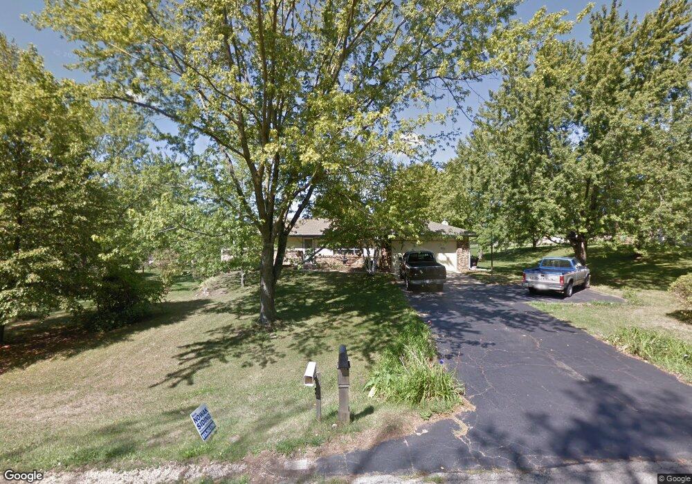
11010 Branding Iron Ln Roscoe, IL 61073
Estimated Value: $243,000 - $289,000
3
Beds
2
Baths
1,389
Sq Ft
$192/Sq Ft
Est. Value
About This Home
This home is located at 11010 Branding Iron Ln, Roscoe, IL 61073 and is currently estimated at $266,488, approximately $191 per square foot. 11010 Branding Iron Ln is a home located in Winnebago County with nearby schools including Ledgewood Elementary School, Stone Creek School, and Kinnikinnick School.
Ownership History
Date
Name
Owned For
Owner Type
Purchase Details
Closed on
Jan 11, 2022
Sold by
Evans Richard A
Bought by
Evans Richard A and Evans Judy L
Current Estimated Value
Home Financials for this Owner
Home Financials are based on the most recent Mortgage that was taken out on this home.
Original Mortgage
$63,991
Outstanding Balance
$42,498
Interest Rate
2.69%
Mortgage Type
New Conventional
Estimated Equity
$223,990
Purchase Details
Closed on
Jan 7, 2022
Sold by
Evans Richard A
Bought by
Evans Richard A and Evans Judy L
Home Financials for this Owner
Home Financials are based on the most recent Mortgage that was taken out on this home.
Original Mortgage
$63,991
Outstanding Balance
$42,498
Interest Rate
2.69%
Mortgage Type
New Conventional
Estimated Equity
$223,990
Purchase Details
Closed on
Dec 30, 2021
Sold by
Evans Richard A
Bought by
Evans Richard A and Evans Judy L
Home Financials for this Owner
Home Financials are based on the most recent Mortgage that was taken out on this home.
Original Mortgage
$63,991
Outstanding Balance
$42,498
Interest Rate
2.69%
Mortgage Type
New Conventional
Estimated Equity
$223,990
Create a Home Valuation Report for This Property
The Home Valuation Report is an in-depth analysis detailing your home's value as well as a comparison with similar homes in the area
Home Values in the Area
Average Home Value in this Area
Purchase History
| Date | Buyer | Sale Price | Title Company |
|---|---|---|---|
| Evans Richard A | -- | Lakeshore Title | |
| Evans Richard A | -- | Lakeshore Title | |
| Evans Richard A | -- | Lakeshore Title |
Source: Public Records
Mortgage History
| Date | Status | Borrower | Loan Amount |
|---|---|---|---|
| Open | Evans Richard A | $63,991 | |
| Closed | Evans Richard A | $63,991 | |
| Closed | Evans Richard A | $63,991 |
Source: Public Records
Tax History Compared to Growth
Tax History
| Year | Tax Paid | Tax Assessment Tax Assessment Total Assessment is a certain percentage of the fair market value that is determined by local assessors to be the total taxable value of land and additions on the property. | Land | Improvement |
|---|---|---|---|---|
| 2024 | $4,599 | $66,765 | $13,675 | $53,090 |
| 2023 | $4,205 | $59,916 | $12,272 | $47,644 |
| 2022 | $3,950 | $54,773 | $11,219 | $43,554 |
| 2021 | $3,729 | $51,454 | $10,539 | $40,915 |
| 2020 | $3,632 | $49,585 | $10,156 | $39,429 |
| 2019 | $3,501 | $47,364 | $9,701 | $37,663 |
| 2018 | $3,241 | $45,512 | $9,322 | $36,190 |
| 2017 | $3,337 | $43,896 | $8,991 | $34,905 |
| 2016 | $3,188 | $43,192 | $8,847 | $34,345 |
| 2015 | $3,032 | $41,958 | $8,594 | $33,364 |
| 2014 | $3,244 | $41,427 | $8,485 | $32,942 |
Source: Public Records
Map
Nearby Homes
- 11752 Love Rd
- 7822 Burr Oak Rd
- 6149 Dorothy Ln
- 6216 Schaumburg Ln
- 5961 Lacrosse Ln
- 11948 Southgate Rd
- 10401 Ray Dr
- 6058 Dorothy Ln
- 10679 Harrison Ct
- 12227 Joncey Dr
- 9885 Highstone Dr
- 10472 Atwood Rd
- 0 Atwood Rd Unit 202406609
- 0 Atwood Rd Unit 22063958
- 0 Atwood Rd Unit MRD12204329
- 5552 Broad St
- 10356 Geneva Dr
- 10683 Main St
- 10821 Keokuk Trail
- 7709 N Gate Rd
- 11032 Branding Iron Ln
- 10976 Branding Iron Ln
- 11017 Pheasant Run Ln
- 10971 Branding Iron Ln
- 10995 Pheasant Run Ln
- 11027 Branding Iron Ln
- 11051 Pheasant Run Ln
- 11066 Branding Iron Ln
- 11049 Branding Iron Ln
- 6936 Musket Ln
- 10965 Branding Iron Ln
- 6888 Musket Ln
- 11012 Pheasant Run Ln
- 10944 Bayberry Dr
- 11042 Pheasant Run Ln
- 11073 Branding Iron Ln
- 11085 Pheasant Run Ln
- 11088 Branding Iron Ln
- 10988 Pheasant Run Ln
- 11074 Pheasant Run Ln