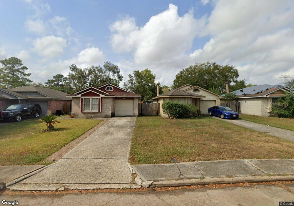
11012 Beaver Trail Dr Houston, TX 77086
North Houston NeighborhoodEstimated Value: $183,619 - $209,000
3
Beds
2
Baths
1,453
Sq Ft
$133/Sq Ft
Est. Value
About This Home
This home is located at 11012 Beaver Trail Dr, Houston, TX 77086 and is currently estimated at $193,405, approximately $133 per square foot. 11012 Beaver Trail Dr is a home located in Harris County with nearby schools including Kujawa EC/Pre-K/K School, Carmichael Elementary School, and Shotwell Middle School.
Ownership History
Date
Name
Owned For
Owner Type
Purchase Details
Closed on
Dec 17, 2004
Sold by
Kari Mohinder S
Bought by
Morgan Don A
Current Estimated Value
Home Financials for this Owner
Home Financials are based on the most recent Mortgage that was taken out on this home.
Original Mortgage
$85,500
Outstanding Balance
$42,847
Interest Rate
5.74%
Mortgage Type
Purchase Money Mortgage
Estimated Equity
$150,558
Create a Home Valuation Report for This Property
The Home Valuation Report is an in-depth analysis detailing your home's value as well as a comparison with similar homes in the area
Home Values in the Area
Average Home Value in this Area
Purchase History
| Date | Buyer | Sale Price | Title Company |
|---|---|---|---|
| Morgan Don A | -- | American Title Co |
Source: Public Records
Mortgage History
| Date | Status | Borrower | Loan Amount |
|---|---|---|---|
| Open | Morgan Don A | $85,500 |
Source: Public Records
Tax History Compared to Growth
Tax History
| Year | Tax Paid | Tax Assessment Tax Assessment Total Assessment is a certain percentage of the fair market value that is determined by local assessors to be the total taxable value of land and additions on the property. | Land | Improvement |
|---|---|---|---|---|
| 2025 | $1,813 | $187,291 | $32,680 | $154,611 |
| 2024 | $1,813 | $183,608 | $27,360 | $156,248 |
| 2023 | $1,813 | $186,256 | $27,360 | $158,896 |
| 2022 | $2,696 | $162,203 | $20,520 | $141,683 |
| 2021 | $2,575 | $136,677 | $20,520 | $116,157 |
| 2020 | $2,491 | $131,876 | $20,520 | $111,356 |
| 2019 | $2,412 | $125,173 | $20,520 | $104,653 |
| 2018 | $862 | $97,513 | $20,520 | $76,993 |
| 2017 | $2,115 | $97,513 | $20,520 | $76,993 |
| 2016 | $1,923 | $70,268 | $20,520 | $49,748 |
| 2015 | $1,881 | $72,399 | $11,400 | $60,999 |
| 2014 | $1,881 | $74,180 | $11,400 | $62,780 |
Source: Public Records
Map
Nearby Homes
- 7222 Northleaf Dr
- 11007 Tobasa Ct
- 7227 Greenyard Dr
- 7218 Winding Trace Dr
- 11006 Crinkleawn Dr
- 5010 Kale Ct
- 7002 Sandswept Ln
- 7023 Sandswept Ln
- 10711 Heather Hill Dr
- 11021 Crenchrus Ct
- 5103 Dartmoor Ridge Trail
- 10614 Mackenzie Dr
- 6654 Brownie Campbell Rd
- 10723 Mackenzie Dr
- 6722 Winding Trace Dr
- 11009 Panicum Ct
- 6610 Northleaf Dr
- 6630 Brownie Campbell Rd
- 10307 Bammel North Houston Rd
- 6911 Silver Star Dr
- 11008 Beaver Trail Dr
- 11014 Beaver Trail Dr
- 11006 Beaver Trail Dr
- 11016 Beaver Trail Dr
- 11011 Sacaton Dr
- 11015 Sacaton Dr
- 11009 Sacaton Dr
- 11002 Beaver Trail Dr
- 11007 Sacaton Dr
- 11017 Sacaton Dr
- 11011 Beaver Trail Dr
- 11020 Beaver Trail Dr
- 11015 Beaver Trail Dr
- 11009 Beaver Trail Dr
- 11003 Sacaton Dr
- 11019 Sacaton Dr
- 11007 Beaver Trail Dr
- 11017 Beaver Trail Dr
- 11021 Sacaton Dr
- 11003 Beaver Trail Dr