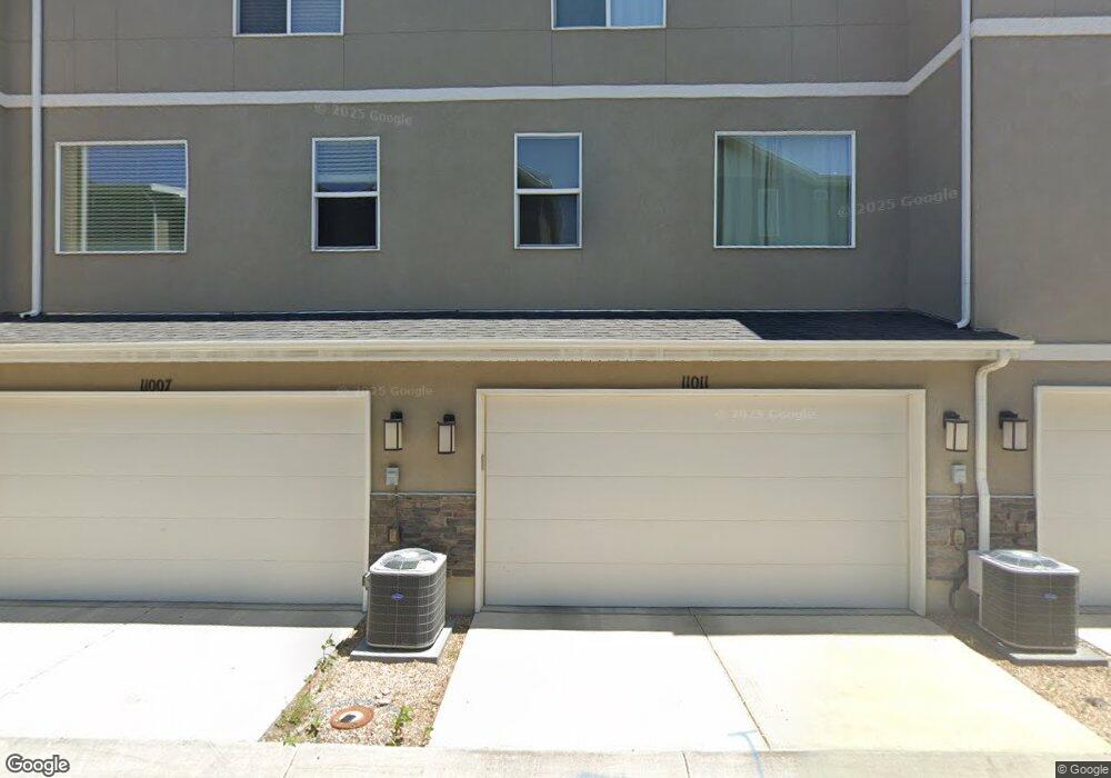
11013 S Harvest Pointe Dr Unit 2035 South Jordan, UT 84009
Estimated Value: $455,201 - $503,000
4
Beds
3
Baths
1,955
Sq Ft
$240/Sq Ft
Est. Value
About This Home
This home is located at 11013 S Harvest Pointe Dr Unit 2035, South Jordan, UT 84009 and is currently estimated at $468,800, approximately $239 per square foot. 11013 S Harvest Pointe Dr Unit 2035 is a home located in Salt Lake County with nearby schools including Eastlake Elementary School, Elk Ridge Middle School, and Mountain West Montessori Academy.
Ownership History
Date
Name
Owned For
Owner Type
Purchase Details
Closed on
Nov 4, 2019
Sold by
Maw Taylor E and Maw Kory
Bought by
King Matthew
Current Estimated Value
Home Financials for this Owner
Home Financials are based on the most recent Mortgage that was taken out on this home.
Original Mortgage
$232,425
Outstanding Balance
$204,880
Interest Rate
3.7%
Mortgage Type
New Conventional
Estimated Equity
$263,920
Purchase Details
Closed on
Jul 19, 2018
Sold by
Crowther Ryan
Bought by
Maw Taylor E and Maw Kory
Home Financials for this Owner
Home Financials are based on the most recent Mortgage that was taken out on this home.
Original Mortgage
$270,000
Interest Rate
4.6%
Mortgage Type
New Conventional
Purchase Details
Closed on
Mar 3, 2017
Sold by
D R Horton Inc
Bought by
Crowther Ryan
Home Financials for this Owner
Home Financials are based on the most recent Mortgage that was taken out on this home.
Original Mortgage
$254,232
Interest Rate
4.19%
Mortgage Type
FHA
Create a Home Valuation Report for This Property
The Home Valuation Report is an in-depth analysis detailing your home's value as well as a comparison with similar homes in the area
Home Values in the Area
Average Home Value in this Area
Purchase History
| Date | Buyer | Sale Price | Title Company |
|---|---|---|---|
| King Matthew | -- | Vanguard Title Union Park | |
| Maw Taylor E | -- | Title Guarantee | |
| Crowther Ryan | -- | Cottonwood Title |
Source: Public Records
Mortgage History
| Date | Status | Borrower | Loan Amount |
|---|---|---|---|
| Open | King Matthew | $232,425 | |
| Previous Owner | Maw Taylor E | $270,000 | |
| Previous Owner | Crowther Ryan | $254,232 |
Source: Public Records
Tax History Compared to Growth
Tax History
| Year | Tax Paid | Tax Assessment Tax Assessment Total Assessment is a certain percentage of the fair market value that is determined by local assessors to be the total taxable value of land and additions on the property. | Land | Improvement |
|---|---|---|---|---|
| 2025 | $2,347 | $469,300 | $63,500 | $405,800 |
| 2024 | $2,347 | $445,600 | $58,900 | $386,700 |
| 2023 | $2,399 | $429,800 | $57,200 | $372,600 |
| 2022 | $2,632 | $426,700 | $56,100 | $370,600 |
| 2021 | $2,148 | $323,600 | $42,800 | $280,800 |
| 2020 | $1,928 | $291,100 | $41,500 | $249,600 |
| 2019 | $1,892 | $280,900 | $50,000 | $230,900 |
| 2018 | $1,803 | $266,300 | $50,000 | $216,300 |
| 2017 | $1,659 | $240,200 | $40,900 | $199,300 |
| 2016 | $821 | $61,900 | $61,900 | $0 |
Source: Public Records
Map
Nearby Homes
- 10963 S Coastal Dune Dr
- 3677 W Golden Sky Ln
- 3577 Haven Hollow Dr
- 10847 S Big Meadow Dr
- Princeton Plan at High Pointe
- Sheridan Plan at High Pointe
- Dashell Plan at High Pointe
- Dakota Plan at High Pointe
- Olympus Plan at High Pointe
- Sweetwater Plan at High Pointe
- Roosevelt Plan at High Pointe
- Witzel Plan at High Pointe
- 3527 Haven Aire Dr
- 10931 S Glamis Dune Dr
- 10984 S Nellis Dune Ct
- 10988 S Greenvale Ct
- 10941 Little Sahara Dr
- 10934 Little Sahara Dr
- 10918 Little Sahara Dr Unit 1001
- 3884 Sand Lake Dr
- 11013 S Harvest Pointe Dr
- 11011 S Harvest Pointe Dr
- 11017 S Harvest Pointe Dr
- 11007 S Harvest Pointe Dr Unit 2037
- 11007 S Harvest Pointe Dr
- 11003 S Harvest Pointe Dr Unit 2038
- 11003 S Harvest Pointe Dr
- 11012 S Harvest Pointe Dr
- 11016 S Harvest Pointe Dr Unit 2014
- 11016 S Harvest Pointe Dr
- 11001 S Harvest Pointe Dr
- 11006 S Harvest Pointe Dr Unit 2012
- 11022 S Harvest Pointe Dr Unit 2015
- 11022 S Harvest Pointe Dr
- 11026 S Big Meadow Dr
- 11024 S Big Meadow Dr Unit 2029
- 11026 S Harvest Pointe Dr
- 11026 S Harvest Pointe Dr Unit 2016
- 11002 S Harvest Pointe Dr Unit 2011
- 11002 S Harvest Pointe Dr