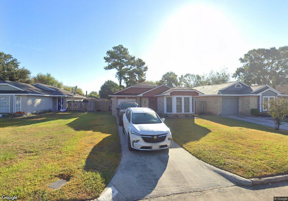
11014 Cottontop Ct Houston, TX 77086
North Houston NeighborhoodEstimated Value: $165,421 - $184,000
2
Beds
1
Bath
1,094
Sq Ft
$159/Sq Ft
Est. Value
About This Home
This home is located at 11014 Cottontop Ct, Houston, TX 77086 and is currently estimated at $174,105, approximately $159 per square foot. 11014 Cottontop Ct is a home located in Harris County with nearby schools including Kujawa EC/Pre-K/K School, Carmichael Elementary School, and Shotwell Middle School.
Ownership History
Date
Name
Owned For
Owner Type
Purchase Details
Closed on
Jan 19, 1996
Sold by
Sam Houston Mtg Co Inc
Bought by
Williams Alfred and Williams Patricia
Current Estimated Value
Home Financials for this Owner
Home Financials are based on the most recent Mortgage that was taken out on this home.
Original Mortgage
$36,850
Outstanding Balance
$980
Interest Rate
7.14%
Estimated Equity
$173,125
Purchase Details
Closed on
May 2, 1995
Sold by
Weatherby Analicia
Bought by
First Interstate Bank Of California
Create a Home Valuation Report for This Property
The Home Valuation Report is an in-depth analysis detailing your home's value as well as a comparison with similar homes in the area
Home Values in the Area
Average Home Value in this Area
Purchase History
| Date | Buyer | Sale Price | Title Company |
|---|---|---|---|
| Williams Alfred | -- | Commonwealth Land Title Co | |
| First Interstate Bank Of California | $21,000 | -- |
Source: Public Records
Mortgage History
| Date | Status | Borrower | Loan Amount |
|---|---|---|---|
| Open | Williams Alfred | $36,850 |
Source: Public Records
Tax History Compared to Growth
Tax History
| Year | Tax Paid | Tax Assessment Tax Assessment Total Assessment is a certain percentage of the fair market value that is determined by local assessors to be the total taxable value of land and additions on the property. | Land | Improvement |
|---|---|---|---|---|
| 2025 | $1,465 | $161,200 | $32,680 | $128,520 |
| 2024 | $1,465 | $157,240 | $27,360 | $129,880 |
| 2023 | $1,465 | $159,442 | $27,360 | $132,082 |
| 2022 | $2,367 | $138,054 | $20,520 | $117,534 |
| 2021 | $2,260 | $116,798 | $20,520 | $96,278 |
| 2020 | $2,187 | $112,725 | $20,520 | $92,205 |
| 2019 | $2,117 | $107,172 | $20,520 | $86,652 |
| 2018 | $713 | $84,214 | $20,520 | $63,694 |
| 2017 | $1,856 | $84,214 | $20,520 | $63,694 |
| 2016 | $1,688 | $61,672 | $20,520 | $41,152 |
| 2015 | $954 | $61,854 | $11,400 | $50,454 |
| 2014 | $954 | $63,279 | $11,400 | $51,879 |
Source: Public Records
Map
Nearby Homes
- 7227 Greenyard Dr
- 7222 Northleaf Dr
- 7218 Winding Trace Dr
- 11007 Tobasa Ct
- 5010 Kale Ct
- 10711 Heather Hill Dr
- 7002 Sandswept Ln
- 7023 Sandswept Ln
- 10723 Mackenzie Dr
- 10614 Mackenzie Dr
- 5103 Dartmoor Ridge Trail
- 11006 Crinkleawn Dr
- 11021 Crenchrus Ct
- 10307 Bammel North Houston Rd
- 6722 Winding Trace Dr
- 6654 Brownie Campbell Rd
- 11009 Panicum Ct
- 6630 Brownie Campbell Rd
- 6610 Northleaf Dr
- 7302 Seton Lake Dr
- 11012 Cottontop Ct
- 11016 Cottontop Ct
- 11008 Cottontop Ct
- 11015 Beaver Trail Dr
- 11011 Beaver Trail Dr
- 11017 Beaver Trail Dr
- 11006 Cottontop Ct
- 11020 Cottontop Ct
- 11009 Beaver Trail Dr
- 11021 Beaver Trail Dr
- 11015 Cottontop Ct
- 11011 Cottontop Ct
- 11017 Cottontop Ct
- 11007 Beaver Trail Dr
- 11002 Cottontop Ct
- 11009 Cottontop Ct
- 11022 Cottontop Ct
- 11003 Beaver Trail Dr
- 11024 Cottontop Ct
- 11021 Cottontop Ct