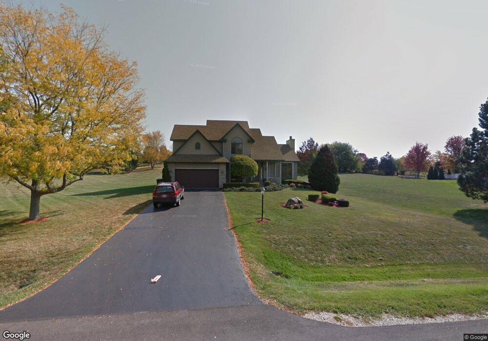
11016 Huron Dr Spring Grove, IL 60081
Estimated Value: $450,231 - $547,000
Studio
1
Bath
2,119
Sq Ft
$240/Sq Ft
Est. Value
About This Home
This home is located at 11016 Huron Dr, Spring Grove, IL 60081 and is currently estimated at $508,808, approximately $240 per square foot. 11016 Huron Dr is a home located in McHenry County with nearby schools including Richmond Grade School, Nippersink Middle School, and Richmond-Burton High School.
Ownership History
Date
Name
Owned For
Owner Type
Purchase Details
Closed on
Nov 13, 2017
Sold by
Mcdermid Marcey J
Bought by
Mcdermid Marcey J
Current Estimated Value
Purchase Details
Closed on
May 30, 1998
Sold by
Bland Dean R and Bland Anita P
Bought by
Radwanski David A and Mcdermid Marcey J
Purchase Details
Closed on
Jul 8, 1996
Sold by
Klm Builders Inc
Bought by
Bland Dean R and Bland Anita P
Home Financials for this Owner
Home Financials are based on the most recent Mortgage that was taken out on this home.
Original Mortgage
$165,000
Interest Rate
8.09%
Mortgage Type
Purchase Money Mortgage
Create a Home Valuation Report for This Property
The Home Valuation Report is an in-depth analysis detailing your home's value as well as a comparison with similar homes in the area
Home Values in the Area
Average Home Value in this Area
Purchase History
| Date | Buyer | Sale Price | Title Company |
|---|---|---|---|
| Mcdermid Marcey J | -- | None Available | |
| Radwanski David A | $226,000 | -- | |
| Bland Dean R | $225,000 | -- |
Source: Public Records
Mortgage History
| Date | Status | Borrower | Loan Amount |
|---|---|---|---|
| Previous Owner | Bland Dean R | $165,000 |
Source: Public Records
Tax History
| Year | Tax Paid | Tax Assessment Tax Assessment Total Assessment is a certain percentage of the fair market value that is determined by local assessors to be the total taxable value of land and additions on the property. | Land | Improvement |
|---|---|---|---|---|
| 2024 | $8,805 | $125,229 | $16,618 | $108,611 |
| 2023 | $8,512 | $113,906 | $15,507 | $98,399 |
| 2022 | $8,021 | $100,199 | $13,641 | $86,558 |
| 2021 | $7,619 | $94,456 | $12,859 | $81,597 |
| 2020 | $7,446 | $90,293 | $12,292 | $78,001 |
| 2019 | $7,493 | $88,889 | $12,101 | $76,788 |
| 2018 | $7,643 | $86,141 | $11,727 | $74,414 |
| 2017 | $7,432 | $79,881 | $13,957 | $65,924 |
| 2016 | $7,458 | $76,288 | $13,329 | $62,959 |
| 2013 | -- | $89,660 | $14,208 | $75,452 |
Source: Public Records
Map
Nearby Homes
- 11111 Huron Dr
- 10905 Breezy Lawn Rd
- 11013 Serenity Path
- 11101 Serenity Path
- 2303 Fox Bluff Ln
- Lt1 Majestic Way W
- 1914 Spring Dale Dr
- 2102 W Hunters Ln
- 2919 Il Route 173
- 9436 Bellaire Ln
- Lot 16 Harding
- 10105 N Clark Rd
- 9510 Martin Dr
- 31700 118th St
- 2044 Matthew Ave
- Lot 17 & 18 Harding Ave
- 2611 E Lake Shore Dr
- 35324 110th St
- 3159 E Lakeshore Dr
- 210 W Spring Dr
- 11004 Huron Dr
- 11102 Huron Dr
- 10918 Huron Dr
- 11015 Huron Dr
- 11103 Huron Dr
- 11019 Michigan Dr
- 11011 Michigan Dr
- 11005 Huron Dr
- 11015 Michigan Dr
- 10910 Huron Dr
- 11110 Huron Dr
- 10917 Huron Dr
- 1413 Superior Ct
- 1403 Superior Ct
- 11007 Michigan Dr
- 10909 Huron Dr
- 10906 Huron Dr
- 11016 Michigan Dr
- 11102 Michigan Dr
- 1603 Breezy Lawn Rd
Your Personal Tour Guide
Ask me questions while you tour the home.