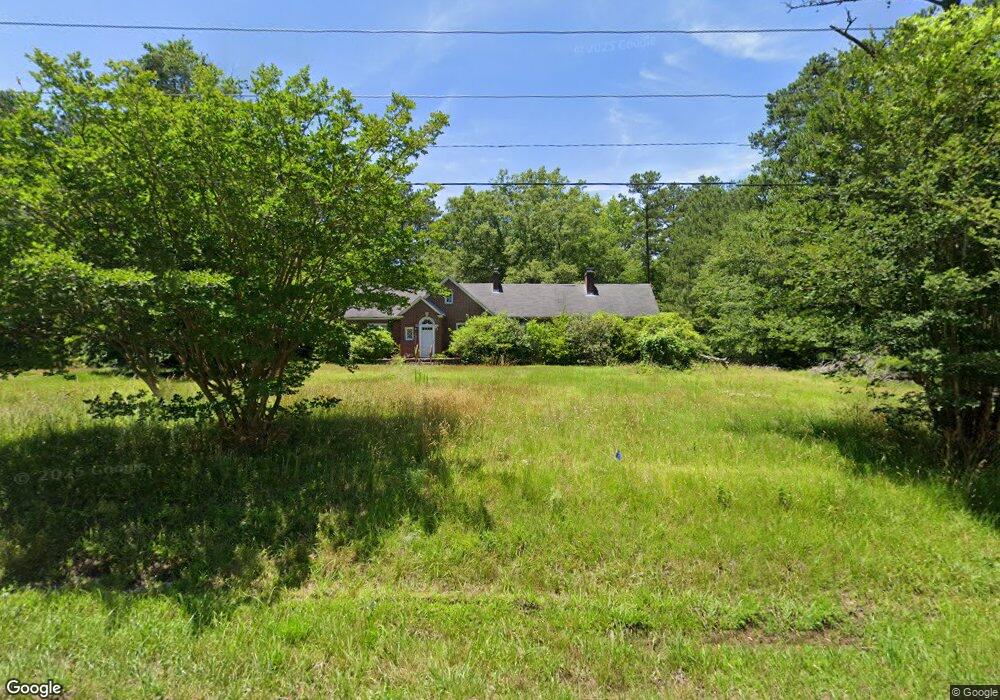
11017 Wilson Blvd Blythewood, SC 29016
Estimated Value: $222,000 - $386,000
4
Beds
2
Baths
2,540
Sq Ft
$125/Sq Ft
Est. Value
About This Home
This home is located at 11017 Wilson Blvd, Blythewood, SC 29016 and is currently estimated at $317,886, approximately $125 per square foot. 11017 Wilson Blvd is a home located in Richland County with nearby schools including Bethel-Hanberry Elementary School, Muller Road Middle, and Blythewood High School.
Ownership History
Date
Name
Owned For
Owner Type
Purchase Details
Closed on
Jul 26, 2024
Sold by
R & S Wilson Properties Llc
Bought by
Pulte Home Company Llc
Current Estimated Value
Purchase Details
Closed on
Oct 4, 2023
Sold by
Wilson Stanley M
Bought by
R & S Wilson Properties Llc
Purchase Details
Closed on
Oct 16, 2017
Sold by
Wilson Stanley M and Owens Carol W
Bought by
R & S Wilson Properties Llc
Purchase Details
Closed on
Sep 9, 2013
Sold by
Wilson Stanley M and Wilson John Roger
Bought by
Wilson Stanley M and Owens Carol W
Purchase Details
Closed on
Jul 19, 2000
Sold by
Wilson Stanley M
Bought by
Wilson Stanley M and Trust B
Create a Home Valuation Report for This Property
The Home Valuation Report is an in-depth analysis detailing your home's value as well as a comparison with similar homes in the area
Home Values in the Area
Average Home Value in this Area
Purchase History
| Date | Buyer | Sale Price | Title Company |
|---|---|---|---|
| Pulte Home Company Llc | -- | None Listed On Document | |
| Pulte Home Company Llc | -- | None Listed On Document | |
| R & S Wilson Properties Llc | -- | None Listed On Document | |
| R & S Wilson Properties Llc | -- | None Listed On Document | |
| Wilson Stanley M | -- | None Available | |
| Wilson Stanley M | -- | -- |
Source: Public Records
Tax History Compared to Growth
Tax History
| Year | Tax Paid | Tax Assessment Tax Assessment Total Assessment is a certain percentage of the fair market value that is determined by local assessors to be the total taxable value of land and additions on the property. | Land | Improvement |
|---|---|---|---|---|
| 2024 | $2,626 | $71,800 | $0 | $0 |
| 2023 | $2,626 | $2,500 | $0 | $0 |
| 2022 | $2,404 | $62,500 | $12,300 | $50,200 |
| 2021 | $2,389 | $3,750 | $0 | $0 |
| 2020 | $2,575 | $4,080 | $0 | $0 |
| 2019 | $2,332 | $6,790 | $0 | $0 |
| 2018 | $2,536 | $4,080 | $0 | $0 |
| 2017 | $2,474 | $4,080 | $0 | $0 |
| 2016 | $2,461 | $4,080 | $0 | $0 |
| 2015 | $2,402 | $4,080 | $0 | $0 |
| 2014 | $3,413 | $105,500 | $0 | $0 |
| 2013 | -- | $0 | $0 | $0 |
Source: Public Records
Map
Nearby Homes
- 11033 Wilson Blvd
- 218 Oakhurst Rd
- 0 Oakhurst Place Unit Lot 70
- 0 Oakhurst Place Unit Lot 73
- 0 Oakhurst Place Unit Lot 72
- 0 Oakhurst Place Unit Lot 71
- 514 Cooley Farm Ct
- 0 Cross Ridge Rd Unit Lot 74
- 0 Cross Ridge Rd Unit Lot 75
- 0 Cross Ridge Rd Unit Lot 76
- 0 Cross Ridge Rd Unit Lot 77
- 204 Mcnulty St
- 125 Blythewood Rd
- 19 Fangango Ct
- 791 Langford Rd
- NX 1057 Langford Rd
- 1024 Beaufort Farm Rd
- 1034 Beaufort Farm Rd
- 1018 Beaufort Farm Rd
- 1025 Beaufort Farm Rd
- 11016 Wilson Blvd
- 11029 Wilson Blvd
- 11019 Wilson Blvd
- 514 Main St
- 513 Main St
- 1036 Frank Dale Rd
- 11041 Wilson Blvd
- 1056 Frank Dale Rd
- 501 Main St
- 11056 Wilson Blvd
- 11049 Wilson Blvd
- 500 Main St
- 504 Wilson Blvd
- 140 Oakhurst Rd
- 140 Oakhurst Dr
- 201 Mclean Rd
- 436 Main St
- 200 Oakhurst Rd
- 1088 Frank Dale Rd
- 119 Oakhurst Rd