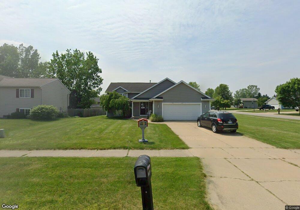
11019 Douglas Dr Allendale, MI 49401
Estimated Value: $353,418 - $378,000
3
Beds
1
Bath
1,700
Sq Ft
$214/Sq Ft
Est. Value
About This Home
This home is located at 11019 Douglas Dr, Allendale, MI 49401 and is currently estimated at $363,605, approximately $213 per square foot. 11019 Douglas Dr is a home located in Ottawa County with nearby schools including Evergreen Elementary School, Allendale Middle School, and Allendale High School.
Ownership History
Date
Name
Owned For
Owner Type
Purchase Details
Closed on
Mar 28, 2005
Sold by
Schroud Peter M and Schroud Tanya L
Bought by
Copeland Cory
Current Estimated Value
Home Financials for this Owner
Home Financials are based on the most recent Mortgage that was taken out on this home.
Original Mortgage
$148,400
Interest Rate
6.05%
Mortgage Type
Fannie Mae Freddie Mac
Purchase Details
Closed on
Sep 3, 2004
Sold by
Englund Tanya L and Englund Thomas L
Bought by
Schroud Peter M and Schroud Tanya L
Create a Home Valuation Report for This Property
The Home Valuation Report is an in-depth analysis detailing your home's value as well as a comparison with similar homes in the area
Home Values in the Area
Average Home Value in this Area
Purchase History
| Date | Buyer | Sale Price | Title Company |
|---|---|---|---|
| Copeland Cory | $148,400 | -- | |
| Schroud Peter M | -- | -- |
Source: Public Records
Mortgage History
| Date | Status | Borrower | Loan Amount |
|---|---|---|---|
| Previous Owner | Copeland Cory | $148,400 |
Source: Public Records
Tax History Compared to Growth
Tax History
| Year | Tax Paid | Tax Assessment Tax Assessment Total Assessment is a certain percentage of the fair market value that is determined by local assessors to be the total taxable value of land and additions on the property. | Land | Improvement |
|---|---|---|---|---|
| 2025 | $2,888 | $137,000 | $0 | $0 |
| 2024 | $2,468 | $138,700 | $0 | $0 |
| 2023 | $2,355 | $124,400 | $0 | $0 |
| 2022 | $2,615 | $114,700 | $0 | $0 |
| 2021 | $2,545 | $98,600 | $0 | $0 |
| 2020 | $2,515 | $99,200 | $0 | $0 |
| 2019 | $2,468 | $95,300 | $0 | $0 |
| 2018 | $2,318 | $87,000 | $0 | $0 |
| 2017 | $2,256 | $79,700 | $0 | $0 |
| 2016 | $2,167 | $78,500 | $0 | $0 |
| 2015 | -- | $74,500 | $0 | $0 |
| 2014 | -- | $69,000 | $0 | $0 |
Source: Public Records
Map
Nearby Homes
- 11506 56th Ave
- 5621 Estate Rd
- 10940 Gayle Ln
- 5690 Forest View St
- 5325 Margot Ln
- 5241 Margot Ln
- 10786 Melanie Dr
- 5279 Windfield Dr
- 10718 Melanie Dr
- 10725 Melanie Dr
- 10713 Melanie Dr
- 5779 Huber St
- 10724 Greyhound Ave
- The Silverton Plan at Pearline Estates
- The Breckenridge Plan at Pearline Estates
- The McKinley Plan at Pearline Estates
- The Emerson Plan at Pearline Estates
- The Whitney Plan at Pearline Estates
- The Harper Plan at Pearline Estates
- The Sierra Plan at Pearline Estates
- 11009 Douglas Dr
- 11022 Jordan Ct
- 11010 Jordan Ct
- 10997 Douglas Dr
- 5337 Jordan St
- 10998 Jordan Ct
- 11014 Douglas Dr
- 5325 Jordan St
- 5349 Jordan St
- 10985 Douglas Dr
- 5313 Jordan St
- 10998 Douglas Dr
- 5361 Jordan St
- 10986 Jordan Ct
- 10986 Douglas Dr
- 5301 Jordan St
- 10973 Douglas Dr
- 11015 Jordan Ct
- 5373 Jordan St
- 10974 Jordan Ct