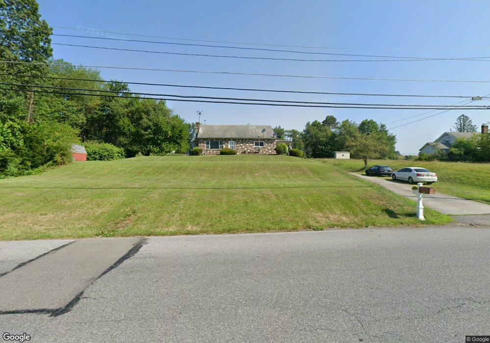
1102 Bridge St Lehighton, PA 18235
Estimated Value: $251,000 - $297,000
3
Beds
1
Bath
1,344
Sq Ft
$203/Sq Ft
Est. Value
About This Home
This home is located at 1102 Bridge St, Lehighton, PA 18235 and is currently estimated at $272,831, approximately $202 per square foot. 1102 Bridge St is a home located in Carbon County with nearby schools including Lehighton Area High School, Sts. Peter & Paul School, and Valley Ridge Academy.
Ownership History
Date
Name
Owned For
Owner Type
Purchase Details
Closed on
Sep 19, 2021
Sold by
Bridge Street Real Estate Llc
Bought by
Thomas Gary
Current Estimated Value
Home Financials for this Owner
Home Financials are based on the most recent Mortgage that was taken out on this home.
Original Mortgage
$160,050
Outstanding Balance
$145,634
Interest Rate
2.8%
Mortgage Type
New Conventional
Estimated Equity
$127,197
Purchase Details
Closed on
Oct 1, 2012
Sold by
Behler A Donald and Behler Mary G
Bought by
Bridge Street Real Estate Llc
Create a Home Valuation Report for This Property
The Home Valuation Report is an in-depth analysis detailing your home's value as well as a comparison with similar homes in the area
Home Values in the Area
Average Home Value in this Area
Purchase History
| Date | Buyer | Sale Price | Title Company |
|---|---|---|---|
| Thomas Gary | $165,000 | Carbon Search & Stlmt Svcs I | |
| Bridge Street Real Estate Llc | $127,530 | None Available |
Source: Public Records
Mortgage History
| Date | Status | Borrower | Loan Amount |
|---|---|---|---|
| Open | Thomas Gary | $160,050 |
Source: Public Records
Tax History Compared to Growth
Tax History
| Year | Tax Paid | Tax Assessment Tax Assessment Total Assessment is a certain percentage of the fair market value that is determined by local assessors to be the total taxable value of land and additions on the property. | Land | Improvement |
|---|---|---|---|---|
| 2025 | $4,188 | $52,500 | $5,950 | $46,550 |
| 2024 | $3,978 | $52,500 | $5,950 | $46,550 |
| 2023 | $3,938 | $52,500 | $5,950 | $46,550 |
| 2022 | $3,938 | $52,500 | $5,950 | $46,550 |
| 2021 | $3,800 | $52,500 | $5,950 | $46,550 |
| 2020 | $3,708 | $52,500 | $5,950 | $46,550 |
| 2019 | $3,551 | $52,500 | $5,950 | $46,550 |
| 2018 | $3,472 | $52,500 | $5,950 | $46,550 |
| 2017 | $3,446 | $52,500 | $5,950 | $46,550 |
| 2016 | -- | $52,500 | $5,950 | $46,550 |
| 2015 | -- | $52,500 | $5,950 | $46,550 |
| 2014 | -- | $52,500 | $5,950 | $46,550 |
Source: Public Records
Map
Nearby Homes
- 410 S 8th St
- 639 Iron St
- 408 Bridge St
- 0 Emily Plan at Summit Point Unit PACC2005480
- 0 Copper Beech Plan at Summit Ridge Unit PACC2005478
- 0 Black Cherry Plan at Summit Ridge Unit PACC2005474
- 0 Ridge
- 522 Iron St
- 260 S 3rd St
- 515 Mahoning St
- 196 S 3rd St
- 134 Bridge St
- 808 Coal St
- 236 S 2nd St
- 230 S 2nd St
- 8 Lentz Ave
- 119 S 3rd St
- 470 N 8th St
- 142 Bankway St
- 215 N 4th St
- 1100 Bridge St
- 981 Bridge St
- 0 Ashtown Dr Unit 1007465304
- 000 Ashtown Dr
- 0 Ashtown Dr Unit 7119471
- 0 Ashtown Dr Unit 7-595
- 0 Ashtown Dr Unit 7-483
- 0 Ashtown Dr Unit 715300
- 0 Ashtown Dr Unit 13-156
- 0 Ashtown Dr Unit 12-3471
- 0 Ashtown Dr Unit PM-24706
- 0 Ashtown Dr Unit PM-57835
- 0 Ashtown Dr Unit 636177
- 0 Ashtown Dr Unit 630140
- 0 Ashtown Dr Unit PACC115336
- 0 Ashtown Dr Unit 615230
- 0 Ashtown Dr Unit PM-64622
- 0 Ashtown Dr Unit PM-16585
- 0 Ashtown Dr Unit 599609
- 0 Ashtown Dr Unit 428692