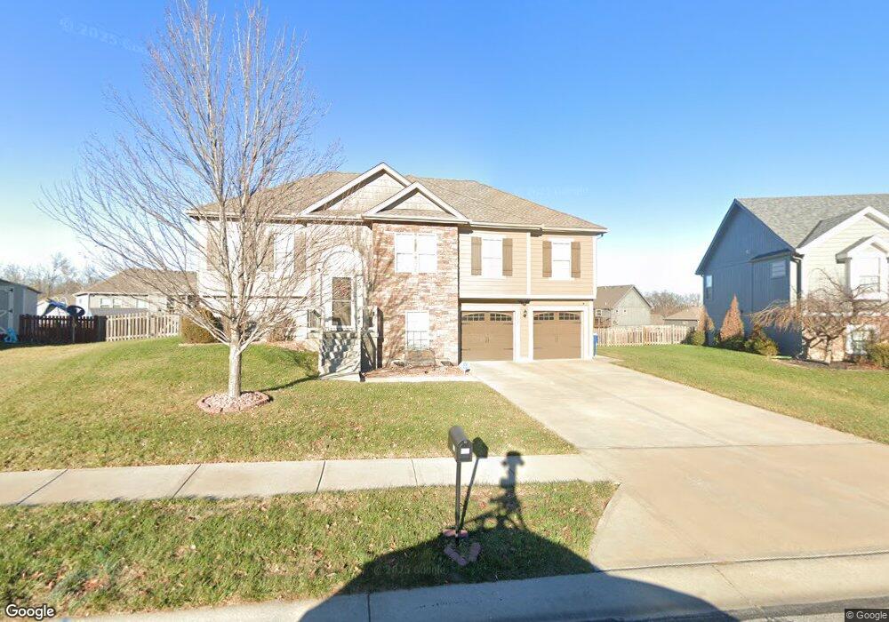
1102 E 15th St Kearney, MO 64060
Estimated Value: $382,598 - $447,000
4
Beds
3
Baths
1,557
Sq Ft
$265/Sq Ft
Est. Value
About This Home
This home is located at 1102 E 15th St, Kearney, MO 64060 and is currently estimated at $411,900, approximately $264 per square foot. 1102 E 15th St is a home located in Clay County with nearby schools including Kearney Junior High School and Kearney High School.
Ownership History
Date
Name
Owned For
Owner Type
Purchase Details
Closed on
Oct 5, 2020
Sold by
Knight Wanda L
Bought by
Mahaffey Robert A and Mahaffey Timmarie L
Current Estimated Value
Home Financials for this Owner
Home Financials are based on the most recent Mortgage that was taken out on this home.
Original Mortgage
$211,894
Outstanding Balance
$188,468
Interest Rate
2.9%
Mortgage Type
FHA
Estimated Equity
$223,432
Purchase Details
Closed on
Oct 5, 2011
Sold by
Robertson Construction L L C
Bought by
Knight Wanda L
Home Financials for this Owner
Home Financials are based on the most recent Mortgage that was taken out on this home.
Original Mortgage
$180,212
Interest Rate
4.4%
Mortgage Type
FHA
Purchase Details
Closed on
Sep 29, 2011
Sold by
Dcl Tract Ii Llc
Bought by
Robertson Construction L L C
Home Financials for this Owner
Home Financials are based on the most recent Mortgage that was taken out on this home.
Original Mortgage
$180,212
Interest Rate
4.4%
Mortgage Type
FHA
Create a Home Valuation Report for This Property
The Home Valuation Report is an in-depth analysis detailing your home's value as well as a comparison with similar homes in the area
Home Values in the Area
Average Home Value in this Area
Purchase History
| Date | Buyer | Sale Price | Title Company |
|---|---|---|---|
| Mahaffey Robert A | -- | Stewart Title Company | |
| Knight Wanda L | -- | None Available | |
| Robertson Construction L L C | -- | None Available |
Source: Public Records
Mortgage History
| Date | Status | Borrower | Loan Amount |
|---|---|---|---|
| Open | Mahaffey Robert A | $211,894 | |
| Previous Owner | Robertson Construction L L C | $180,212 |
Source: Public Records
Tax History
| Year | Tax Paid | Tax Assessment Tax Assessment Total Assessment is a certain percentage of the fair market value that is determined by local assessors to be the total taxable value of land and additions on the property. | Land | Improvement |
|---|---|---|---|---|
| 2025 | $3,664 | $58,600 | -- | -- |
| 2024 | $3,664 | $53,470 | -- | -- |
| 2023 | $3,652 | $53,470 | $0 | $0 |
| 2022 | $3,332 | $47,180 | $0 | $0 |
| 2021 | $3,267 | $47,177 | $6,650 | $40,527 |
| 2020 | $3,175 | $41,710 | $0 | $0 |
| 2019 | $3,158 | $41,710 | $0 | $0 |
Source: Public Records
Map
Nearby Homes
- 1300 Melissa Ct
- 801 Southbrook Pkwy
- 800 E 13th Terrace
- 1307 Stonecrest Dr
- 1305 Stonecrest Dr
- 21421 Jesse James Farm Rd
- 1505 Emerald Cir
- 623 E 13th St
- 1209 Noah's Ln
- 1204 Noah's Ln
- 1202 Noah Ln
- 919 E 8th Cir
- 905 Susan St
- 819 Susan St
- 901 Pine Crest Ave
- 1901 Meadowlane
- 1301 Ada St
- 2305 Larkspur Ln
- 2118 Glenside Rd
- 2108 Glenside Rd
Your Personal Tour Guide
Ask me questions while you tour the home.