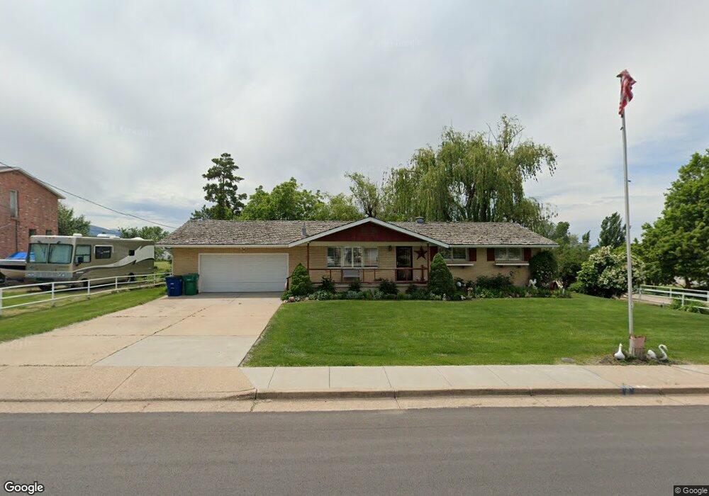
1102 E Gordon Ave Layton, UT 84040
--
Bed
--
Bath
1,515
Sq Ft
0.99
Acres
About This Home
This home is located at 1102 E Gordon Ave, Layton, UT 84040. 1102 E Gordon Ave is a home located in Davis County with nearby schools including King Elementary School, Central Davis Junior High School, and Layton High School.
Create a Home Valuation Report for This Property
The Home Valuation Report is an in-depth analysis detailing your home's value as well as a comparison with similar homes in the area
Home Values in the Area
Average Home Value in this Area
Tax History
| Year | Tax Paid | Tax Assessment Tax Assessment Total Assessment is a certain percentage of the fair market value that is determined by local assessors to be the total taxable value of land and additions on the property. | Land | Improvement |
|---|---|---|---|---|
| 2024 | -- | $315,699 | $198,878 | $116,821 |
| 2023 | $2,951 | $302,500 | $154,462 | $148,037 |
| 2022 | $2,956 | $544,000 | $281,954 | $262,046 |
| 2021 | $2,888 | $436,000 | $243,307 | $192,693 |
| 2020 | $2,472 | $358,000 | $228,741 | $129,259 |
| 2019 | $2,566 | $364,000 | $197,090 | $166,910 |
| 2018 | $2,409 | $343,000 | $181,237 | $161,763 |
| 2016 | $1,961 | $144,045 | $89,290 | $54,755 |
| 2015 | $1,847 | $128,810 | $89,290 | $39,520 |
| 2014 | $2,292 | $124,084 | $89,290 | $34,794 |
| 2013 | -- | $116,872 | $50,532 | $66,340 |
Source: Public Records
Map
Nearby Homes
- 1033 E 825 N
- 997 E 825 N
- 1048 E Cherry Ln
- 1545 E 975 N
- 861 E 575 N
- 857 E 575 N
- 1156 Cherrywood Dr
- 1503 E 530 N
- 508 N Adamswood Rd
- 556 N Fairfield Rd Unit A2
- 556 N Fairfield Rd Unit D1
- 556 N Fairfield Rd Unit D2
- 556 N Fairfield Rd Unit A3
- 556 N Fairfield Rd Unit D3
- 556 N Fairfield Rd Unit D4
- 556 N Fairfield Rd Unit A1
- 556 N Fairfield Rd Unit A4
- 800 Kirk St
- 479 N 1375 E
- 806 Valeria Dr
- 1128 E Gordon Ave
- 1080 E 1000 N
- 1068 E Gordon Ave
- 1133 E Gordon Ave
- 1029 Walburk Ave
- 998 N 1000 E
- 1115 E Gordon Ave
- 1052 E Gordon Ave
- 1052 N 1000 E
- 1020 N 1000 E
- 1026 Walburk Ave
- 1030 Kimberly Dr
- 1031 Walburk Ave
- 1015 Kimberly Dr
- 1169 E Gordon Ave
- 1034 Kimberly Dr
- 1152 E Gordon Ave
- 1035 Walburk Ave
- 1032 Walburk Ave
- 1028 E Gordon Ave
Your Personal Tour Guide
Ask me questions while you tour the home.