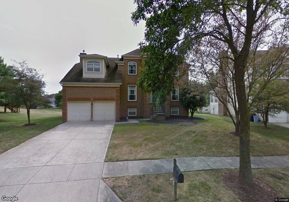
1102 Merganser Ct Upper Marlboro, MD 20774
Estimated Value: $674,080 - $769,000
--
Bed
4
Baths
3,308
Sq Ft
$217/Sq Ft
Est. Value
About This Home
This home is located at 1102 Merganser Ct, Upper Marlboro, MD 20774 and is currently estimated at $718,270, approximately $217 per square foot. 1102 Merganser Ct is a home located in Prince George's County with nearby schools including Perrywood Elementary School, Kettering Middle School, and Largo High School.
Ownership History
Date
Name
Owned For
Owner Type
Purchase Details
Closed on
Jul 3, 2013
Sold by
Gay Leslie and Hardy Lavern B
Bought by
Gay Leslie and Gay Lavern
Current Estimated Value
Home Financials for this Owner
Home Financials are based on the most recent Mortgage that was taken out on this home.
Original Mortgage
$316,000
Outstanding Balance
$229,035
Interest Rate
3.92%
Mortgage Type
Stand Alone Second
Estimated Equity
$489,235
Purchase Details
Closed on
Oct 24, 1994
Sold by
Us Home Corp
Bought by
Gay Leslie
Home Financials for this Owner
Home Financials are based on the most recent Mortgage that was taken out on this home.
Original Mortgage
$273,600
Interest Rate
8.49%
Purchase Details
Closed on
Jun 3, 1994
Sold by
Dee Corporation
Bought by
U S Home Corp
Create a Home Valuation Report for This Property
The Home Valuation Report is an in-depth analysis detailing your home's value as well as a comparison with similar homes in the area
Home Values in the Area
Average Home Value in this Area
Purchase History
| Date | Buyer | Sale Price | Title Company |
|---|---|---|---|
| Gay Leslie | -- | None Available | |
| Gay Leslie | $288,071 | -- | |
| U S Home Corp | $27,746 | -- |
Source: Public Records
Mortgage History
| Date | Status | Borrower | Loan Amount |
|---|---|---|---|
| Open | Gay Leslie | $316,000 | |
| Closed | U S Home Corp | $273,600 |
Source: Public Records
Tax History Compared to Growth
Tax History
| Year | Tax Paid | Tax Assessment Tax Assessment Total Assessment is a certain percentage of the fair market value that is determined by local assessors to be the total taxable value of land and additions on the property. | Land | Improvement |
|---|---|---|---|---|
| 2025 | $7,990 | $684,500 | $166,300 | $518,200 |
| 2024 | $7,990 | $638,800 | $0 | $0 |
| 2023 | $7,636 | $593,100 | $0 | $0 |
| 2022 | $7,206 | $547,400 | $101,300 | $446,100 |
| 2021 | $6,848 | $514,233 | $0 | $0 |
| 2020 | $6,647 | $481,067 | $0 | $0 |
| 2019 | $6,409 | $447,900 | $100,600 | $347,300 |
| 2018 | $6,158 | $419,067 | $0 | $0 |
| 2017 | $5,944 | $390,233 | $0 | $0 |
| 2016 | -- | $361,400 | $0 | $0 |
| 2015 | $5,980 | $361,400 | $0 | $0 |
| 2014 | $5,980 | $361,400 | $0 | $0 |
Source: Public Records
Map
Nearby Homes
- 1309 Merganser Ct
- 14101 Silver Teal Way
- 13509 Trumpeter Swan Ct
- 13008 Boykin Place
- 1121 Blue Wing Terrace
- 1600 Whistling Duck Dr
- 13903 Norton Hill Ct
- 932 Pine Forest Ln
- 900 Pine Forest Ln
- 12328 Rollys Ridge Ave
- 937 Pine Forest Ln Unit 1908
- 12300 Rollys Ridge Ave
- 12354 Rollys Ridge Ave
- 12250 Open View Ln
- 13403 Hillrod Ln
- 13201 Eddington Dr
- 711 Bleak Hill Place
- 13300 Burleigh St
- 13214 Eddington Dr
- 13500 Mary Bowie Pkwy
- 1104 Merganser Ct
- 13207 Water Fowl Way
- 13206 Cape Shell Ct
- 13204 Cape Shell Ct
- 13208 Cape Shell Ct
- 13209 Water Fowl Way
- 1103 Merganser Ct
- 1106 Merganser Ct
- 13203 Water Fowl Way
- 1105 Merganser Ct
- 13202 Cape Shell Ct
- 13210 Cape Shell Ct
- 13211 Water Fowl Way
- 1107 Merganser Ct
- 1108 Merganser Ct
- 13207 Cape Shell Ct
- 13201 Water Fowl Way
- 13212 Cape Shell Ct
- 13208 Water Fowl Way
- 13119 Water Fowl Way