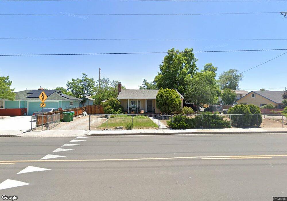
1102 Sullivan Ln Sparks, NV 89431
Downtown Sparks NeighborhoodEstimated Value: $326,034 - $387,000
2
Beds
1
Bath
936
Sq Ft
$377/Sq Ft
Est. Value
About This Home
This home is located at 1102 Sullivan Ln, Sparks, NV 89431 and is currently estimated at $352,759, approximately $376 per square foot. 1102 Sullivan Ln is a home located in Washoe County with nearby schools including Kate M Smith Elementary School, Sparks Middle School, and Sparks High School.
Ownership History
Date
Name
Owned For
Owner Type
Purchase Details
Closed on
Jul 17, 1996
Sold by
Stokes Robert C
Bought by
Cooper Lorie Diane
Current Estimated Value
Purchase Details
Closed on
Dec 7, 1994
Sold by
Kogut Zbyslaw M
Bought by
Cooper Lorie Diane and Stokes Robert Charles
Home Financials for this Owner
Home Financials are based on the most recent Mortgage that was taken out on this home.
Original Mortgage
$80,391
Interest Rate
9.08%
Mortgage Type
FHA
Create a Home Valuation Report for This Property
The Home Valuation Report is an in-depth analysis detailing your home's value as well as a comparison with similar homes in the area
Home Values in the Area
Average Home Value in this Area
Purchase History
| Date | Buyer | Sale Price | Title Company |
|---|---|---|---|
| Cooper Lorie Diane | -- | -- | |
| Cooper Lorie Diane | $81,000 | Stewart Title |
Source: Public Records
Mortgage History
| Date | Status | Borrower | Loan Amount |
|---|---|---|---|
| Previous Owner | Cooper Lorie Diane | $80,391 |
Source: Public Records
Tax History
| Year | Tax Paid | Tax Assessment Tax Assessment Total Assessment is a certain percentage of the fair market value that is determined by local assessors to be the total taxable value of land and additions on the property. | Land | Improvement |
|---|---|---|---|---|
| 2026 | $437 | $43,186 | $28,224 | $14,962 |
| 2025 | $579 | $43,751 | $28,868 | $14,883 |
| 2024 | $579 | $41,844 | $27,104 | $14,740 |
| 2023 | $563 | $38,604 | $25,060 | $13,544 |
| 2022 | $547 | $33,091 | $22,064 | $11,027 |
| 2021 | $535 | $25,059 | $14,308 | $10,751 |
| 2020 | $518 | $24,501 | $13,944 | $10,557 |
| 2019 | $503 | $22,680 | $12,684 | $9,996 |
| 2018 | $485 | $18,425 | $8,848 | $9,577 |
| 2017 | $474 | $16,900 | $7,476 | $9,424 |
| 2016 | $462 | $16,095 | $6,692 | $9,403 |
| 2015 | $466 | $15,583 | $6,356 | $9,227 |
| 2014 | $452 | $13,729 | $4,984 | $8,745 |
| 2013 | -- | $11,686 | $3,164 | $8,522 |
Source: Public Records
Map
Nearby Homes
- 2127 Greyhaven Ln
- 2168 Cannonball Rd
- 2040 G St
- 1947 H St
- 2282 Cannonball Rd
- 2136 Roundhouse Rd
- 1947 G St
- 1889 Merchant St
- 2371 Roundhouse Rd
- 1745 I St
- 2380 Roundhouse Rd
- 1720 H St
- 2006 Prater Way Unit 82
- 848 Rock Blvd
- 1830 C St
- 1563 Steven Ct
- 1045 Adrian Way
- 1536 Irene Way
- 979 Damon Ln
- 1536 Oxford Ave
- 1150 Sullivan Ln
- 1052 Sullivan Ln
- 1056 Sullivan Ln Unit 4
- 2047 K St
- 2105 Pauline Ave
- 2100 Jessie Ave
- 1054 Sullivan Ln Unit 4
- 1054 Sullivan Ln Unit 9
- 2041 K St
- 2125 Pauline Ave
- 2110 Pauline Ave
- 1051 20th St
- 2120 Jessie Ave
- 2030 I St
- 2120 Pauline Ave
- 2028 I St
- 2035 K St
- 1200 Sullivan Ln
- 2105 Jessie Ave
- 2026 I St
Your Personal Tour Guide
Ask me questions while you tour the home.