Estimated Value: $463,000 - $492,000
3
Beds
1
Bath
1,000
Sq Ft
$478/Sq Ft
Est. Value
About This Home
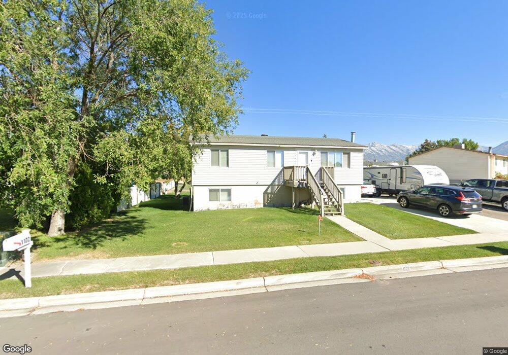
This home is located at 1102 W 1870 N, Lehi, UT 84043 and is currently estimated at $478,205, approximately $478 per square foot. 1102 W 1870 N is a home located in Utah County with nearby schools including Lehi Elementary School, Lehi Junior High School, and Lehi High School.
Ownership History
Date
Name
Owned For
Owner Type
Purchase Details
Closed on
Feb 1, 2016
Sold by
Mccollum Mercedes and Mccollum Larry A
Bought by
Mccollum Larry A and Mccollum Mercedes
Current Estimated Value
Purchase Details
Closed on
May 11, 2004
Sold by
Mccollum Mercedes and Mccollum Larry A
Bought by
Mccollum Larry A and Mccollum Mercedes
Home Financials for this Owner
Home Financials are based on the most recent Mortgage that was taken out on this home.
Original Mortgage
$15,000
Interest Rate
5.86%
Mortgage Type
Credit Line Revolving
Create a Home Valuation Report for This Property
The Home Valuation Report is an in-depth analysis detailing your home's value as well as a comparison with similar homes in the area
Home Values in the Area
Average Home Value in this Area
Purchase History
| Date | Buyer | Sale Price | Title Company |
|---|---|---|---|
| Mccollum Larry A | -- | None Available | |
| Mccollum Larry A | -- | Inwest Title Services Inc |
Source: Public Records
Mortgage History
| Date | Status | Borrower | Loan Amount |
|---|---|---|---|
| Closed | Mccollum Larry A | $15,000 |
Source: Public Records
Tax History Compared to Growth
Tax History
| Year | Tax Paid | Tax Assessment Tax Assessment Total Assessment is a certain percentage of the fair market value that is determined by local assessors to be the total taxable value of land and additions on the property. | Land | Improvement |
|---|---|---|---|---|
| 2025 | $1,714 | $214,720 | $176,800 | $213,600 |
| 2024 | $1,714 | $200,530 | $0 | $0 |
| 2023 | $1,599 | $203,225 | $0 | $0 |
| 2022 | $1,583 | $195,030 | $0 | $0 |
| 2021 | $1,385 | $257,900 | $102,300 | $155,600 |
| 2020 | $1,304 | $240,100 | $94,700 | $145,400 |
| 2019 | $1,255 | $240,100 | $94,700 | $145,400 |
| 2018 | $1,300 | $235,200 | $89,800 | $145,400 |
| 2017 | $1,233 | $118,580 | $0 | $0 |
| 2016 | $1,264 | $112,805 | $0 | $0 |
| 2015 | $1,194 | $101,145 | $0 | $0 |
| 2014 | $1,092 | $91,960 | $0 | $0 |
Source: Public Records
Map
Nearby Homes
- 1011 W Mountain Way Unit 316
- 1272 W 1800 N
- 1249 W 1800 N
- 1610 N 1125 W
- 1817 W Bad Rock Cir
- 1332 W 1500 N
- 902 W 1500 N
- 1094 W 1425 N
- 2287 N 750 W
- 5312 N Springview Ct Unit 106
- 1027 N 3685 W Unit 248
- 2191 W Swift Fox Dr Unit 274
- 999 Empire St
- 2184 W Cape Fox Way N Unit 220
- 1060 N Canvasback Dr Unit 405
- 1089 N 3685 W Unit 253
- 500 S Center St E
- 1077 N 3685 W Unit 252
- 1672 S 70 W
- 2209 W Swift Fox Way Unit 271