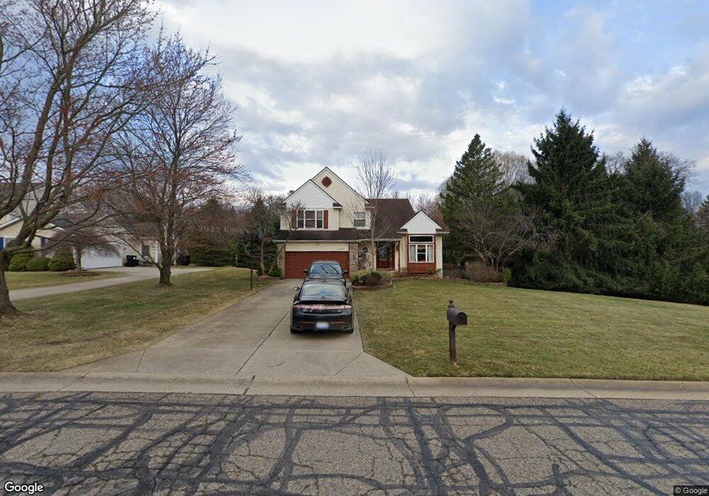
11022 Mourning Dove Ln South Lyon, MI 48178
Estimated Value: $479,498 - $533,000
4
Beds
3
Baths
2,138
Sq Ft
$239/Sq Ft
Est. Value
About This Home
This home is located at 11022 Mourning Dove Ln, South Lyon, MI 48178 and is currently estimated at $510,125, approximately $238 per square foot. 11022 Mourning Dove Ln is a home located in Livingston County with nearby schools including Hawkins Elementary School, Scranton Middle School, and Brighton High School.
Ownership History
Date
Name
Owned For
Owner Type
Purchase Details
Closed on
Apr 4, 1996
Sold by
Campbell K Grant
Bought by
Stouder Gregory R and Stouder A
Current Estimated Value
Home Financials for this Owner
Home Financials are based on the most recent Mortgage that was taken out on this home.
Original Mortgage
$166,900
Outstanding Balance
$7,923
Interest Rate
7.44%
Mortgage Type
New Conventional
Estimated Equity
$502,202
Create a Home Valuation Report for This Property
The Home Valuation Report is an in-depth analysis detailing your home's value as well as a comparison with similar homes in the area
Home Values in the Area
Average Home Value in this Area
Purchase History
| Date | Buyer | Sale Price | Title Company |
|---|---|---|---|
| Stouder Gregory R | $186,900 | -- |
Source: Public Records
Mortgage History
| Date | Status | Borrower | Loan Amount |
|---|---|---|---|
| Open | Stouder Gregory R | $166,900 |
Source: Public Records
Tax History Compared to Growth
Tax History
| Year | Tax Paid | Tax Assessment Tax Assessment Total Assessment is a certain percentage of the fair market value that is determined by local assessors to be the total taxable value of land and additions on the property. | Land | Improvement |
|---|---|---|---|---|
| 2025 | $3,730 | $230,100 | $0 | $0 |
| 2024 | $1,610 | $197,900 | $0 | $0 |
| 2023 | $1,539 | $188,800 | $0 | $0 |
| 2022 | $3,167 | $150,300 | $0 | $0 |
| 2021 | $3,167 | $178,200 | $0 | $0 |
| 2020 | $3,115 | $156,900 | $0 | $0 |
| 2019 | $3,061 | $150,300 | $0 | $0 |
| 2018 | $3,008 | $146,800 | $0 | $0 |
| 2017 | $2,957 | $146,100 | $0 | $0 |
| 2016 | $2,975 | $136,600 | $0 | $0 |
| 2014 | $2,485 | $111,200 | $0 | $0 |
| 2012 | $2,485 | $98,300 | $0 | $0 |
Source: Public Records
Map
Nearby Homes
- 10820 Bouldercrest Dr
- 10403 Bouldercrest Dr
- 11433 Marshall Rd
- 10456 Oak Shore Dr
- 10593 9 Mile Rd
- 10537 Oak Forest Dr
- 10512 Oak Forest Dr
- 10468 Oak Shore Dr
- 10536 Oak Shore Dr
- 10875 Charring Cross Cir
- 11346 E Shore Dr
- 10320 Harpers Ferry Ct
- 10303 9 Mile Rd
- 10324 Greenwood Rd
- 10194 Elmcrest Rd
- 11108 Wood Run Cir
- 11078 Wood Run Cir
- 9550 Silverside
- 9736 Cross Creek Dr
- 11390 Ridge Rd
- 11044 Mourning Dove Ln
- 10900 9 Mile Rd
- 10699 Blue Heron Dr
- 10633 Swallowtail Ct
- 10879 9 Mile Rd
- 10700 Blue Heron Dr
- 10727 Blue Heron Dr
- 10617 Swallowtail Ct
- 10888 9 Mile Rd
- 11089 Mourning Dove Ln
- 10742 Blue Heron Dr
- 10609 Swallowtail Ct
- 10755 Blue Heron Dr
- 11092 Wild Turkey Run
- 10649 Swallowtail Ct
- 10640 Swallowtail Ct
- 10614 Swallowtail Ct
- 10909 9 Mile Rd
- 10935 9 Mile Rd
- 10783 Blue Heron Dr