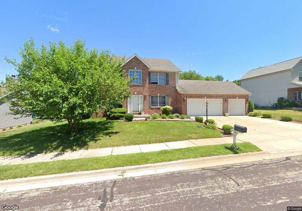
11022 N Jason Dr Dunlap, IL 61525
North Peoria NeighborhoodEstimated Value: $351,892 - $405,000
4
Beds
3
Baths
2,142
Sq Ft
$177/Sq Ft
Est. Value
About This Home
This home is located at 11022 N Jason Dr, Dunlap, IL 61525 and is currently estimated at $378,223, approximately $176 per square foot. 11022 N Jason Dr is a home located in Peoria County with nearby schools including Hickory Grove Elementary School, Dunlap Middle School, and Dunlap High School.
Ownership History
Date
Name
Owned For
Owner Type
Purchase Details
Closed on
Feb 2, 2007
Sold by
Relo Direct Inc
Bought by
Griffin Michelle A
Current Estimated Value
Home Financials for this Owner
Home Financials are based on the most recent Mortgage that was taken out on this home.
Original Mortgage
$219,200
Interest Rate
3.12%
Mortgage Type
New Conventional
Create a Home Valuation Report for This Property
The Home Valuation Report is an in-depth analysis detailing your home's value as well as a comparison with similar homes in the area
Home Values in the Area
Average Home Value in this Area
Purchase History
| Date | Buyer | Sale Price | Title Company |
|---|---|---|---|
| Griffin Michelle A | $274,000 | First American Title |
Source: Public Records
Mortgage History
| Date | Status | Borrower | Loan Amount |
|---|---|---|---|
| Previous Owner | Griffin Michelle A | $219,200 |
Source: Public Records
Tax History
| Year | Tax Paid | Tax Assessment Tax Assessment Total Assessment is a certain percentage of the fair market value that is determined by local assessors to be the total taxable value of land and additions on the property. | Land | Improvement |
|---|---|---|---|---|
| 2024 | $6,025 | $99,400 | $16,200 | $83,200 |
| 2023 | $6,064 | $94,670 | $15,430 | $79,240 |
| 2022 | $6,129 | $86,980 | $14,550 | $72,430 |
| 2021 | $6,211 | $82,840 | $13,860 | $68,980 |
| 2020 | $6,250 | $82,020 | $13,720 | $68,300 |
| 2019 | $6,447 | $84,550 | $14,140 | $70,410 |
| 2018 | $6,525 | $86,390 | $14,120 | $72,270 |
| 2017 | $6,782 | $89,060 | $14,560 | $74,500 |
| 2016 | $7,064 | $89,060 | $14,560 | $74,500 |
| 2015 | $6,607 | $86,470 | $14,140 | $72,330 |
| 2014 | $6,537 | $85,420 | $13,970 | $71,450 |
| 2013 | -- | $84,570 | $13,830 | $70,740 |
Source: Public Records
Map
Nearby Homes
- 11018 N Waterton
- 10703 N Dana Dr
- 11436 N Northtrail Dr
- 2107 W Gerald Dr
- 2331 W Molly Ln
- 11705 N Brians Way
- 11217 N Oakwood Dr Unit 53
- 2623 W Stonehenge Ct
- 1315 W Wexford Place
- 1133 W Brookforest Dr
- 0 W Alta Rd
- 11308 N Hickory Woods Ct
- 2714 W Stonehenge Ct
- 2817 W Lake Trail Ct
- 1205 W Poplar Woods Ct
- 11216 Blackstone Ct
- 3000 W Saddle Creek Dr
- 3112 W Saddle Creek Dr
- 2218 W Augusta Dr
- 3113 W Summerbend Ct
- 11022 N Jason Dr Unit D
- 11018 N Jason Dr
- 11100 N Jason Dr
- 11023 N Rhonda Way
- 11021 N Jason Dr
- 11021 N Rhonda Way
- 11010 N Jason Dr
- 11015 N Rhonda Way
- 11103 N Rhonda Way
- 11017 N Jason Dr
- 11112 N Jason Dr
- 11101 N Jason Dr
- 11013 N Rhonda Way
- 11105 N Rhonda Way
- 11011 N Jason Dr
- 11002 N Jason Dr
- 11003 N Rhonda Way
- 11003 N Rhonda Way Unit 25B
- 11111 N Jason Dr
- 11020 N Northfield Ln
Your Personal Tour Guide
Ask me questions while you tour the home.