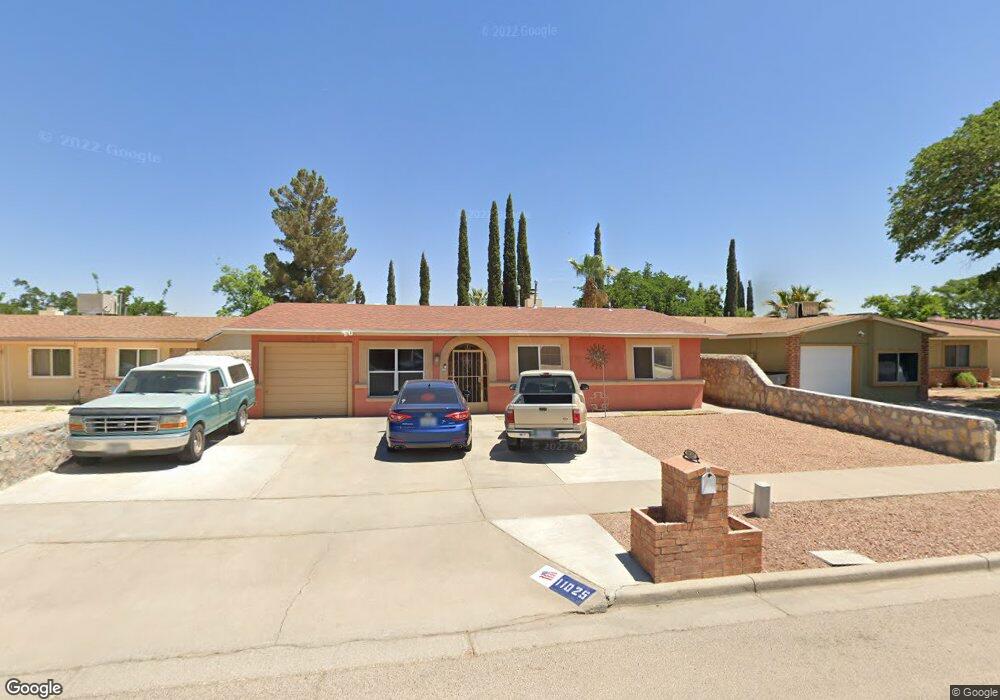
11025 Art Wall Dr El Paso, TX 79936
Glen Cove NeighborhoodEstimated Value: $224,023 - $267,000
3
Beds
2
Baths
1,716
Sq Ft
$146/Sq Ft
Est. Value
About This Home
This home is located at 11025 Art Wall Dr, El Paso, TX 79936 and is currently estimated at $251,256, approximately $146 per square foot. 11025 Art Wall Dr is a home located in El Paso County with nearby schools including Tierra Del Sol Elementary School, J M Hanks High School, and EL PASO LEADERSHIP ACADEMY - MIDDLE EAST.
Ownership History
Date
Name
Owned For
Owner Type
Purchase Details
Closed on
Jun 8, 2001
Sold by
Smith Rhonda and Smith Fredrick D
Bought by
Guerra Rosendo and Guerra Veronica
Current Estimated Value
Home Financials for this Owner
Home Financials are based on the most recent Mortgage that was taken out on this home.
Original Mortgage
$70,380
Outstanding Balance
$26,731
Interest Rate
7.1%
Mortgage Type
VA
Estimated Equity
$224,525
Purchase Details
Closed on
Aug 15, 2000
Sold by
Cox William R
Bought by
Smith Rhonda and Smith Fredrick D
Create a Home Valuation Report for This Property
The Home Valuation Report is an in-depth analysis detailing your home's value as well as a comparison with similar homes in the area
Home Values in the Area
Average Home Value in this Area
Purchase History
| Date | Buyer | Sale Price | Title Company |
|---|---|---|---|
| Guerra Rosendo | -- | -- | |
| Smith Rhonda | -- | -- |
Source: Public Records
Mortgage History
| Date | Status | Borrower | Loan Amount |
|---|---|---|---|
| Open | Guerra Rosendo | $70,380 |
Source: Public Records
Tax History Compared to Growth
Tax History
| Year | Tax Paid | Tax Assessment Tax Assessment Total Assessment is a certain percentage of the fair market value that is determined by local assessors to be the total taxable value of land and additions on the property. | Land | Improvement |
|---|---|---|---|---|
| 2025 | -- | $190,483 | -- | -- |
| 2024 | -- | $173,166 | -- | -- |
| 2023 | $4,582 | $157,424 | $0 | $0 |
| 2022 | $4,444 | $143,113 | $0 | $0 |
| 2021 | $4,229 | $137,398 | $22,264 | $115,134 |
| 2020 | $3,736 | $118,275 | $16,519 | $101,756 |
| 2018 | $3,649 | $117,332 | $16,519 | $100,813 |
| 2017 | $3,278 | $107,249 | $16,519 | $90,730 |
| 2016 | $3,278 | $107,249 | $16,519 | $90,730 |
| 2015 | $2,235 | $107,249 | $16,519 | $90,730 |
| 2014 | $2,235 | $107,476 | $16,519 | $90,957 |
Source: Public Records
Map
Nearby Homes
- 11013 Bob Stone Dr
- 11016 Bob Stone Dr
- 11012 Bob Stone Dr
- 2009 Bobby Jones Dr Unit B
- 11008 Johnny Miller Dr
- 2308 Tom Watson Ct
- 1901 Bobby Jones Dr
- 1817 Hugh Royer Place
- 2604 Anise Dr
- 1868 Tom Bolt Dr
- 1913 Seagull Dr
- 2325 Ken Venturi Ln
- 2348 Sea Side Dr
- 2313 Frank Beard Dr
- 1844 Jack Nicklaus Dr Unit 1846
- 10916 Miller Barber Dr
- 2820 Beachcomber Dr
- 2825 Wong Place Unit A/D
- 11132 Wharf Cove Dr
- 2000 Solano Dr
- 11021 Art Wall Dr
- 11029 Art Wall Dr
- 2424 Anise Dr
- 2428 Anise Dr
- 11019 Art Wall Dr
- 11033 Art Wall Dr
- 2420 Anise Dr
- 2432 Anise Dr
- 11024 Art Wall Dr
- 11028 Art Wall Dr
- 11017 Art Wall Dr
- 11037 Art Wall Dr
- 11020 Art Wall Dr
- 11032 Art Wall Dr
- 2416 Anise Dr
- 2436 Anise Dr
- 11013 Art Wall Dr
- 11016 Art Wall Dr
- 11036 Art Wall Dr
- 11041 Art Wall Dr