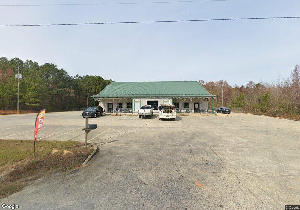
11025 Us Highway 78 Riverside, AL 35135
Estimated Value: $606,989
--
Bed
--
Bath
7,280
Sq Ft
$83/Sq Ft
Est. Value
About This Home
This home is located at 11025 Us Highway 78, Riverside, AL 35135 and is currently estimated at $606,989, approximately $83 per square foot. 11025 Us Highway 78 is a home located in St. Clair County.
Ownership History
Date
Name
Owned For
Owner Type
Purchase Details
Closed on
Mar 21, 2024
Sold by
Herbs Famous Bbq Llc
Bought by
Sams Properties Llc
Current Estimated Value
Home Financials for this Owner
Home Financials are based on the most recent Mortgage that was taken out on this home.
Original Mortgage
$480,000
Outstanding Balance
$471,968
Interest Rate
6.9%
Mortgage Type
New Conventional
Estimated Equity
$135,021
Purchase Details
Closed on
May 17, 2023
Sold by
Raughton Linda
Bought by
Herbs Famous Bbq Llc
Home Financials for this Owner
Home Financials are based on the most recent Mortgage that was taken out on this home.
Original Mortgage
$650,000
Interest Rate
7%
Mortgage Type
New Conventional
Purchase Details
Closed on
Nov 30, 2022
Sold by
Burt Heather
Bought by
Strampe Victoria
Home Financials for this Owner
Home Financials are based on the most recent Mortgage that was taken out on this home.
Original Mortgage
$400,000
Interest Rate
6.95%
Mortgage Type
New Conventional
Purchase Details
Closed on
Aug 31, 2021
Sold by
Quest Kids Club And Family Center Inc
Bought by
Burt Heather
Purchase Details
Closed on
Apr 21, 2008
Sold by
R & R Rentals
Bought by
Raughton Marlon L and Raughton Linda G
Create a Home Valuation Report for This Property
The Home Valuation Report is an in-depth analysis detailing your home's value as well as a comparison with similar homes in the area
Home Values in the Area
Average Home Value in this Area
Purchase History
| Date | Buyer | Sale Price | Title Company |
|---|---|---|---|
| Sams Properties Llc | $600,000 | None Listed On Document | |
| Herbs Famous Bbq Llc | $650,000 | None Listed On Document | |
| Heather Burt And Raughton Holdings Llc | $20,000 | None Listed On Document | |
| Strampe Victoria | $400,000 | -- | |
| Burt Heather | -- | None Listed On Document | |
| Raughton Marlon L | -- | None Available |
Source: Public Records
Mortgage History
| Date | Status | Borrower | Loan Amount |
|---|---|---|---|
| Open | Sams Properties Llc | $480,000 | |
| Previous Owner | Heather Burt And Raughton Holdings Llc | $650,000 | |
| Previous Owner | Strampe Victoria | $400,000 |
Source: Public Records
Tax History Compared to Growth
Tax History
| Year | Tax Paid | Tax Assessment Tax Assessment Total Assessment is a certain percentage of the fair market value that is determined by local assessors to be the total taxable value of land and additions on the property. | Land | Improvement |
|---|---|---|---|---|
| 2024 | $5,177 | $126,262 | $32,940 | $93,322 |
| 2023 | $4,964 | $126,262 | $32,940 | $93,322 |
| 2022 | $0 | $105,850 | $24,460 | $81,390 |
| 2021 | $0 | $105,850 | $24,460 | $81,390 |
| 2020 | $2,663 | $95,236 | $24,464 | $70,772 |
| 2019 | $2,663 | $94,636 | $24,464 | $70,172 |
| 2018 | $3,363 | $36,580 | $0 | $0 |
| 2017 | $3,363 | $73,960 | $0 | $0 |
| 2016 | $2,663 | $73,960 | $0 | $0 |
| 2015 | $3,363 | $73,960 | $0 | $0 |
| 2014 | $3,363 | $93,420 | $0 | $0 |
Source: Public Records
Map
Nearby Homes
- 185 Rockwell Dr
- 555 Creek Ridge Dr
- 200 Maplewood Cir
- 402 Paradise Isle Unit 402
- 625 Creek Ridge Dr
- 905 Truss Ferry Rd
- 915 Truss Ferry Rd
- 1604 Truss Ferry Rd
- 2205 Walker St
- 2500 Sprayberry Rd
- Flannery Plan at Sumter Landing
- Mattie Plan at Sumter Landing
- Coleman Plan at Sumter Landing
- Everly A Plan at Sumter Landing
- Knox Plan at Sumter Landing
- Carolina Plan at Sumter Landing
- Cahaba Plan at Sumter Landing
- Wildwood Plan at Sumter Landing
- 60 Sumter Way
- 1330 McKesie St