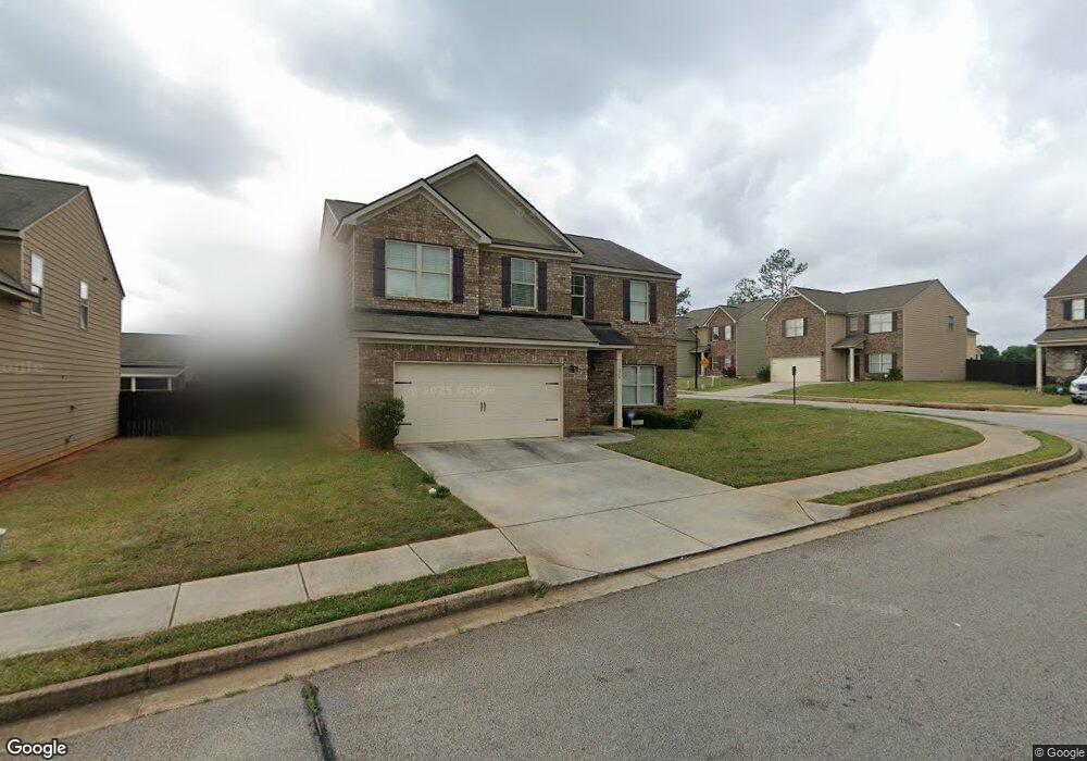
11028 Station Dr Unit 167 Hampton, GA 30228
Estimated Value: $307,000 - $333,000
4
Beds
3
Baths
2,400
Sq Ft
$133/Sq Ft
Est. Value
About This Home
This home is located at 11028 Station Dr Unit 167, Hampton, GA 30228 and is currently estimated at $319,805, approximately $133 per square foot. 11028 Station Dr Unit 167 is a home located in Clayton County with nearby schools including Michelle Obama STEM Elementary Academy, Eddie White Academy, and Lovejoy High School.
Ownership History
Date
Name
Owned For
Owner Type
Purchase Details
Closed on
May 16, 2022
Sold by
Moran Barbara Jean
Bought by
Anderson Cemondra A and Anderson Brenae
Current Estimated Value
Home Financials for this Owner
Home Financials are based on the most recent Mortgage that was taken out on this home.
Original Mortgage
$312,558
Outstanding Balance
$295,889
Interest Rate
4.87%
Mortgage Type
FHA
Estimated Equity
$23,916
Purchase Details
Closed on
Feb 2, 2017
Bought by
Moran Jack Louis and Moran Barbara Janell
Purchase Details
Closed on
May 21, 2015
Sold by
The Bank Of Georgia
Bought by
Builders Professional Grp Llc
Purchase Details
Closed on
Jun 12, 2014
Sold by
Mcdonough Road Development Llc
Bought by
The Bank Of Georgia
Create a Home Valuation Report for This Property
The Home Valuation Report is an in-depth analysis detailing your home's value as well as a comparison with similar homes in the area
Home Values in the Area
Average Home Value in this Area
Purchase History
| Date | Buyer | Sale Price | Title Company |
|---|---|---|---|
| Anderson Cemondra A | $318,325 | -- | |
| Moran Jack Louis | $173,000 | -- | |
| Builders Professional Grp Llc | $266,000 | -- | |
| The Bank Of Georgia | -- | -- |
Source: Public Records
Mortgage History
| Date | Status | Borrower | Loan Amount |
|---|---|---|---|
| Open | Anderson Cemondra A | $312,558 |
Source: Public Records
Tax History Compared to Growth
Tax History
| Year | Tax Paid | Tax Assessment Tax Assessment Total Assessment is a certain percentage of the fair market value that is determined by local assessors to be the total taxable value of land and additions on the property. | Land | Improvement |
|---|---|---|---|---|
| 2024 | $4,847 | $124,240 | $10,400 | $113,840 |
| 2023 | $4,597 | $127,320 | $10,080 | $117,240 |
| 2022 | $4,755 | $121,160 | $10,400 | $110,760 |
| 2021 | $3,529 | $89,360 | $10,400 | $78,960 |
| 2020 | $3,588 | $89,712 | $10,400 | $79,312 |
| 2019 | $3,350 | $82,531 | $9,600 | $72,931 |
| 2018 | $2,809 | $69,200 | $9,600 | $59,600 |
| 2017 | $2,569 | $63,130 | $9,600 | $53,530 |
| 2016 | $309 | $7,600 | $7,600 | $0 |
| 2015 | $24 | $0 | $0 | $0 |
| 2014 | $24 | $600 | $600 | $0 |
Source: Public Records
Map
Nearby Homes
- 11096 Cornerstone Way
- 11209 Cornerstone Ln
- 11180 Cornerstone Ln
- 10945 Station Dr
- 823 Cambridge Pkwy
- 2582 Rosecommons Dr
- 915 Bel Air Blvd
- 10794 Wheeler Trace
- 10834 Wheeler Trace
- 953 Mystic Way
- 2256 Nicole Dr
- 2274 Nicole Dr
- 10891 Wheeler Trace
- 0 Freeman Rd Unit 10644461
- 2406 Brianna Dr
- 2351 Brianna Dr
- 11608 Winston Dr
- 195 Twin Oaks Dr
- 2385 Aukerman Trace Unit 80
- 2381 Aukerman Trace Unit 81
- 11028 Station Dr
- 11022 Station Dr Unit 168
- 11022 Station Dr
- 2640 Calvary Dr Unit 166
- 2640 Calvary Dr
- 11016 Station Dr Unit 169
- 11016 Station Dr
- 2646 Calvary Dr Unit 165
- 11016 Station Dive
- 11121 Wind Ridge Dr Unit 114
- 11121 Wind Ridge Dr
- 11115 Wind Ridge Dr Unit 113
- 11029 Station Dr Unit 106
- 11023 Station Dr
- 11127 Wind Ridge Dr Unit 115
- 2652 Calvary Dr Unit 164
- 11109 Wind Ridge Dr Unit 112
- 0 Wind Ridge Dr Unit 8868834
- 11010 Station Dr
- 11010 Station Dr Unit 170