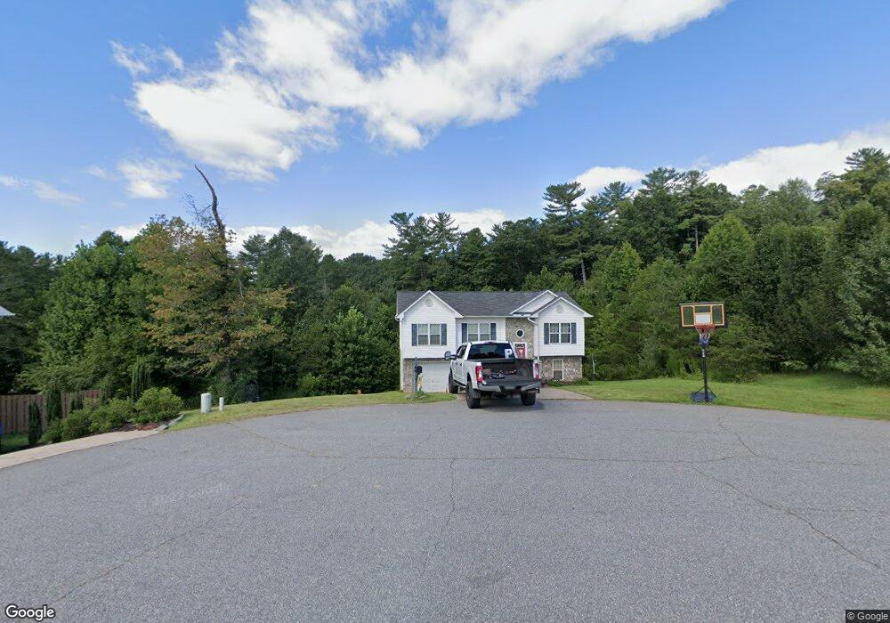
1103 Allman Ridge Rd Morganton, NC 28655
Estimated Value: $249,000 - $275,000
3
Beds
2
Baths
1,100
Sq Ft
$235/Sq Ft
Est. Value
About This Home
This home is located at 1103 Allman Ridge Rd, Morganton, NC 28655 and is currently estimated at $258,043, approximately $234 per square foot. 1103 Allman Ridge Rd is a home located in Burke County with nearby schools including Oak Hill Elementary School, Table Rock Middle School, and Freedom High School.
Ownership History
Date
Name
Owned For
Owner Type
Purchase Details
Closed on
Mar 27, 2009
Sold by
Griffin Benjamin D and Griffin Jackie P
Bought by
Ebert Tamber and Ebert David
Current Estimated Value
Home Financials for this Owner
Home Financials are based on the most recent Mortgage that was taken out on this home.
Original Mortgage
$113,407
Outstanding Balance
$72,111
Interest Rate
5.13%
Mortgage Type
FHA
Estimated Equity
$185,932
Create a Home Valuation Report for This Property
The Home Valuation Report is an in-depth analysis detailing your home's value as well as a comparison with similar homes in the area
Home Values in the Area
Average Home Value in this Area
Purchase History
| Date | Buyer | Sale Price | Title Company |
|---|---|---|---|
| Ebert Tamber | $115,500 | None Available |
Source: Public Records
Mortgage History
| Date | Status | Borrower | Loan Amount |
|---|---|---|---|
| Open | Ebert Tamber | $113,407 |
Source: Public Records
Tax History Compared to Growth
Tax History
| Year | Tax Paid | Tax Assessment Tax Assessment Total Assessment is a certain percentage of the fair market value that is determined by local assessors to be the total taxable value of land and additions on the property. | Land | Improvement |
|---|---|---|---|---|
| 2025 | $1,257 | $183,467 | $17,515 | $165,952 |
| 2024 | $1,262 | $183,467 | $17,515 | $165,952 |
| 2023 | $1,262 | $183,467 | $17,515 | $165,952 |
| 2022 | $1,055 | $123,885 | $16,681 | $107,204 |
| 2021 | $1,049 | $123,885 | $16,681 | $107,204 |
| 2020 | $1,045 | $123,885 | $16,681 | $107,204 |
| 2019 | $1,045 | $123,885 | $16,681 | $107,204 |
| 2018 | $1,029 | $121,898 | $16,681 | $105,217 |
| 2017 | $1,027 | $121,898 | $16,681 | $105,217 |
| 2016 | $1,004 | $121,898 | $16,681 | $105,217 |
| 2015 | $1,001 | $121,898 | $16,681 | $105,217 |
Source: Public Records
Map
Nearby Homes
- 2556 Nc 126
- 3666 Grandview Dr
- 3680 Grandview Dr
- 3375 Nc 126
- 2482 Paddock Cir
- 0 Boyd Moore Ave Unit CAR3848175
- 1060 Hawksbill Dr
- 130 Hawksbill Dr Unit 47
- 2151 River Bend Ln
- 4625 Boyd Moore Ave
- 4617 Harbor View Terrace
- 1504 Brentwood Place
- 2040 River Bend Ln
- 1513 Brentwood Place
- 3100 E Moonlight Place Unit 42
- 3026 Coventry Dr
- 2108 E Bluewater Dr
- 2148 E Bluewater Dr
- 1600 Lillians Point Ct Unit 33
- 2937 Frank Whisnant Rd
- 1097 Allman Ridge Rd
- 1115 Allman Ridge Rd
- 1094 Allman Ridge Rd
- 1121 Allman Ridge Rd
- 1116 Allman Ridge Rd
- 1129 Allman Ridge Rd
- 1124 Allman Ridge Rd
- 1137 Allman Ridge Rd
- 1132 Allman Ridge Rd
- 1145 Allman Ridge Rd
- 1272 Star Ln
- 1175 Allman Ridge Rd
- 1283 Star Ln
- 1260 Star Ln
- 1271 Star Ln
- 1248 Star Ln Unit 8
- 1259 Star Ln
- 1236 Star Ln
- 1265 Buckhorn Tavern Rd
- 1247 Star Ln