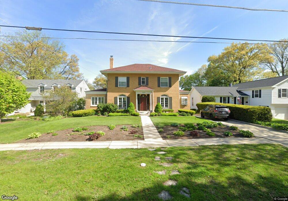
1103 E Forest Ave Wheaton, IL 60187
Hawthorne NeighborhoodEstimated Value: $595,051 - $718,000
4
Beds
2
Baths
2,064
Sq Ft
$308/Sq Ft
Est. Value
About This Home
This home is located at 1103 E Forest Ave, Wheaton, IL 60187 and is currently estimated at $635,013, approximately $307 per square foot. 1103 E Forest Ave is a home located in DuPage County with nearby schools including Washington Elementary School, Franklin Middle School, and Wheaton North High School.
Ownership History
Date
Name
Owned For
Owner Type
Purchase Details
Closed on
Jun 14, 1994
Sold by
Rigali William C and Rigali Roberta I
Bought by
Freeman David J and Freeman Anne C
Current Estimated Value
Home Financials for this Owner
Home Financials are based on the most recent Mortgage that was taken out on this home.
Original Mortgage
$240,700
Interest Rate
5.87%
Create a Home Valuation Report for This Property
The Home Valuation Report is an in-depth analysis detailing your home's value as well as a comparison with similar homes in the area
Home Values in the Area
Average Home Value in this Area
Purchase History
| Date | Buyer | Sale Price | Title Company |
|---|---|---|---|
| Freeman David J | -- | -- | |
| Freeman David J | $267,500 | -- |
Source: Public Records
Mortgage History
| Date | Status | Borrower | Loan Amount |
|---|---|---|---|
| Closed | Freeman David J | $240,700 |
Source: Public Records
Tax History
| Year | Tax Paid | Tax Assessment Tax Assessment Total Assessment is a certain percentage of the fair market value that is determined by local assessors to be the total taxable value of land and additions on the property. | Land | Improvement |
|---|---|---|---|---|
| 2024 | $11,566 | $195,455 | $41,490 | $153,965 |
| 2023 | $11,077 | $179,910 | $38,190 | $141,720 |
| 2022 | $11,359 | $170,020 | $36,090 | $133,930 |
| 2021 | $11,323 | $165,980 | $35,230 | $130,750 |
| 2020 | $11,288 | $164,430 | $34,900 | $129,530 |
| 2019 | $11,031 | $160,090 | $33,980 | $126,110 |
| 2018 | $10,370 | $149,180 | $32,020 | $117,160 |
| 2017 | $10,218 | $143,680 | $30,840 | $112,840 |
| 2016 | $10,085 | $137,940 | $29,610 | $108,330 |
| 2015 | $10,010 | $131,600 | $28,250 | $103,350 |
| 2014 | $10,366 | $133,840 | $23,040 | $110,800 |
| 2013 | $10,099 | $134,240 | $23,110 | $111,130 |
Source: Public Records
Map
Nearby Homes
- 817 E Forest Ave
- 820 Cherry St
- 1607 Stoddard Ave
- 582 Glendale Ave
- 412 Lawrence Ave
- 404 Lawrence Ave
- 808 Bridle Ln
- 1603 Ashton Ct
- 1906 N Summit St
- 314 E Jefferson Ave
- 328 Lorraine St
- 312 E Lincoln Ave
- 123 S Blanchard St
- 2009 Mackenzie Place
- 1115 N Main St
- 1017 N Main St
- 110 Travers Ave
- 1902 N Washington St
- 488 Newton Ave
- 1017 Tartan Ct
- 1107 E Forest Ave
- 1049 E Forest Ave
- 1025 E Forest Ave
- 1117 E Forest Ave
- 1106 E Forest Ave
- 1017 Eddy Ct
- 1040 E Forest Ave
- 1121 E Forest Ave
- 1020 Stoddard Ave
- 1101 N President St
- 1103 N President St
- 1009 Eddy Ct
- 1016 Stoddard Ave
- 1110 Shady Ln
- 1111 N President St
- 1010 Eddy Ct
- 1102 Shady Ln
- 1010 Stoddard Ave
- 1000 E Forest Ave
- 1001 Eddy Ct
Your Personal Tour Guide
Ask me questions while you tour the home.