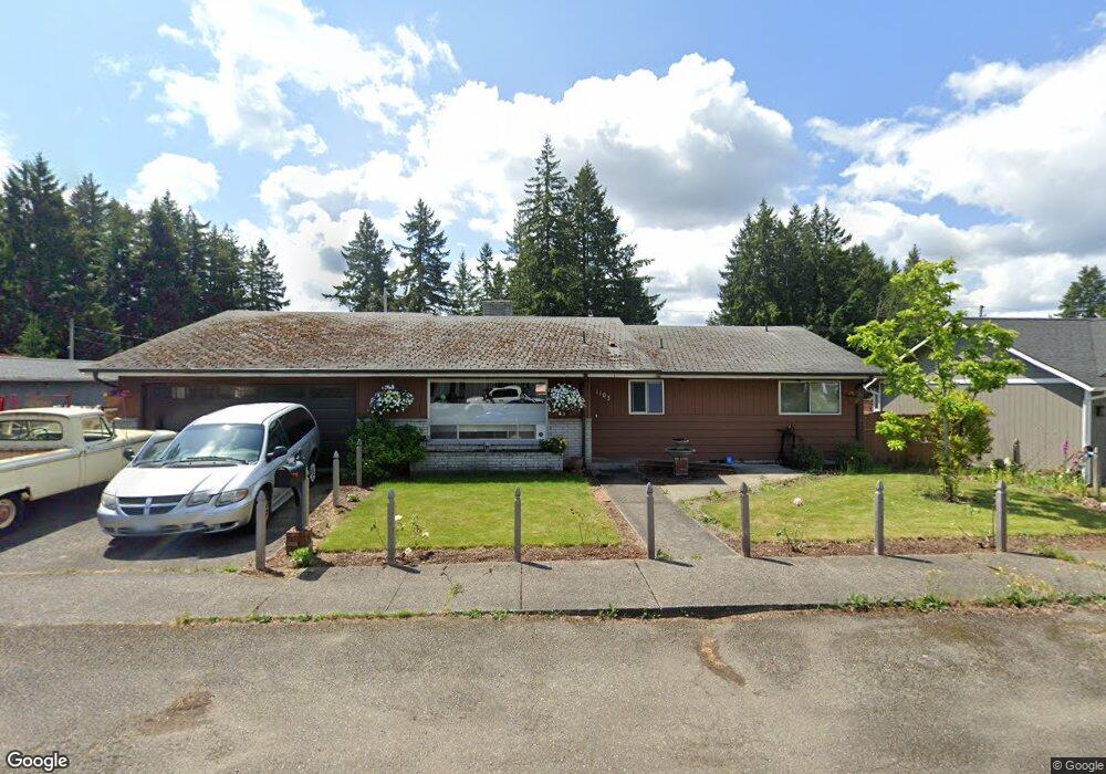
1103 Laurel St Shelton, WA 98584
Estimated Value: $376,000 - $428,000
2
Beds
3
Baths
1,733
Sq Ft
$232/Sq Ft
Est. Value
About This Home
This home is located at 1103 Laurel St, Shelton, WA 98584 and is currently estimated at $401,525, approximately $231 per square foot. 1103 Laurel St is a home located in Mason County with nearby schools including Mountain View Elementary School, Olympic Middle School, and Oakland Bay Junior High School.
Ownership History
Date
Name
Owned For
Owner Type
Purchase Details
Closed on
Jan 31, 2020
Sold by
Tyas Dennis Allen
Bought by
Lane Toby J and Lane Shawna Lenae O Leary
Current Estimated Value
Home Financials for this Owner
Home Financials are based on the most recent Mortgage that was taken out on this home.
Original Mortgage
$113,000
Outstanding Balance
$100,318
Interest Rate
3.74%
Mortgage Type
Seller Take Back
Estimated Equity
$301,207
Purchase Details
Closed on
Aug 19, 2014
Sold by
Tyas Gayle
Bought by
Tyas Dennis A and Tyas Gayle
Create a Home Valuation Report for This Property
The Home Valuation Report is an in-depth analysis detailing your home's value as well as a comparison with similar homes in the area
Home Values in the Area
Average Home Value in this Area
Purchase History
| Date | Buyer | Sale Price | Title Company |
|---|---|---|---|
| Lane Toby J | $113,000 | Mason County Title Co | |
| Tyas Dennis A | -- | None Available |
Source: Public Records
Mortgage History
| Date | Status | Borrower | Loan Amount |
|---|---|---|---|
| Open | Lane Toby J | $113,000 |
Source: Public Records
Tax History Compared to Growth
Tax History
| Year | Tax Paid | Tax Assessment Tax Assessment Total Assessment is a certain percentage of the fair market value that is determined by local assessors to be the total taxable value of land and additions on the property. | Land | Improvement |
|---|---|---|---|---|
| 2025 | $3,163 | $317,645 | $34,900 | $282,745 |
| 2024 | $3,163 | $321,435 | $31,725 | $289,710 |
| 2023 | $2,925 | $279,895 | $29,375 | $250,520 |
| 2022 | $2,906 | $232,385 | $27,715 | $204,670 |
| 2021 | $2,814 | $232,385 | $27,715 | $204,670 |
| 2020 | $2,656 | $207,535 | $30,120 | $177,415 |
| 2018 | $2,396 | $143,425 | $46,750 | $96,675 |
| 2017 | $2,015 | $143,425 | $46,750 | $96,675 |
| 2016 | $1,981 | $130,475 | $46,750 | $83,725 |
| 2015 | $1,953 | $130,475 | $46,750 | $83,725 |
| 2014 | -- | $126,860 | $44,000 | $82,860 |
| 2013 | -- | $137,060 | $41,250 | $95,810 |
Source: Public Records
Map
Nearby Homes
- 1233 W Birch St
- 1226 W Alder St
- 416 N 8th St
- 1604 King St
- 1119 W Franklin St
- 903 W Franklin St
- 1212 W Railroad Ave
- 722 718 W Franklin St
- 407 N 6th St
- 1720 Jefferson St
- 1347 W Franklin St
- 519 N 5th St
- 121 S 10th St
- 0 XXX Henry St
- 226 S 9th St
- 1313 W Cota St Unit 27
- 1533 Northcliff Rd
- 522 N 3rd St
- 201 Moore Ave
- 201 W Alder St
- 1115 Laurel St
- 1102 W Birch St
- 1110 W Birch St
- 1127 Laurel St
- 1102 Laurel St
- 1030 W Birch St
- 1116 Laurel St
- 1030 Laurel St
- 1128 W Birch St
- 1021 Laurel St
- 1043 Connection St
- 1012 W Birch St
- 627 N 12th St
- 1127 Connection St
- 1004 Laurel St
- 1015 W Birch St
- 1204 W Birch St
- 1121 W Birch St
- 705 N 12th St
- 1025 Connection St