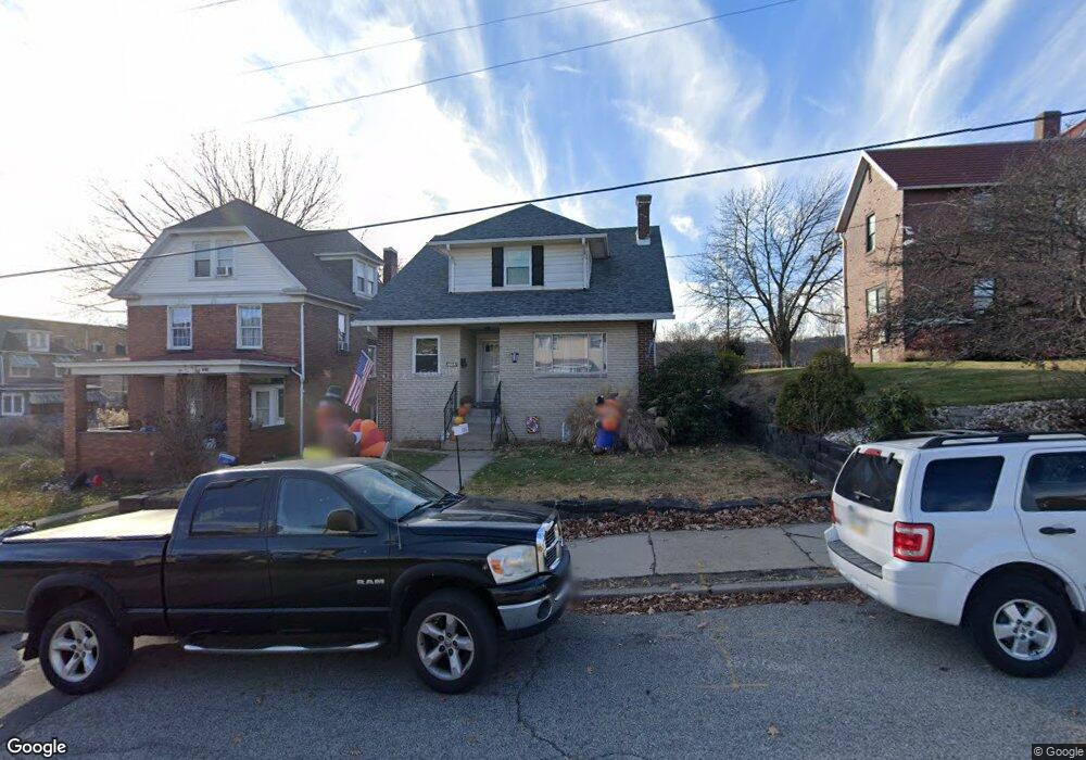
1103 Leishman Ave New Kensington, PA 15068
Estimated Value: $74,000 - $91,000
--
Bed
--
Bath
1,248
Sq Ft
$67/Sq Ft
Est. Value
About This Home
This home is located at 1103 Leishman Ave, New Kensington, PA 15068 and is currently estimated at $83,315, approximately $66 per square foot. 1103 Leishman Ave is a home located in Westmoreland County with nearby schools including Mary Queen of Apostles School.
Ownership History
Date
Name
Owned For
Owner Type
Purchase Details
Closed on
Apr 3, 2018
Sold by
U S Bank National Association
Bought by
Wolford Jack Scott
Current Estimated Value
Purchase Details
Closed on
Feb 23, 2018
Sold by
Abraham Boris and Abraham Jennifer A
Bought by
U S Bank National Association and The Pennsylvania Housing Finance Agency
Purchase Details
Closed on
Dec 4, 2006
Sold by
Rapp Timothy
Bought by
Abraham Boris and Abraham Jennifer A
Home Financials for this Owner
Home Financials are based on the most recent Mortgage that was taken out on this home.
Original Mortgage
$58,810
Interest Rate
6.24%
Mortgage Type
FHA
Create a Home Valuation Report for This Property
The Home Valuation Report is an in-depth analysis detailing your home's value as well as a comparison with similar homes in the area
Home Values in the Area
Average Home Value in this Area
Purchase History
| Date | Buyer | Sale Price | Title Company |
|---|---|---|---|
| Wolford Jack Scott | $8,000 | None Available | |
| U S Bank National Association | $2,446 | None Available | |
| Abraham Boris | $59,275 | None Available |
Source: Public Records
Mortgage History
| Date | Status | Borrower | Loan Amount |
|---|---|---|---|
| Previous Owner | Abraham Boris | $58,810 |
Source: Public Records
Tax History Compared to Growth
Tax History
| Year | Tax Paid | Tax Assessment Tax Assessment Total Assessment is a certain percentage of the fair market value that is determined by local assessors to be the total taxable value of land and additions on the property. | Land | Improvement |
|---|---|---|---|---|
| 2025 | $945 | $5,920 | $3,010 | $2,910 |
| 2024 | $936 | $5,920 | $3,010 | $2,910 |
| 2023 | $886 | $5,920 | $3,010 | $2,910 |
| 2022 | $859 | $5,920 | $3,010 | $2,910 |
| 2021 | $839 | $5,920 | $3,010 | $2,910 |
| 2020 | $822 | $5,920 | $3,010 | $2,910 |
| 2019 | $801 | $15,880 | $3,010 | $12,870 |
| 2018 | $2,117 | $15,880 | $3,010 | $12,870 |
| 2017 | $2,085 | $15,880 | $3,010 | $12,870 |
| 2016 | $2,085 | $15,880 | $3,010 | $12,870 |
| 2015 | $2,085 | $15,880 | $3,010 | $12,870 |
| 2014 | $2,003 | $15,880 | $3,010 | $12,870 |
Source: Public Records
Map
Nearby Homes
- 1134 Leishman Ave
- 1025 Kenneth Ave
- 201 Locust St
- 105 Locust St
- 318 Ridge Ave
- 486 McCargo St
- 254 Ridge Ave
- 1233 Kenneth Ave
- 1218 Woodmont Ave
- 1240 Victoria Ave
- 327 Charles Ave
- 225 Highland Ave
- 168 Short St
- 159 Freeport Rd
- 1312 Woodmont Ave
- 125 North St
- 533 Freeport Rd
- 1308 Taylor Ave
- 1512 Kenneth Ave
- 1521 Victoria Ave
- 1101 Leishman Ave
- 800 Walnut St
- 1102 Kenneth Ave
- 264 Walnut St
- 804 Walnut St
- 1100 Kenneth Ave
- 725 Walnut St
- 717 Walnut St
- 1108 Leishman Ave
- 806 Walnut St
- 711 Walnut St
- 1116 Leishman Ave Unit 16
- 709 Walnut St
- 810 Walnut St
- 803 Walnut St
- 1045 Leishman Ave
- 1120 Leishman Ave
- 1125 Leishman Ave
- 1050 Kenneth Ave
- 1041 Leishman Ave