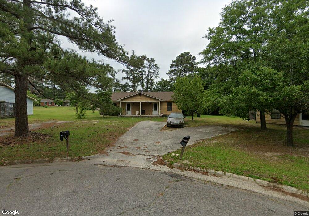
1103 Lewis Cir Rockingham, NC 28379
Estimated Value: $147,000 - $221,000
--
Bed
--
Bath
1,840
Sq Ft
$98/Sq Ft
Est. Value
About This Home
This home is located at 1103 Lewis Cir, Rockingham, NC 28379 and is currently estimated at $180,822, approximately $98 per square foot. 1103 Lewis Cir is a home with nearby schools including Washington Street Elementary School, Rockingham Middle School, and Ashley Chapel Educational Center.
Ownership History
Date
Name
Owned For
Owner Type
Purchase Details
Closed on
Jan 1, 1986
Bought by
Hewett Edward and Hewett C
Current Estimated Value
Create a Home Valuation Report for This Property
The Home Valuation Report is an in-depth analysis detailing your home's value as well as a comparison with similar homes in the area
Home Values in the Area
Average Home Value in this Area
Purchase History
| Date | Buyer | Sale Price | Title Company |
|---|---|---|---|
| Hewett Edward | -- | -- |
Source: Public Records
Tax History Compared to Growth
Tax History
| Year | Tax Paid | Tax Assessment Tax Assessment Total Assessment is a certain percentage of the fair market value that is determined by local assessors to be the total taxable value of land and additions on the property. | Land | Improvement |
|---|---|---|---|---|
| 2025 | $1,287 | $139,752 | $5,862 | $133,890 |
| 2024 | $1,315 | $139,752 | $5,862 | $133,890 |
| 2023 | $1,235 | $117,533 | $4,689 | $112,844 |
| 2022 | $1,235 | $117,533 | $4,689 | $112,844 |
| 2021 | $1,227 | $117,533 | $4,689 | $112,844 |
| 2020 | $1,219 | $117,533 | $4,689 | $112,844 |
| 2019 | $1,219 | $117,533 | $4,689 | $112,844 |
| 2018 | $1,219 | $117,533 | $4,689 | $112,844 |
| 2016 | $1,166 | $117,533 | $4,689 | $112,844 |
| 2014 | -- | $95,059 | $4,226 | $90,833 |
Source: Public Records
Map
Nearby Homes
- 40 Cauthen Dr
- 42 Cauthen Dr
- 43 Cauthen Dr
- 41 Cauthen Dr
- 906 Cypress St
- 1109 Laurel Ave
- 179 Aleo Second Ave
- 0 Seventh Avenue Aleo
- 106 Safie 3rd St
- 47 S Long Dr
- 117 Smith St
- 116 Hannah Pickett Seventh Ave
- 232 Aleo Seventh Ave
- 313 Mcarthur Dr
- 106 Pence St
- 149 Hannah Pickett 1st Ave
- 136 Central Ave
- 440 Hood St
- 128 Watkins Ave
- 109 Entwistle Third St
- 1101 Lewis Cir
- 1106 Lewis Cir
- 1102 Lewis Cir
- 1104 Lewis Cir
- 1202 Hemlock St
- 1204 Hemlock St
- 1330 S Long Dr
- 1326 S Long Dr
- 1206 Hemlock St
- 1334 S Long Dr
- 1207 Hemlock St
- 1322 S Long Dr
- 1343 S Long Dr
- 1406 Cauthen Dr
- 1338 S Long Dr
- 1208 Hemlock St
- 1320 S Long Dr
- 1345 S Long Dr
- 1412 Cauthen Dr
- 1342 S Long Dr