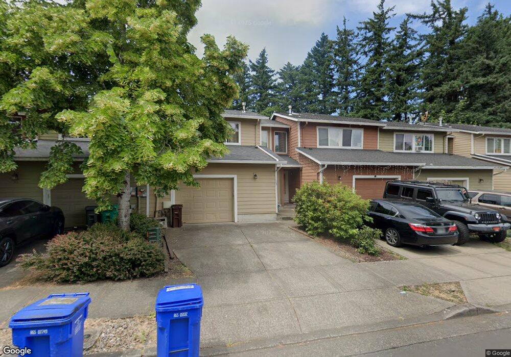
1103 NE Palmblad Dr Gresham, OR 97030
Northeast Gresham NeighborhoodEstimated Value: $316,000 - $382,000
Studio
2
Baths
1,492
Sq Ft
$232/Sq Ft
Est. Value
About This Home
This home is located at 1103 NE Palmblad Dr, Gresham, OR 97030 and is currently estimated at $345,869, approximately $231 per square foot. 1103 NE Palmblad Dr is a home located in Multnomah County with nearby schools including Hall Elementary School, Gordon Russell Middle School, and Sam Barlow High School.
Ownership History
Date
Name
Owned For
Owner Type
Purchase Details
Closed on
Jul 20, 2006
Sold by
Langham Anna G
Bought by
Mullin Paul J and Mullin Anna G
Current Estimated Value
Home Financials for this Owner
Home Financials are based on the most recent Mortgage that was taken out on this home.
Original Mortgage
$175,000
Outstanding Balance
$140,268
Interest Rate
6.57%
Mortgage Type
Stand Alone Refi Refinance Of Original Loan
Estimated Equity
$205,601
Purchase Details
Closed on
Mar 16, 2005
Sold by
Ostercraft Inc
Bought by
Langham Anna G and Mullin Paul J
Home Financials for this Owner
Home Financials are based on the most recent Mortgage that was taken out on this home.
Original Mortgage
$133,510
Interest Rate
5.75%
Mortgage Type
Purchase Money Mortgage
Create a Home Valuation Report for This Property
The Home Valuation Report is an in-depth analysis detailing your home's value as well as a comparison with similar homes in the area
Home Values in the Area
Average Home Value in this Area
Purchase History
| Date | Buyer | Sale Price | Title Company |
|---|---|---|---|
| Mullin Paul J | -- | Transnation Title Insurance | |
| Langham Anna G | $166,888 | Pacific Nw Title |
Source: Public Records
Mortgage History
| Date | Status | Borrower | Loan Amount |
|---|---|---|---|
| Open | Mullin Paul J | $175,000 | |
| Closed | Langham Anna G | $133,510 | |
| Closed | Langham Anna G | $33,378 |
Source: Public Records
Tax History
| Year | Tax Paid | Tax Assessment Tax Assessment Total Assessment is a certain percentage of the fair market value that is determined by local assessors to be the total taxable value of land and additions on the property. | Land | Improvement |
|---|---|---|---|---|
| 2025 | $3,400 | $167,100 | -- | -- |
| 2024 | $3,255 | $162,240 | -- | -- |
| 2023 | $3,255 | $157,520 | -- | -- |
| 2022 | $2,883 | $152,940 | $0 | $0 |
| 2021 | $2,810 | $148,490 | $0 | $0 |
| 2020 | $2,644 | $144,170 | $0 | $0 |
| 2019 | $2,575 | $139,980 | $0 | $0 |
| 2018 | $2,456 | $135,910 | $0 | $0 |
| 2017 | $2,356 | $131,960 | $0 | $0 |
| 2016 | $2,077 | $128,120 | $0 | $0 |
| 2015 | $2,032 | $124,390 | $0 | $0 |
| 2014 | $1,983 | $120,770 | $0 | $0 |
Source: Public Records
Map
Nearby Homes
- 2980 NE Division St Unit 31
- 2980 NE Division St Unit 13
- 2980 NE Division St Unit 43
- 1350 NE Cochran Dr
- 820 NE Cochran Ave
- 1465 NE Kane Dr Unit 4
- 1553 NE Hale Place Unit 1
- 1480 NE Kane Dr
- 2811 NE 6th St
- 863 NE Fleming Ave Unit B10
- 445 NE Village Squire Ave Unit 4
- 579 NE Fleming Ave Unit C41
- 569 NE Fleming Ave Unit B46
- 912 NE Hacienda Ct Unit 916
- 220 NE Village Squire Ave Unit 12
- 900 NE Francis Ave Unit 29
- 900 NE Francis Ave
- 900 NE Francis Ave Unit 63
- 361 NE Village Squire Ave Unit 4
- 251 NE Village Squire Ave Unit 2
- 1117 NE Palmblad Dr
- 1091 NE Palmblad Dr
- 1079 NE Palmblad Dr
- 1135 NE Palmblad Dr
- 1057 NE Palmblad Dr
- 1151 NE Palmblad Dr
- 1163 NE Palmblad Dr
- 1043 NE Palmblad Dr
- 1031 NE Palmblad Dr
- 1187 NE Palmblad Dr
- 1112 NE Palmblad Dr Unit 401
- 1116 NE Palmblad Dr Unit 402
- 1108 NE Palmblad Dr Unit 302
- 1211 NE Palmblad Dr
- 1128 NE Palmblad Dr Unit 502
- 1124 NE Palmblad Dr Unit 501
- 1146 NE Palmblad Dr Unit 602
- 1104 NE Palmblad Dr Unit 301
- 1142 NE Palmblad Dr Unit 601
- 2863 NE Division St
Your Personal Tour Guide
Ask me questions while you tour the home.