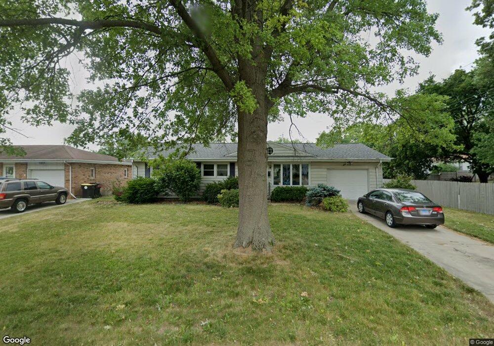
1103 Sheridan Rd Normal, IL 61761
Maple Wood NeighborhoodEstimated Value: $229,000 - $239,247
3
Beds
2
Baths
1,254
Sq Ft
$187/Sq Ft
Est. Value
About This Home
This home is located at 1103 Sheridan Rd, Normal, IL 61761 and is currently estimated at $234,312, approximately $186 per square foot. 1103 Sheridan Rd is a home located in McLean County with nearby schools including Colene Hoose Elementary School, Chiddix Junior High School, and Normal Community West High School.
Ownership History
Date
Name
Owned For
Owner Type
Purchase Details
Closed on
Oct 18, 2024
Sold by
Fraser Julie M and Fraser-Lindsey Julie Marie
Bought by
Fraser-Lindsey Jonathan Mark and Fraser-Lindsey Julie
Current Estimated Value
Purchase Details
Closed on
Sep 8, 2006
Sold by
Wilcoxson Gary H and Wilcoxson Catherine E
Bought by
Fraser Julie M
Home Financials for this Owner
Home Financials are based on the most recent Mortgage that was taken out on this home.
Original Mortgage
$103,000
Interest Rate
6.7%
Create a Home Valuation Report for This Property
The Home Valuation Report is an in-depth analysis detailing your home's value as well as a comparison with similar homes in the area
Home Values in the Area
Average Home Value in this Area
Purchase History
| Date | Buyer | Sale Price | Title Company |
|---|---|---|---|
| Fraser-Lindsey Jonathan Mark | -- | None Listed On Document | |
| Fraser Julie M | $133,000 | None Available |
Source: Public Records
Mortgage History
| Date | Status | Borrower | Loan Amount |
|---|---|---|---|
| Previous Owner | Fraser Julie M | $103,000 |
Source: Public Records
Tax History Compared to Growth
Tax History
| Year | Tax Paid | Tax Assessment Tax Assessment Total Assessment is a certain percentage of the fair market value that is determined by local assessors to be the total taxable value of land and additions on the property. | Land | Improvement |
|---|---|---|---|---|
| 2024 | $3,669 | $57,910 | $12,313 | $45,597 |
| 2022 | $3,669 | $46,845 | $9,960 | $36,885 |
| 2021 | $3,513 | $44,197 | $9,397 | $34,800 |
| 2020 | $3,487 | $43,737 | $9,299 | $34,438 |
| 2019 | $3,366 | $43,502 | $9,249 | $34,253 |
| 2018 | $3,324 | $43,041 | $9,151 | $33,890 |
| 2017 | $3,205 | $43,041 | $9,151 | $33,890 |
| 2016 | $2,411 | $43,041 | $9,151 | $33,890 |
| 2015 | $3,072 | $42,033 | $8,937 | $33,096 |
| 2014 | $3,034 | $42,033 | $8,937 | $33,096 |
| 2013 | -- | $42,033 | $8,937 | $33,096 |
Source: Public Records
Map
Nearby Homes
- 8 Brookwood Dr
- 205 Hammitt Dr
- 111 Riss Dr
- 311 S Towanda Ave Unit 1
- 1402 Keller Rd Unit 4
- 17 Sunset Rd
- 107 N Blair Dr Unit 16
- 107 N Blair Dr Unit 8
- 101 Radliff Rd
- 403 Delmar Ln
- 105 Ambrose Way
- 319 Hillside Ln
- 212 Columbia Dr
- 1203 S Linden St
- 306 Judith Dr
- 100 E Virginia Ave
- 701 Broadway
- 1509 Fort Jesse Rd Unit 13
- 5 Broadway Place
- 1316 Rutledge Rd
- 1105 Sheridan Rd
- 27 Kingswood Dr
- 4 Hundman Ct
- 25 Kingswood Dr
- 1107 Sheridan Rd
- 23 Kingswood Dr
- 1104 Sheridan Rd
- 1102 Sheridan Rd
- 3 Hundman Ct
- 1106 Sheridan Rd
- 1109 Sheridan Rd
- 1100 Sheridan Rd
- 1108 Sheridan Rd
- 21 Kingswood Dr
- 18 Kingswood Dr
- 1111 Sheridan Rd
- 22 Brookwood Dr
- 6 Hundman Ct
- 1010 Sheridan Rd
- 2 Hundman Ct