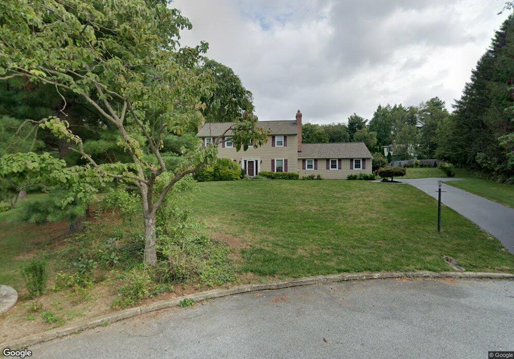
1103 Talcose Ln West Chester, PA 19380
Estimated Value: $679,415 - $811,000
4
Beds
3
Baths
2,416
Sq Ft
$308/Sq Ft
Est. Value
About This Home
This home is located at 1103 Talcose Ln, West Chester, PA 19380 and is currently estimated at $743,354, approximately $307 per square foot. 1103 Talcose Ln is a home located in Chester County with nearby schools including East Bradford Elementary School, E.N. Peirce Middle School, and Henderson High School.
Ownership History
Date
Name
Owned For
Owner Type
Purchase Details
Closed on
Jun 16, 1995
Sold by
Robinson Richard E and Robinson Joan H
Bought by
Groening Steven A and Lang Groening Cynthia A
Current Estimated Value
Home Financials for this Owner
Home Financials are based on the most recent Mortgage that was taken out on this home.
Original Mortgage
$162,000
Interest Rate
7.82%
Create a Home Valuation Report for This Property
The Home Valuation Report is an in-depth analysis detailing your home's value as well as a comparison with similar homes in the area
Home Values in the Area
Average Home Value in this Area
Purchase History
| Date | Buyer | Sale Price | Title Company |
|---|---|---|---|
| Groening Steven A | $202,500 | -- |
Source: Public Records
Mortgage History
| Date | Status | Borrower | Loan Amount |
|---|---|---|---|
| Closed | Groening Steven A | $162,000 |
Source: Public Records
Tax History Compared to Growth
Tax History
| Year | Tax Paid | Tax Assessment Tax Assessment Total Assessment is a certain percentage of the fair market value that is determined by local assessors to be the total taxable value of land and additions on the property. | Land | Improvement |
|---|---|---|---|---|
| 2025 | $5,257 | $181,340 | $28,970 | $152,370 |
| 2024 | $5,257 | $181,340 | $28,970 | $152,370 |
| 2023 | $5,211 | $181,340 | $28,970 | $152,370 |
| 2022 | $5,143 | $181,340 | $28,970 | $152,370 |
| 2021 | $5,026 | $181,340 | $28,970 | $152,370 |
| 2020 | $4,993 | $181,340 | $28,970 | $152,370 |
| 2019 | $4,831 | $181,340 | $28,970 | $152,370 |
| 2018 | $4,724 | $181,340 | $28,970 | $152,370 |
| 2017 | $4,618 | $181,340 | $28,970 | $152,370 |
| 2016 | $3,922 | $181,340 | $28,970 | $152,370 |
| 2015 | $3,922 | $181,340 | $28,970 | $152,370 |
| 2014 | $3,922 | $181,340 | $28,970 | $152,370 |
Source: Public Records
Map
Nearby Homes
- 1280 Cardinal Ave
- 1179 Harmony Hill Rd
- 141 Four Leaf Dr
- 1020 Boot Rd
- 4 Amanda Ln
- 1223 Hall Rd
- 1252 Memory Ln
- 510 Pine Needle Dr
- 34 May Apple Dr Unit 18
- Lot 1 Susan Dr
- 546 W Boot Rd
- 1236 Shadyside Rd
- 950 Sugars Bridge Rd
- 530 Legion Dr
- 479 Douglas Dr
- 29 N Tompkins Square
- 1430 Grove Ave
- 1432 Grove Ave
- 806 Downingtown Pike
- 317 William Taft Ave
- 1105 Talcose Ln
- 1100 Talcose Ln
- 951 Briar Wood Cir
- 959 Harmony Hill Rd
- 1107 Talcose Ln
- 1109 Talcose Ln
- 923 Briar Wood Cir
- 921 Briar Wood Cir
- 1149 Valley Creek Rd
- 970 Pippin Ln
- 925 Briar Wood Cir
- 940 Harmony Hill Rd
- 1151 Valley Creek Rd
- 934 Harmony Hill Rd
- 919 Briar Wood Cir
- 924 Briar Wood Cir
- 922 Briar Wood Cir
- 974 Pippin Ln
- 932 Harmony Hill Rd
- 1157 Valley Creek Rd