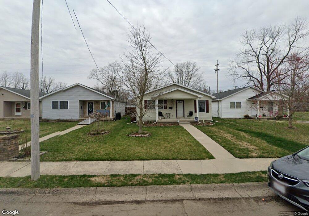
1103 W Perrin Ave Springfield, OH 45506
Estimated Value: $105,000 - $117,369
2
Beds
1
Bath
1,160
Sq Ft
$98/Sq Ft
Est. Value
About This Home
This home is located at 1103 W Perrin Ave, Springfield, OH 45506 and is currently estimated at $113,592, approximately $97 per square foot. 1103 W Perrin Ave is a home located in Clark County with nearby schools including Fulton Elementary School, Hayward Middle School, and Springfield High School.
Ownership History
Date
Name
Owned For
Owner Type
Purchase Details
Closed on
May 12, 2008
Sold by
Clark County Community Habitat For Human
Bought by
Lookabaugh Cynthia Jo
Current Estimated Value
Purchase Details
Closed on
Nov 22, 2005
Sold by
Clark County Community Habitat For Human
Bought by
Lookabaugh Cynthia Jo
Home Financials for this Owner
Home Financials are based on the most recent Mortgage that was taken out on this home.
Original Mortgage
$53,005
Interest Rate
6.13%
Mortgage Type
Seller Take Back
Create a Home Valuation Report for This Property
The Home Valuation Report is an in-depth analysis detailing your home's value as well as a comparison with similar homes in the area
Home Values in the Area
Average Home Value in this Area
Purchase History
| Date | Buyer | Sale Price | Title Company |
|---|---|---|---|
| Lookabaugh Cynthia Jo | -- | None Available | |
| Lookabaugh Cynthia Jo | $65,000 | -- |
Source: Public Records
Mortgage History
| Date | Status | Borrower | Loan Amount |
|---|---|---|---|
| Previous Owner | Lookabaugh Cynthia Jo | $53,005 |
Source: Public Records
Tax History
| Year | Tax Paid | Tax Assessment Tax Assessment Total Assessment is a certain percentage of the fair market value that is determined by local assessors to be the total taxable value of land and additions on the property. | Land | Improvement |
|---|---|---|---|---|
| 2025 | $1,161 | $34,090 | $2,450 | $31,640 |
| 2024 | $1,131 | $23,470 | $1,940 | $21,530 |
| 2023 | $1,131 | $23,470 | $1,940 | $21,530 |
| 2022 | $1,159 | $23,470 | $1,940 | $21,530 |
| 2021 | $1,131 | $21,150 | $1,750 | $19,400 |
| 2020 | $1,133 | $21,150 | $1,750 | $19,400 |
| 2019 | $1,136 | $21,150 | $1,750 | $19,400 |
| 2018 | $1,126 | $20,130 | $1,750 | $18,380 |
| 2017 | $1,125 | $20,132 | $1,750 | $18,382 |
| 2016 | $1,126 | $20,132 | $1,750 | $18,382 |
| 2015 | $1,149 | $20,132 | $1,750 | $18,382 |
| 2014 | $1,144 | $20,132 | $1,750 | $18,382 |
| 2013 | $1,131 | $20,132 | $1,750 | $18,382 |
Source: Public Records
Map
Nearby Homes
- 929 S Western Ave
- 00 Russell Ave
- 802 Innisfallen Ave
- 550 W Parkwood Ave
- 1920 Russell Ave
- 1109 Montgomery Ave
- 1002 S Yellow Springs St
- 2000 Springmont Ave
- 830 Dibert Ave
- 506 W Southern Ave
- 0 Montgomery Ave
- 2140 Shawnee Ave
- 518 Hazelbrook Ave
- 405 W Southern Ave
- 1730 Damascus Ave
- 410 W Liberty St
- 326 W Grand Ave
- 311 W Grand Ave
- 525 S Light St
- 1230 W Pleasant St
- 1091 W Perrin Ave
- 1107 W Perrin Ave
- 1031 W Perrin Ave
- 1116 W Rose St
- 1023 W Perrin Ave
- 1119 W Perrin Ave
- 1108 W Rose St
- 1102 W Rose St
- 1122 W Perrin Ave
- 1106 W Perrin Ave
- 1110 W Perrin Ave
- 1122 W Rose St
- 1038 W Perrin Ave
- 1114 W Perrin Ave
- 1015 W Perrin Ave
- 1024 W Perrin Ave
- 1120 W Perrin Ave
- 1201 W Perrin Ave
- 1018 W Perrin Ave
- 1012 W Rose St
Your Personal Tour Guide
Ask me questions while you tour the home.