Estimated Value: $204,000 - $226,436
Studio
2
Baths
1,550
Sq Ft
$138/Sq Ft
Est. Value
About This Home
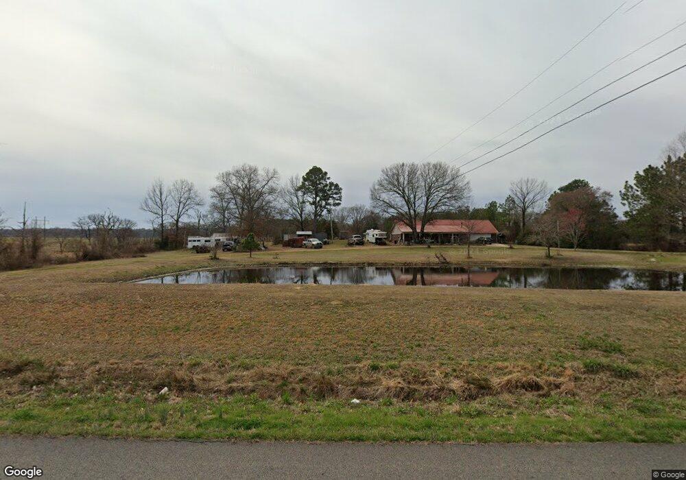
This home is located at 1103 Wire Rd, Ozark, AR 72949 and is currently estimated at $213,479, approximately $137 per square foot. 1103 Wire Rd is a home located in Franklin County with nearby schools including Ozark Kindergarten School, Elgin B Milton Primary School, and Ozark Upper Elementary School.
Ownership History
Date
Name
Owned For
Owner Type
Purchase Details
Closed on
May 25, 2022
Sold by
Reynolds Dwain M and Reynolds Brenda J
Bought by
Dwain And Brenda Reynolds Revocable Trust
Current Estimated Value
Purchase Details
Closed on
Apr 10, 2012
Sold by
Chancey Betty and Reeves Kathleen
Bought by
Reynolds Dwain M and Reynolds Brenda J
Home Financials for this Owner
Home Financials are based on the most recent Mortgage that was taken out on this home.
Original Mortgage
$133,000
Interest Rate
3.97%
Mortgage Type
New Conventional
Purchase Details
Closed on
Sep 20, 1999
Bought by
Shockley and Millsap
Create a Home Valuation Report for This Property
The Home Valuation Report is an in-depth analysis detailing your home's value as well as a comparison with similar homes in the area
Purchase History
| Date | Buyer | Sale Price | Title Company |
|---|---|---|---|
| Dwain And Brenda Reynolds Revocable Trust | -- | Legacy Law Firm Pllc | |
| Reynolds Dwain M | -- | -- | |
| Shockley | $10,000 | -- |
Source: Public Records
Mortgage History
| Date | Status | Borrower | Loan Amount |
|---|---|---|---|
| Previous Owner | Reynolds Dwain M | $133,000 |
Source: Public Records
Tax History
| Year | Tax Paid | Tax Assessment Tax Assessment Total Assessment is a certain percentage of the fair market value that is determined by local assessors to be the total taxable value of land and additions on the property. | Land | Improvement |
|---|---|---|---|---|
| 2025 | $734 | $27,840 | $3,290 | $24,550 |
| 2024 | $834 | $27,840 | $3,290 | $24,550 |
| 2023 | $909 | $27,840 | $3,290 | $24,550 |
| 2022 | $959 | $27,840 | $3,290 | $24,550 |
| 2021 | $959 | $27,840 | $3,290 | $24,550 |
| 2020 | $916 | $26,950 | $4,030 | $22,920 |
| 2019 | $916 | $26,950 | $4,030 | $22,920 |
| 2018 | $941 | $26,950 | $4,030 | $22,920 |
| 2017 | $941 | $26,950 | $4,030 | $22,920 |
| 2016 | $941 | $26,950 | $4,030 | $22,920 |
| 2015 | $944 | $27,020 | $4,030 | $22,990 |
| 2014 | -- | $27,020 | $4,030 | $22,990 |
| 2013 | -- | $27,020 | $4,030 | $22,990 |
Source: Public Records
Map
Nearby Homes
- TBD Commercial St
- 1832 Lone Oak Rd
- 2442 Wire Rd
- 1019 Duncan Rd
- 14441 Lower Jethro Rd
- 719 Norma Ln
- 9417 Puddin Ridge Rd
- 1214 Cataberry Run Rd
- 13542 Watalula Rd
- 927 W Highway 64
- 19940 Arkansas 23
- Tract 2 Arkansas 23
- 4503 Dogwood Ln
- 2407 W Highway 64
- 617 N 35th St
- 8071 Red Oak Dr
- 2006 Gordon Dr
- 507 N 35th St
- 1205 N 18th St
- 1912 Johnson St
- 1103 Wire Rd
- 1048 Wire Rd
- 1209 Wire Rd
- 1225 Wire Rd
- 1122 Wire Rd
- 1202 Wire Rd
- 12022 Wishing Well Ln
- 12023 Wishing Well Ln
- 12134 Wishing Well Ln
- 1308 Wire Rd
- 11820 Wishing Well Ln
- 912 Wire Rd
- 11800 Wishing Well Ln
- 1417 Wire Rd
- 1835 Mattox Rd
- 1822 Mattox Rd
- 1543 Mattox Rd
- 1609 Mattox Rd
- 1846 Mattox Rd
- tbd Hwy 64 & Adams R Tbd
Your Personal Tour Guide
Ask me questions while you tour the home.