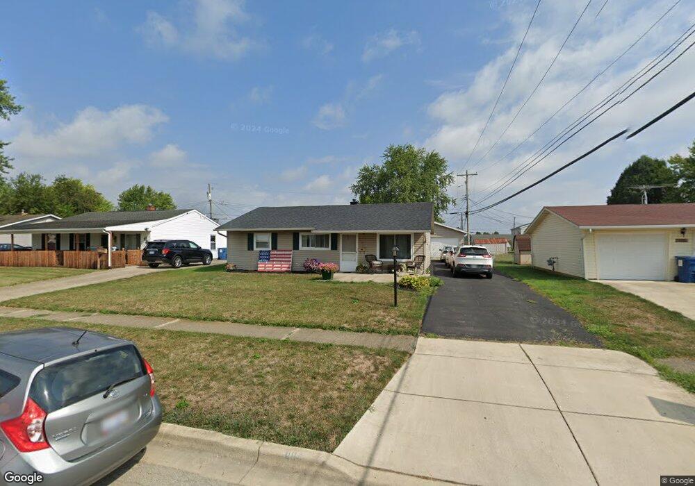
1104 Belford Ave Columbus, OH 43207
Obetz-Lockbourne NeighborhoodEstimated Value: $225,987 - $284,000
3
Beds
1
Bath
1,513
Sq Ft
$167/Sq Ft
Est. Value
About This Home
This home is located at 1104 Belford Ave, Columbus, OH 43207 and is currently estimated at $252,497, approximately $166 per square foot. 1104 Belford Ave is a home located in Franklin County with nearby schools including Hamilton Elementary School, Hamilton Intermediate School, and Hamilton Middle School.
Ownership History
Date
Name
Owned For
Owner Type
Purchase Details
Closed on
Jan 12, 2007
Sold by
Newsome Richard E and Newsome Connie Sue
Bought by
Newsome Gyunvelle M
Current Estimated Value
Home Financials for this Owner
Home Financials are based on the most recent Mortgage that was taken out on this home.
Original Mortgage
$82,000
Outstanding Balance
$49,003
Interest Rate
6.21%
Mortgage Type
Purchase Money Mortgage
Estimated Equity
$203,494
Purchase Details
Closed on
Aug 29, 1995
Sold by
Est Joseph Nevatka
Bought by
Richard E Newsome
Home Financials for this Owner
Home Financials are based on the most recent Mortgage that was taken out on this home.
Original Mortgage
$60,300
Interest Rate
7.43%
Mortgage Type
New Conventional
Purchase Details
Closed on
Jun 15, 1993
Create a Home Valuation Report for This Property
The Home Valuation Report is an in-depth analysis detailing your home's value as well as a comparison with similar homes in the area
Home Values in the Area
Average Home Value in this Area
Purchase History
| Date | Buyer | Sale Price | Title Company |
|---|---|---|---|
| Newsome Gyunvelle M | $102,500 | Valmer Land | |
| Richard E Newsome | $67,000 | -- | |
| -- | -- | -- |
Source: Public Records
Mortgage History
| Date | Status | Borrower | Loan Amount |
|---|---|---|---|
| Open | Newsome Gyunvelle M | $82,000 | |
| Previous Owner | Richard E Newsome | $60,300 |
Source: Public Records
Tax History Compared to Growth
Tax History
| Year | Tax Paid | Tax Assessment Tax Assessment Total Assessment is a certain percentage of the fair market value that is determined by local assessors to be the total taxable value of land and additions on the property. | Land | Improvement |
|---|---|---|---|---|
| 2024 | $3,015 | $65,980 | $16,140 | $49,840 |
| 2023 | $2,999 | $65,975 | $16,135 | $49,840 |
| 2022 | $2,038 | $37,590 | $5,670 | $31,920 |
| 2021 | $2,066 | $37,590 | $5,670 | $31,920 |
| 2020 | $2,104 | $37,590 | $5,670 | $31,920 |
| 2019 | $1,982 | $31,370 | $4,730 | $26,640 |
| 2018 | $1,998 | $31,370 | $4,730 | $26,640 |
| 2017 | $2,008 | $31,370 | $4,730 | $26,640 |
| 2016 | $2,060 | $31,850 | $5,530 | $26,320 |
| 2015 | $1,954 | $31,850 | $5,530 | $26,320 |
| 2014 | $1,944 | $31,850 | $5,530 | $26,320 |
| 2013 | $1,039 | $35,350 | $6,125 | $29,225 |
Source: Public Records
Map
Nearby Homes
- 1099 Secrest Ave
- 1091 Secrest Ave
- 1031 Secrest Ave
- 1059 Belford Ave
- 4917 Fishburn Ct
- 5081 Lockbourne Rd
- 1292 Webb Dr Unit Lot 83
- 1291 Webb Dr Unit Lot 90
- 920 Cherrydale Ave
- 5083 Meadowbrook Dr
- 1315 Webb Dr Unit Lot 93
- 5140 Meadowbrook Dr
- 5340 Edgeview Rd
- 4434 Butler Farms Dr
- 4241 Gelbray Ct
- 4175 Holstein Dr
- 4410 Holstein Dr
- 785 Scarlett Ln
- 1962 Reese Ave
- 1987 Reese Ave
- 1096 Belford Ave
- 1112 Belford Ave
- 4921 Sutherland Dr
- 1088 Belford Ave
- 1107 Secrest Ave
- 1119 Secrest Ave
- 1080 Belford Ave
- 1107 Belford Ave
- 1119 Belford Ave
- 1099 Belford Ave
- 1083 Secrest Ave
- 1091 Belford Ave
- 1072 Belford Ave
- 4961 Sutherland Dr
- 1083 Belford Ave
- 4926 Sutherland Dr
- 4936 Sutherland Dr
- 1075 Secrest Ave
- 4918 Sutherland Dr
- 4946 Sutherland Dr