Estimated Value: $640,000 - $668,316
3
Beds
3
Baths
3,508
Sq Ft
$188/Sq Ft
Est. Value
About This Home
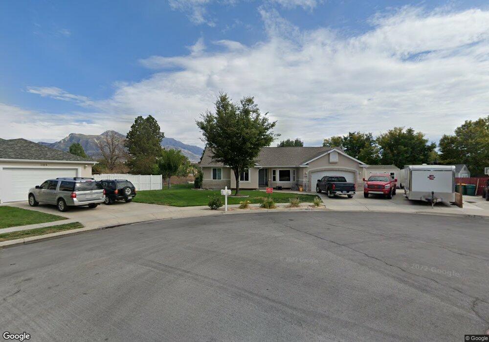
This home is located at 1104 E 2180 N, Lehi, UT 84043 and is currently estimated at $658,105, approximately $187 per square foot. 1104 E 2180 N is a home located in Utah County with nearby schools including Freedom Elementary School, Lehi Junior High School, and Skyridge High School.
Ownership History
Date
Name
Owned For
Owner Type
Purchase Details
Closed on
Mar 13, 1998
Sold by
Thompson Orlando
Bought by
Measom Jeffrey R and Measom Jolene D
Current Estimated Value
Home Financials for this Owner
Home Financials are based on the most recent Mortgage that was taken out on this home.
Original Mortgage
$115,000
Outstanding Balance
$21,038
Interest Rate
7.02%
Estimated Equity
$637,067
Purchase Details
Closed on
Jun 20, 1997
Sold by
White Leland D and White Joyce B
Bought by
Thompson Orlando
Home Financials for this Owner
Home Financials are based on the most recent Mortgage that was taken out on this home.
Original Mortgage
$169,600
Interest Rate
7.94%
Mortgage Type
Construction
Create a Home Valuation Report for This Property
The Home Valuation Report is an in-depth analysis detailing your home's value as well as a comparison with similar homes in the area
Home Values in the Area
Average Home Value in this Area
Purchase History
| Date | Buyer | Sale Price | Title Company |
|---|---|---|---|
| Measom Jeffrey R | -- | -- | |
| Thompson Orlando | -- | Provo Abstract Co |
Source: Public Records
Mortgage History
| Date | Status | Borrower | Loan Amount |
|---|---|---|---|
| Open | Measom Jeffrey R | $115,000 | |
| Previous Owner | Thompson Orlando | $169,600 | |
| Closed | Thompson Orlando | $24,750 |
Source: Public Records
Tax History
| Year | Tax Paid | Tax Assessment Tax Assessment Total Assessment is a certain percentage of the fair market value that is determined by local assessors to be the total taxable value of land and additions on the property. | Land | Improvement |
|---|---|---|---|---|
| 2025 | $2,580 | $323,510 | -- | -- |
| 2024 | $2,580 | $301,895 | $0 | $0 |
| 2023 | $2,404 | $305,470 | $0 | $0 |
| 2022 | $2,561 | $315,480 | $0 | $0 |
| 2021 | $2,282 | $425,000 | $139,800 | $285,200 |
| 2020 | $2,151 | $395,900 | $129,400 | $266,500 |
| 2019 | $1,895 | $362,700 | $129,400 | $233,300 |
| 2018 | $1,909 | $345,400 | $123,800 | $221,600 |
| 2017 | $1,861 | $178,970 | $0 | $0 |
| 2016 | $1,840 | $164,230 | $0 | $0 |
| 2015 | $1,923 | $162,910 | $0 | $0 |
| 2014 | $1,729 | $145,585 | $0 | $0 |
Source: Public Records
Map
Nearby Homes
- 10365 N 6960 W
- 975 E 2850 N
- 6756 W 10050 N
- 4233 N 325 E Unit 1415
- 9967 N 6670 W
- 1370 N Cedar Hollow Blvd
- 878 E 3050 N
- 2539 N 300 E
- 1272 N Cedar Hollow Blvd
- 6576 W 9810 N
- 1117 N Cedar Hollow Blvd
- 9932 N 6520 W Unit 40
- 3239 N 620 E
- 2139 N Banbury Ct
- 1602 E Center Pointe Dr
- 1610 E Center Pointe Dr
- 1618 E Center Pointe Dr
- 9435 N Aspen Hollow Cir
- 3368 N 700 E
- 532 E 3270 N
- 1092 E 2180 N
- 1101 E Airport Dr
- 1101 E Airport Dr
- 1103 E 2180 N
- 1119 Airport Dr
- 1085 E Airport Dr
- 1085 E Airport Dr
- 2195 N 1200 E
- 1091 E 2180 N
- 1070 E 2180 N
- 1147 E Airport Dr
- 1067 E Airport Dr
- 1069 E 2180 N
- 1175 E Airport Dr
- 1112 E 2250 N
- 2109 N 1100 E
- 1100 E 2250 N
- 2221 N 1200 E
- 2108 N 1100 E
- 1051 Airport Dr
Your Personal Tour Guide
Ask me questions while you tour the home.