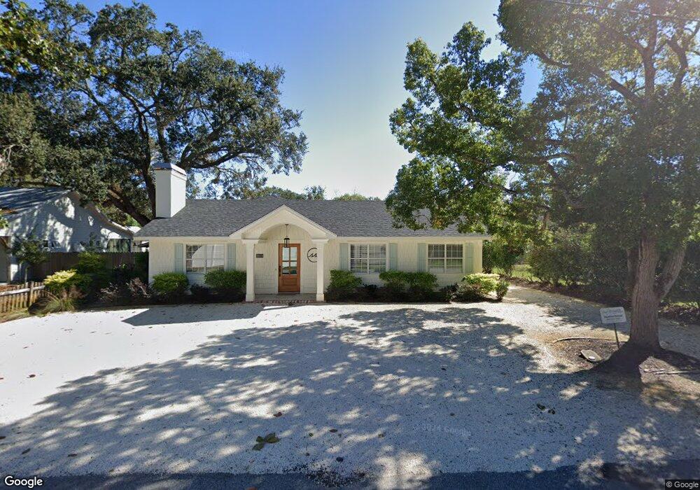
1104 George Lotson Ave Saint Simons Island, GA 31522
Estimated Value: $915,000 - $1,227,000
3
Beds
2
Baths
2,460
Sq Ft
$438/Sq Ft
Est. Value
About This Home
This home is located at 1104 George Lotson Ave, Saint Simons Island, GA 31522 and is currently estimated at $1,076,632, approximately $437 per square foot. 1104 George Lotson Ave is a home located in Glynn County with nearby schools including St. Simons Elementary School, Glynn Middle School, and Glynn Academy.
Ownership History
Date
Name
Owned For
Owner Type
Purchase Details
Closed on
May 13, 2022
Sold by
Simpson Harvey L
Bought by
Tj2 Properties Llc
Current Estimated Value
Home Financials for this Owner
Home Financials are based on the most recent Mortgage that was taken out on this home.
Original Mortgage
$684,000
Interest Rate
5%
Mortgage Type
Mortgage Modification
Purchase Details
Closed on
Mar 11, 2022
Sold by
Mcminn Kimberly I
Bought by
Simpson Harvey L
Create a Home Valuation Report for This Property
The Home Valuation Report is an in-depth analysis detailing your home's value as well as a comparison with similar homes in the area
Home Values in the Area
Average Home Value in this Area
Purchase History
| Date | Buyer | Sale Price | Title Company |
|---|---|---|---|
| Tj2 Properties Llc | -- | -- | |
| Simpson Harvey L | $525,000 | -- |
Source: Public Records
Mortgage History
| Date | Status | Borrower | Loan Amount |
|---|---|---|---|
| Previous Owner | Tj2 Properties Llc | $684,000 |
Source: Public Records
Tax History Compared to Growth
Tax History
| Year | Tax Paid | Tax Assessment Tax Assessment Total Assessment is a certain percentage of the fair market value that is determined by local assessors to be the total taxable value of land and additions on the property. | Land | Improvement |
|---|---|---|---|---|
| 2025 | $10,429 | $415,840 | $186,640 | $229,200 |
| 2024 | $8,409 | $335,320 | $155,520 | $179,800 |
| 2023 | $8,365 | $335,320 | $155,520 | $179,800 |
| 2022 | $2,982 | $319,160 | $155,520 | $163,640 |
| 2021 | $3,071 | $247,200 | $124,400 | $122,800 |
| 2020 | $3,098 | $247,200 | $124,400 | $122,800 |
| 2019 | $3,098 | $188,120 | $65,320 | $122,800 |
| 2018 | $3,098 | $200,800 | $65,320 | $135,480 |
| 2017 | $3,098 | $165,960 | $65,320 | $100,640 |
| 2016 | $2,868 | $165,960 | $65,320 | $100,640 |
| 2015 | $2,913 | $167,480 | $66,840 | $100,640 |
| 2014 | $2,913 | $167,480 | $66,840 | $100,640 |
Source: Public Records
Map
Nearby Homes
- 125 Tiffany Ln
- 1106 George Lotson Ave
- 30 Admirals Cove
- 105 Seaside Cir
- 115 Seaside Cir
- 200 Salt Air Dr Unit 152
- 200 Salt Air Dr Unit 154
- 200 Salt Air Dr Unit 139
- 850 Mallery St Unit 6N
- 850 Mallery St Unit 8K
- 850 Mallery St Unit 6A
- 850 Mallery St Unit 4W
- 850 Mallery St Unit S 3
- 850 Mallery St Unit 4O
- 850 Mallery St Unit 13Q
- 850 Mallery St Unit 9W
- 800 Mallery St Unit 52
- 800 Mallery St Unit 90
- 800 Mallery St Unit C-30
- 800 Mallery St Unit J-89
- 631 Johnson Rd
- 1108 George Lotson Ave
- 1102 Johnson Rd
- 635 Johnson Rd
- 632 Cummings Ln
- 637 Johnson Rd
- 634 Cummings Ln
- 639 Johnson Rd
- 4 Admirals Cove
- 10 Admirals Cove Unit LOT 1
- 10 Admirals Cove
- 636 Cummings Ln
- 632 Johnson Rd
- 636 Johnson Rd
- 1047 Johnson Rd
- 638 Cummings Ln
- 638 Johnson Rd
- 15 Admirals Cove Unit LOT11
- 642 Cummings Ln
- 1200 George Lotson Ave